 SnowScope
Isola 2000 ski map: where the snow lies on the ski area (12 November 2026)
Here is the Isola 2000 ski map as our snow model sees it on 11 November: a first white coat on the top at 2601 m (9 cm), 7 cm at mid-mountain (2214 m) and 2 cm at the base (1828 m). Most of it fell in the last seven days, 31 cm at the top, and the coming week adds about 26 cm up there. Thin, but the season has started to draw its lines.
See the live snow forecast for Isola 2000 in the SnowScope appSnow depth, powder alerts and the 3D map, free.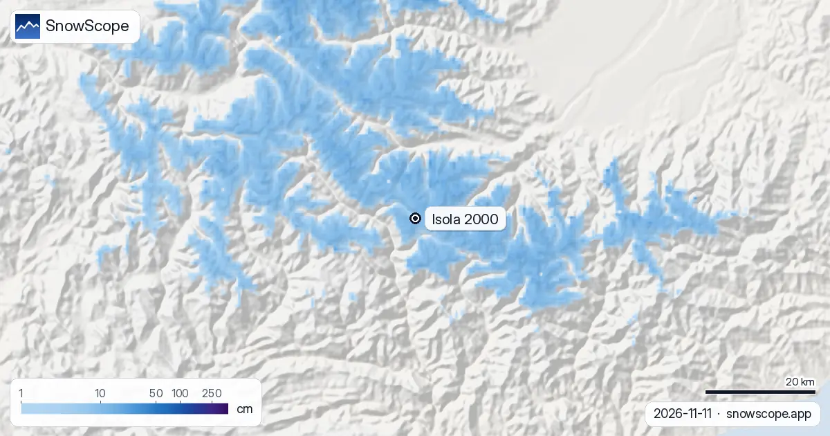
The ski area on the map
Isola 2000 is a purpose-built resort in the Mercantour, in the Alpes-Maritimes, close to the Italian border. The lifts leave from the front de neige above the village and fan out into three sectors: Pelevos, the central slopes above the resort where beginners start; Saint-Sauveur, the side with wooded runs and mogul fields that experienced skiers like; and Lombarde, the sunny, south-facing sector that climbs towards the Col de la Lombarde and the Italian border, with the Mené chair for the steeper runs.
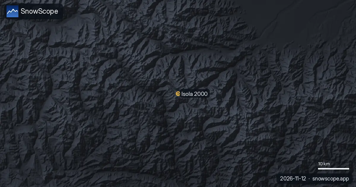
On our map the mapped ski area covers 55 km of runs and 20 lifts between 1828 m and 2601 m (OpenSkiMap figures, not the resort's own count). The pin on the snow map sits on the village; the blue to the north and east is the high Mercantour, the grey to the south is the Tinée valley.
Snow today, height by height
The 11 November model run gives 2 cm at the base, 7 cm at mid-mountain and 9 cm at the top. Nothing fell in the last two days, but the week before was busy: 19 cm at the base, 27 cm at mid-mountain and 31 cm at the top.
Forecast for the next seven days: 2 cm at the base, 18 cm at mid-mountain and 26 cm at the top, with 3 cm already in the next 24 hours. These are model values for the area, not the resort's own measurements, and November sun takes a share of every centimetre.
How thin is this for mid-November?
Not very. In the middle of our 46 past winters (1980-81 to 2025-26) the first snow at the top of Isola 2000 lies on 30 October, at mid-mountain on 8 November and at the base on 13 November, so the calendar is about right.
A usual December has 14 cm at the base, 23 cm at mid-mountain and 43 cm at the top; the ski area reaches its deepest in February, with 35 cm, 53 cm and 95 cm. The peak of a middle winter is 46 cm at the base, 68 cm at mid-mountain and 128 cm at the top. Last winter peaked at 51, 76 and 140 cm.
Reading the map before a trip
The south-facing Lombarde sector gets the sun, so its snow softens first; Saint-Sauveur keeps its cover better in the trees. The best week for 50 cm or more at the top is week 11, in the middle of March, which 83 % of past winters delivered, with a middle depth of 97 cm. Open the live map, zoom on Isola 2000, and the three heights update with every model run.
Tips for skiers
- Watch the top and mid-mountain numbers first: the base at 1828 m usually turns white a week or two later.
- A snow map is not a lift status: the resort decides when the lifts turn.
- After fresh snow, read the Météo-France avalanche bulletin before leaving the marked runs.
More maps (external sites)
References and credits
- Isola 2000, official site and piste map www.isola2000.com/
- Météo-France, mountain weather and avalanche bulletins meteofrance.com/meteo-montagne
About these numbers
Snow numbers: the SnowScope snow model, run of 11 November 2026, at three heights of the resort (model values for the area, not resort measurements), and our snow history, 46 past winters (1980-81 to 2025-26), a model of the past corrected for height. Ski area layout: the resort's own piste map (reference below); run length and lift count are OpenSkiMap mapping. Forecasts change: look at the map before you go.
Official avalanche bulletins: Météo-France – Bulletin d'estimation du risque d'avalanche
Cite this report
For research, teaching or the press: the numbers and charts are free to reuse under CC BY 4.0 with this citation.
SnowScope (2026), Isola 2000 ski map: where the snow lies on the ski area (12 November 2026), https://snowscope.app/blog/en/2026/11/isola-2000-ski-map-snow-12-november-2026.html, accessed 2026-11-12
SnowScope (Atlas Labs). (2026, November 12). Isola 2000 ski map: where the snow lies on the ski area (12 November 2026). SnowScope snow reports. https://snowscope.app/blog/en/2026/11/isola-2000-ski-map-snow-12-november-2026.html
BibTeX
@misc{snowscope2026isola2000skimapsnow12nov,
  author       = {{SnowScope (Atlas Labs)}},
  title        = {Isola 2000 ski map: where the snow lies on the ski area (12 November 2026)},
  year         = {2026},
  month        = nov,
  howpublished = {\url{https://snowscope.app/blog/en/2026/11/isola-2000-ski-map-snow-12-november-2026.html}},
  note         = {Published 2026-11-12 07:43 UTC; accessed 2026-11-12}
}· CC BY 4.0 · Methods, data and tools →
Isola 2000: snow and temperature by height, this winter vs last (tools) →
Follow Isola 2000
Free: a message when fresh snow is coming, and the forecast every morning.

More snow reports
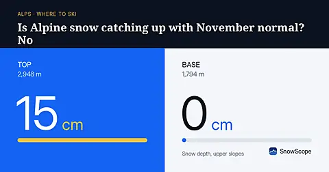
Alpine snow depths are running behind normal for early November, with only 55 cm at the best resorts as of November 3rd.
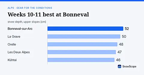
Bonneval-sur-Arc shows 52 cm upper slopes on 8 November. Weeks 10-11 are peak snow months. See what to pack for the forecast.
Is Verbier good for beginners? When is the snow best? How do you get there? Answers from the 4 Vallées and 46 past winters of snow data.