 SnowScope
Italian Alps: 215 cm fell in the Aosta Valley this week
A strong storm system delivered heavy snow across Italy's high mountains in the past three days. The Aosta Valley was the clear winner with 215 cm of new snow, while the Piedmont Alps picked up 76 cm.
See the live snow forecast for La Thuile ski in the SnowScope appSnow depth, powder alerts and the 3D map, free.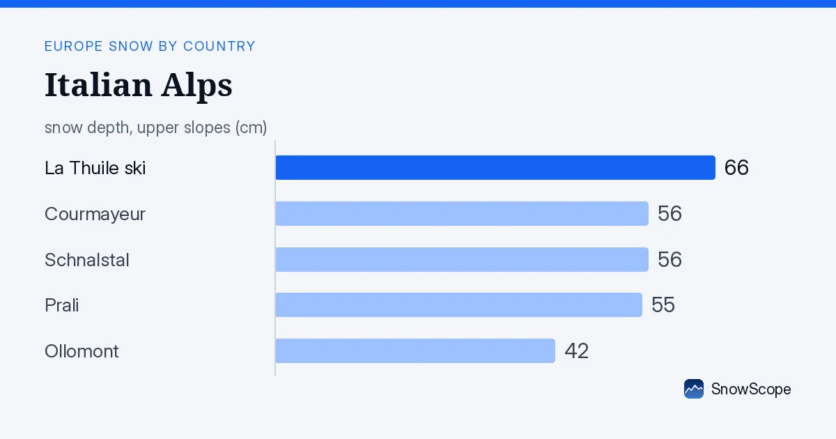
Where the snow landed
The storm favoured the western ranges. The Aosta Valley, straddling the France-Italy border, saw the most: 215 cm of new snow in 72 hours. That is the standout figure for the region. The Piedmont Alps, to the south and east, received 76 cm over the same period—solid accumulation, but less than half what fell further west.
Height mattered too. Above 2500 m across Italy, the model shows a mean depth of 26 cm. At 2000–2500 m, depths average 9 cm and cover 94 per cent of the terrain. Below 1500 m, snow cover is patchy or absent; the snow line sits at 1500 m today.
| Resort | Snow depth | New snow, 72 h | Coming, next days | Top |
|---|---|---|---|---|
| La Thuile ski | 66 cm | 102 cm | 82 cm | 2,608 m |
| Courmayeur | 56 cm | 98 cm | 87 cm | 2,749 m |
| Schnalstal | 56 cm | 15 cm | 12 cm | 3,200 m |
| Prali | 55 cm | 44 cm | 20 cm | – |
| Ollomont | 42 cm | 84 cm | 65 cm | – |
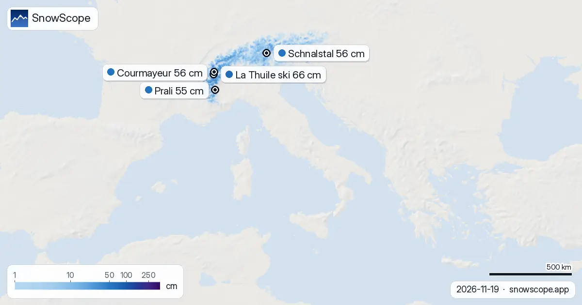
Three days of heavy falls
Italy's snow cover jumped from 20,420 km2 yesterday to 24,860 km2 today—a gain of 4440 km2 in one day. That rise reflects new snow across a wide area. About 19,620 km2 received at least 5 cm of fresh snow in the past 72 hours.
The heaviest single fall was 27 cm in the past 24 hours. Averaged over the three days, parts of the northwest saw as much as 59 cm. These are model estimates for a region, not station readings at a single point.
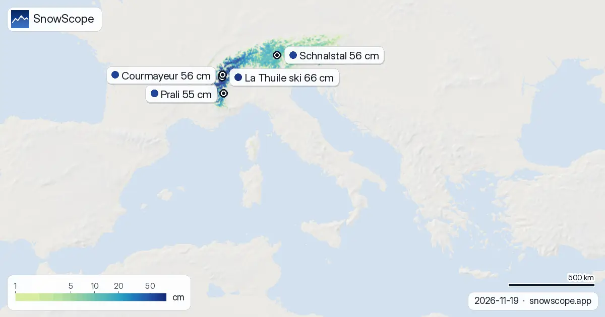
Which resorts lead
La Thuile ski (top 2608 m) has the deepest pack: 66 cm measured on the ground. It also collected the most new snow near a ski resort: 102 cm in 72 hours. Courmayeur (2749 m) sits close behind, with 56 cm depth and 98 cm new.
Both resorts are in the Aosta Valley, the zone that caught the brunt of the storm. Ollomont (84 cm new in 72 hours) and Prali (44 cm new) also benefited, though with less total depth. Schnalstal (the South Tyrolean glacier resort) saw only 15 cm of fresh snow—it lies east of the main snow track.
What comes next
The storm is not finished. The model predicts another 58 cm of new snow across Italy in the next three days, with a peak of 34 cm on 22 November. That will add significantly to the base. By the end of next week, Italy could see 84 cm more—even the Piedmont Alps will catch heavier falls later in the forecast window.
The first fresh snow since mid-November arrives tonight (20 November). Forecasts can shift, so check updates. Early-season snow on thin ground may hide rocks, so caution is wise on off-piste terrain.
Snow cover grows
Before this storm, Italy had 21,950 km2 of snow seven days ago. Today it has 24,860 km2—a net gain despite some melting at low elevations. The white share of the mapped area is now 27 per cent, up from recent lows. Most of the new cover is above 1500 m, where it will stay.
How it compares
La Thuile ski and Courmayeur are both running well above their typical mid-November average. La Thuile sits at 219 per cent of normal for this date; Courmayeur at 295 per cent. This is unusual strength for mid-November in the Alps. Austria's leader, Stubaier Gletscher, has 74 cm; Switzerland's Glacier 3000 has 60 cm—both well-stocked but behind Italy's top two. Use the SnowScope app to track snow depth, fresh snow, and forecasts for your chosen resort.
Tips for skiers
- Aim for elevations above 2000 m in the Aosta Valley and Piedmont Alps for the best and most stable snow through the next week.
- La Thuile ski and Courmayeur will continue to receive heavy snow through 22 November; the forecast window is 3–7 days ahead.
- Below 1500 m, snow cover remains thin or absent. Check the app for exact depths at your resort and chosen slopes.
- Off-piste skiers should consult the official avalanche bulletin before heading into unmarked terrain; early-season consolidation is still under way.
- The 72-hour storm has reset the season in the northwest; check local resort reports to confirm lift openings and terrain availability.
About these numbers
Resort snow depths are the deepest snow on the resort's upper slopes from the SnowScope snow model (about 1 km, run of 19 November); they are estimates for an area, not a measurement at one point. Station values are measurements on the date shown. Forecasts can change. Always read the official avalanche bulletin before going off-piste.
Cite this report
For research, teaching or the press: the numbers and charts are free to reuse under CC BY 4.0 with this citation.
SnowScope (2026), Italian Alps: 215 cm fell in the Aosta Valley this week, https://snowscope.app/blog/en/2026/11/italy-where-the-snow-fell-19-november-2026.html, accessed 2026-11-19
SnowScope (Atlas Labs). (2026, November 19). Italian Alps: 215 cm fell in the Aosta Valley this week. SnowScope snow reports. https://snowscope.app/blog/en/2026/11/italy-where-the-snow-fell-19-november-2026.html
BibTeX
@misc{snowscope2026italywherethesnowfell19n,
  author       = {{SnowScope (Atlas Labs)}},
  title        = {Italian Alps: 215 cm fell in the Aosta Valley this week},
  year         = {2026},
  month        = nov,
  howpublished = {\url{https://snowscope.app/blog/en/2026/11/italy-where-the-snow-fell-19-november-2026.html}},
  note         = {Published 2026-11-19 11:54 UTC; accessed 2026-11-19}
}· CC BY 4.0 · Methods, data and tools →
La Thuile ski: snow and temperature by height, this winter vs last (tools) →
Follow La Thuile ski
Free: a message when fresh snow is coming, and the forecast every morning.

More snow reports
Snow is falling on Slovenia's ski mountains today: about 37 cm on Kanin and 21 cm on Krvavec. Where the snow lies, how it compares with past winters, and the next snowy day.

Tornik on Zlatibor had up to 39 cm on its upper slopes on 15 November 2026; by Wednesday it had melted. Kopaonik barely turned white. The week day by day and what comes next.
Savin Kuk above Žabljak picked up 22 cm of snow from 13 to 19 November and still has 6 cm today. Kolašin 1450 and 1600 are bare. The week day by day, and the next chances.