 SnowScope
Snow in Göteborg? Bare in the city, one white surprise to the north-east (13 November 2026)
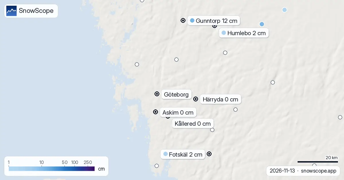
Göteborg is bare. On Friday morning the weather stations at Askim, Kållered, Kärna, Härryda and Mollsjönäs all measured 0 cm of snow, as they have all week. But the night did leave a little snow inland, and one station to the north-east reported a surprising 12 cm.
See the live snow forecast for Göteborg in the SnowScope appSnow depth, powder alerts and the 3D map, free.
Where the snow fell
Gunntorp, 39 km north-east of the city and only 32 m above the sea, measured 12 cm on Friday after bare ground on Thursday. Its neighbours had much less: Humlebo, a little further east, 2 cm; Fotskäl, south-east of the city at 132 m, 2 cm; Linhult, at 173 m, 3 cm.
One station with 12 cm and its neighbours with 2 or 3 suggests a narrow band of heavier snow rather than a white landscape. Treat it as a local event: the city and the coast stayed green.
What to expect in a west-coast November
Göteborg sits outside the area our 46-winter snow history covers, so we cannot give you a normal for the date. What the stations show this week is typical of the Swedish west coast in mid-November: the snow, when it comes, lands inland and on the higher ground first, and rarely stays near the sea.
The weekend
Saturday is mild, up to about 10 °C, with at most a few millimetres of rain. Sunday stays mild and mostly dry, around 5 to 9 °C. Monday brings real rain, roughly 9 to 16 mm. Even the snow inland will most likely be gone by then.
Tips for skiers
- If you want snow from Göteborg this weekend, you will not find much within an hour's drive: the white belt is far north, in Dalarna and Jämtland.
- Wet leaves on the paths in Slottsskogen and Delsjön are the slip risk this weekend.
- Monday's rain on the coast: waterproof shoes, not winter boots.
More maps (external sites)
References and credits
- SMHI, open meteorological observations (snow depth, daily) www.smhi.se/data/meteorologi/ladda-ner-meteorologiska-observationer
- Open-Meteo, weather forecast data (ECMWF and ICON models) open-meteo.com/
About these numbers
Snow depth today: measured at weather stations on the morning of 13 November 2026 (SMHI); a station reports the snow on its own small plot, so a few kilometres away and a hundred metres higher the ground can look different. Usual depth for the date: SnowScope snow history, 46 past winters (1980-81 to 2025-26), a model of the past at the city's height, not a station record. Weekend: two weather models (ECMWF IFS and DWD ICON, read through Open-Meteo), given as a range. Places and rules: the official pages listed below.
Cite this report
For research, teaching or the press: the numbers and charts are free to reuse under CC BY 4.0 with this citation.
SnowScope (2026), Snow in Göteborg? Bare in the city, one white surprise to the north-east (13 November 2026), https://snowscope.app/blog/en/2026/11/goteborg-snow-today-13-november-2026.html, accessed 2026-11-13
SnowScope (Atlas Labs). (2026, November 13). Snow in Göteborg? Bare in the city, one white surprise to the north-east (13 November 2026). SnowScope snow reports. https://snowscope.app/blog/en/2026/11/goteborg-snow-today-13-november-2026.html
BibTeX
@misc{snowscope2026goteborgsnowtoday13novem,
  author       = {{SnowScope (Atlas Labs)}},
  title        = {Snow in Göteborg? Bare in the city, one white surprise to the north-east (13 November 2026)},
  year         = {2026},
  month        = nov,
  howpublished = {\url{https://snowscope.app/blog/en/2026/11/goteborg-snow-today-13-november-2026.html}},
  note         = {Published 2026-11-14 13:29 UTC; accessed 2026-11-13}
}· CC BY 4.0 · Methods, data and tools →
Follow Göteborg
Free: a message when fresh snow is coming, and the forecast every morning.

More snow reports
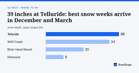
Telluride has 39 inches today. Peak snow weeks historically arrive in late December and March, not November.
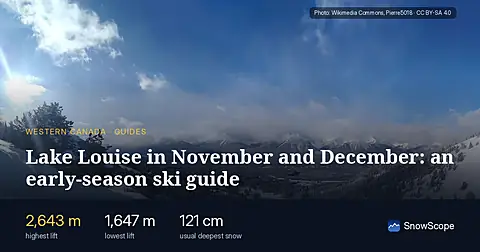
Skiing Lake Louise early in the season: why it starts early, what November and December snow usually looks like in 46 past winters, and how to ski thin early cover.
Baqueira-Beret sits in the Val d'Aran, on the Atlantic side of the Pyrenees. What that means for its snow, tested with 46 past winters against La Molina, and when to go.