 SnowScope
Which Nordic cities have snow today? 14 cities measured (13 November 2026)
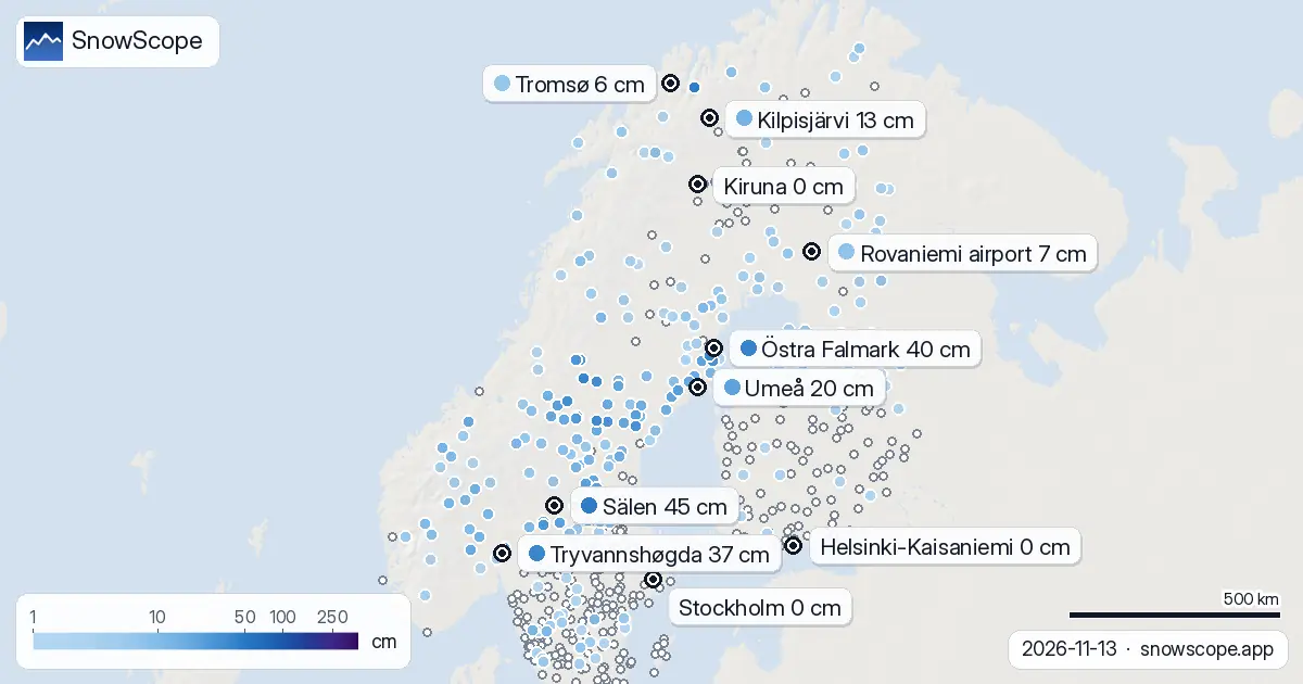
Mid-November is when the Nordic cities split into white and green, and this year the line runs in an odd place. Umeå on the Bothnian coast has 20 cm of snow, while Kiruna, far up in Lapland, has none at all. Here are the 14 big cities, ranked by what the weather stations measured on Friday morning.
See the live snow forecast for Scandinavia in the SnowScope appSnow depth, powder alerts and the 3D map, free.White: Umeå, Östersund, Oulu, Rovaniemi, Tromsø, Oslo
Umeå leads with 20 cm at the Röbäcksdalen station on the edge of town, and it all came in two days: the ground was bare on Wednesday. Östersund comes next, with 19 cm at Norderön and 24 cm at Marby, both on the shores of Storsjön.
Oulu went from nothing to 7 cm overnight. Rovaniemi has 7 cm at the airport and 8 cm at Apukka, a cover that has been building slowly since the start of the week. Tromsø has 6 cm at the city station on the island. Oslo has a thin 4 cm at Blindern, but 37 cm up at Tryvannshøgda on the hill above the city.
Patchy: Luleå and Trondheim
Luleå's airport station sent no snow depth today. The nearest stations that did, 35 to 60 km away, show 3 to 7 cm, all of it new since Thursday, so Luleå is most likely white but thin.
Trondheim's own stations report no snow depth at all. The closest measurements are inland and higher: 5 cm at Meråker and 18 cm at Tågdalen. Down by the fjord, the ground is most likely still bare.
Green: Kiruna, Stockholm, Göteborg, Helsinki, Tampere, Bergen
Kiruna is the surprise. The town station at 519 m measured 0 cm, and so did Jukkasjärvi and Esrange. Our snow history at Kiruna's height had snow on this date in all 46 past winters, with a middle value of 23 cm. Of the 22 Swedish stations north of the Arctic Circle that reported today, only 5 have any snow, and the deepest has 9 cm.
In the south, as usual for mid-November, the capitals are bare: 0 cm in central Stockholm, 0 cm at Helsinki-Kaisaniemi, 0 cm around Göteborg and Tampere, and bare ground at Bergen-Florida. The nearest snow to Stockholm today is 2 cm at Norrveda, 75 km to the north.
Over the weekend
The forecasts we read give the north a little more: about 5 cm in Rovaniemi on Saturday and Sunday together, about 2 cm in Tromsø and Kiruna, a cold night of about -10 °C in Umeå. In the south it stays mild and mostly dry, and Bergen gets heavy rain on Sunday, around 40 mm.
Tips for skiers
- White ground in a city this weekend: Umeå, Östersund and Rovaniemi are the safest bets.
- In Oslo, take the metro up the hill: the snow is in Nordmarka, not in the streets.
- Kiruna visitors expecting snow: the town is bare today; the higher valleys towards the Norwegian border have a few centimetres.
More maps (external sites)
References and credits
- SMHI, open meteorological observations (snow depth, daily) www.smhi.se/data/meteorologi/ladda-ner-meteorologiska-observationer
- MET Norway, free meteorological data (station reports) www.met.no/en/free-meteorological-data
- Ogimet, archive of the international SYNOP station reports (Norway, WMO block 01) www.ogimet.com/
- Finnish Meteorological Institute, open data (daily snow depth) en.ilmatieteenlaitos.fi/open-data
- Open-Meteo, weather forecast data (ECMWF and ICON models) open-meteo.com/
About these numbers
Snow depth today: measured at weather stations on the morning of 13 November 2026 (SMHI, MET Norway station reports in the international SYNOP format, Finnish Meteorological Institute); a station reports the snow on its own small plot, so a few kilometres away and a hundred metres higher the ground can look different. Usual depth for the date: SnowScope snow history, 46 past winters (1980-81 to 2025-26), a model of the past at the city's height, not a station record. Weekend: two weather models (ECMWF IFS and DWD ICON, read through Open-Meteo), given as a range. Places and rules: the official pages listed below.
Cite this report
For research, teaching or the press: the numbers and charts are free to reuse under CC BY 4.0 with this citation.
SnowScope (2026), Which Nordic cities have snow today? 14 cities measured (13 November 2026), https://snowscope.app/blog/en/2026/11/nordic-cities-snow-today-13-november-2026.html, accessed 2026-11-13
SnowScope (Atlas Labs). (2026, November 13). Which Nordic cities have snow today? 14 cities measured (13 November 2026). SnowScope snow reports. https://snowscope.app/blog/en/2026/11/nordic-cities-snow-today-13-november-2026.html
BibTeX
@misc{snowscope2026nordiccitiessnowtoday13n,
  author       = {{SnowScope (Atlas Labs)}},
  title        = {Which Nordic cities have snow today? 14 cities measured (13 November 2026)},
  year         = {2026},
  month        = nov,
  howpublished = {\url{https://snowscope.app/blog/en/2026/11/nordic-cities-snow-today-13-november-2026.html}},
  note         = {Published 2026-11-13 18:09 UTC; accessed 2026-11-13}
}· CC BY 4.0 · Methods, data and tools →
Follow Scandinavia
Free: a message when fresh snow is coming, and the forecast every morning.

More snow reports
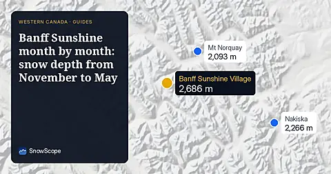
Banff Sunshine Village month by month: about 100 cm at mid-mountain in a usual March over 46 past winters, April deepest near the top, and a season into late May.

Himalaya snow cover in November 2026 from NASA MODIS: snow on 610,409 km² of ground above 2,000 m between the Hindu Kush and Bhutan, half the clear ground white from about 4,800 m in Nepal and 3,600 m in the Karakoram. The NDSI explained, plus shadows, cloud and the low autumn sun.
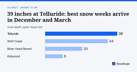
Telluride has 39 inches today. Peak snow weeks historically arrive in late December and March, not November.