 SnowScope
Obergurgl snow report: 20 cm at the top, snow reaching the village this week (13 November 2026)
Obergurgl sits at the head of the Ötztal, one of the highest villages in Austria, and in November that height is its whole story. Today's snow report from our map: about 20 cm at the top (3024 m), about 5 cm at mid-mountain (2404 m) and bare ground at the lowest lifts (1784 m). The week ahead is the interesting part: 21 cm at the bottom, 27 cm in the middle and 34 cm up high, with the snow line just below the village.
See the live snow forecast for Obergurgl in the SnowScope appSnow depth, powder alerts and the 3D map, free.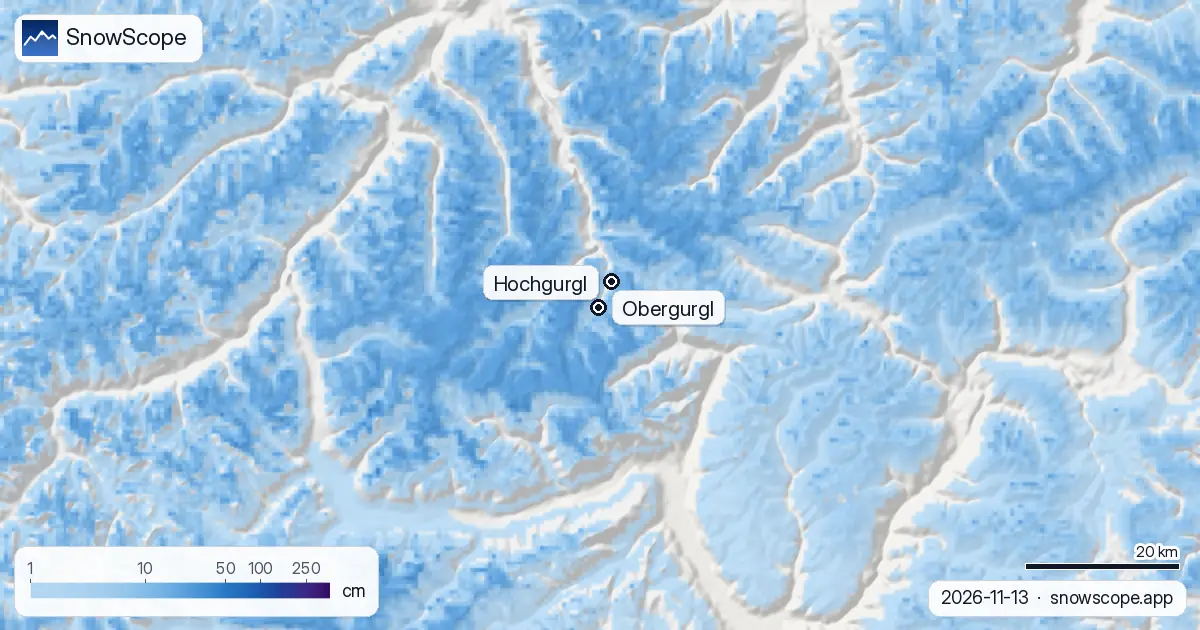
From the bottom lifts up
At 1784 m the ground is still bare. Only 6 cm fell there in the last seven days, and it did not last. Climb to mid-mountain and things change: 16 cm in the week, 8 cm of it in the last 24 hours, now settled to about 5 cm on the ground.
The top has the best cover in the valley so far: 20 cm lying after 20 cm of new snow in seven days, 10 cm of it since yesterday. That is a thin early-season layer, but it is a white one.
Snow forecast for Obergurgl this week
Over the next seven days we see 34 cm at the top, 27 cm at mid-mountain and 21 cm at the lowest lifts, about 4 cm up high in the first 24 hours and the rest after that. Two things to know before you trust it.
First, the snow line. Other forecasts put it around 1700 m, a little under the village, so most of what falls in Obergurgl itself should be snow, with rain or sleet at times. Second, the amount. The other forecasts we check are lower, from 8 to 24 cm at the top. Our 34 cm is the high end: plan with about 20 cm and count anything above as a bonus.
Why the high village is the safer early bet
In our 46 past winters (1980-81 to 2025-26), a usual November holds 12 cm at Obergurgl's lowest lifts, 31 cm at mid-mountain and 62 cm at the top. Down the valley at Sölden's lowest lifts (1346 m), the same month usually has 7 cm, and a middle winter peaks at 48 cm there against 64 cm here. In about half of winters, 6 weeks bring 50 cm or more even at the bottom of Obergurgl, which a lower village rarely sees.
What the season usually builds
December usually lifts the cover to 27, 64 and 125 cm from bottom to top. At mid-mountain, 18 weeks of the winter have 50 cm or more in 9 of 10 winters, at the top 25 weeks. A middle winter peaks at 64 cm low down, 162 cm in the middle and 328 cm on top.
The trend is small at the bottom, 68 cm in the first 15 of our winters against 64 cm in the last 15, and larger at the top, from 341 to 303 cm. Last winter was a poor one, with peaks of 47, 110 and 212 cm. The mapped area, Obergurgl and Hochgurgl together, counts 64 km of runs and 25 lifts.
Tips for skiers
- Plan this week with about 20 cm of new snow at the top, not 34 cm: the forecasts disagree on the amount.
- Snow on the road is likely at the head of the Ötztal: carry chains and check the road before you drive up the valley.
- Thin early cover hides rocks: stay on open, prepared runs, and read the Tyrol avalanche report before any off-piste plan.
More maps (external sites)
References and credits
- Obergurgl-Hochgurgl, official site (lifts, opening dates, snow report) www.obergurgl.com/
- Avalanche.report, avalanche bulletin for Tyrol, South Tyrol and Trentino avalanche.report/
About these numbers
Snow numbers: the SnowScope snow model, run of 12 November 2026 for 13 November, at three heights of the ski area (an estimate for the area, not resort measurements), and our snow history, 46 past winters (1980-81 to 2025-26), corrected for height. The forecast range and the snow line compare other weather forecasts at the same heights. Run length and lift count: OpenSkiMap mapping. Forecasts change: look at the map before you go.
Official avalanche bulletins: Avalanche.report – Euregio Tyrol
Cite this report
For research, teaching or the press: the numbers and charts are free to reuse under CC BY 4.0 with this citation.
SnowScope (2026), Obergurgl snow report: 20 cm at the top, snow reaching the village this week (13 November 2026), https://snowscope.app/blog/en/2026/11/obergurgl-snow-report-13-november-2026.html, accessed 2026-11-13
SnowScope (Atlas Labs). (2026, November 13). Obergurgl snow report: 20 cm at the top, snow reaching the village this week (13 November 2026). SnowScope snow reports. https://snowscope.app/blog/en/2026/11/obergurgl-snow-report-13-november-2026.html
BibTeX
@misc{snowscope2026obergurglsnowreport13nov,
  author       = {{SnowScope (Atlas Labs)}},
  title        = {Obergurgl snow report: 20 cm at the top, snow reaching the village this week (13 November 2026)},
  year         = {2026},
  month        = nov,
  howpublished = {\url{https://snowscope.app/blog/en/2026/11/obergurgl-snow-report-13-november-2026.html}},
  note         = {Published 2026-11-13 13:02 UTC; accessed 2026-11-13}
}· CC BY 4.0 · Methods, data and tools →
Obergurgl: snow and temperature by height, this winter vs last (tools) →
Follow Obergurgl
Free: a message when fresh snow is coming, and the forecast every morning.

More snow reports
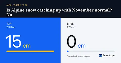
Alpine snow depths are running behind normal for early November, with only 55 cm at the best resorts as of November 3rd.
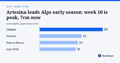
Artesina holds the deepest snow in the Alps this weekend with 22 cm upper slopes. Week 10 sees the best conditions historically. Data from 5 November.
Is Verbier good for beginners? When is the snow best? How do you get there? Answers from the 4 Vallées and 46 past winters of snow data.