 SnowScope
Where it snows in the Pyrenees in the next 14 days: Gavarnie-Gèdre leads with 36 cm
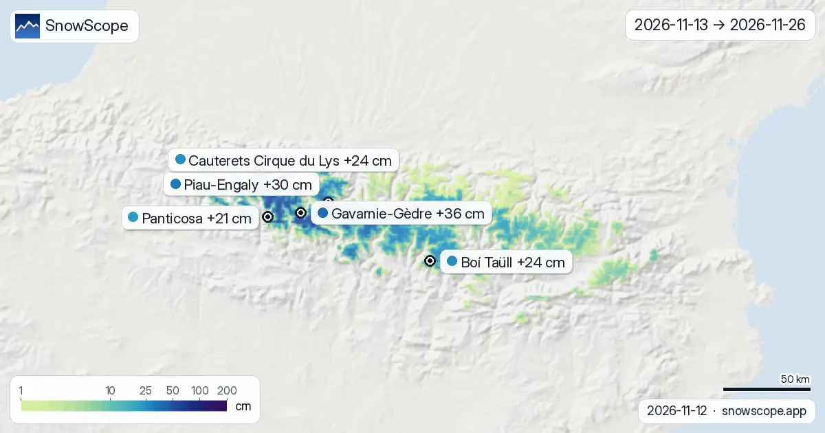
Today's maps look two weeks ahead in the Pyrenees, 13 November to 26 November. They come from the two global models that reach two weeks, ECMWF and GFS; the colours are the middle of the two, every number in this post is given with their range. Gavarnie-Gèdre comes out on top with about 36 cm of new snow up high (15 cm–57 cm between the two models); Piau-Engaly is next at 30 cm. Confidence: good for the trend, lower for any single number.
See the live snow forecast for Gavarnie-Gèdre in the SnowScope appSnow depth, powder alerts and the 3D map, free.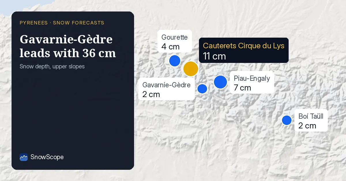
Resort by resort, the next 14 days
At Gavarnie-Gèdre (France) the two weeks add up to about 36 cm (15 cm–57 cm depending on the model): 31 cm by the end of the first week, then 5 cm more. Mark 19 November: that is the biggest day, with 10 cm, out of 4 days at 5 cm or more.
Piau-Engaly (France): about 30 cm in 14 days (14 cm–46 cm between the models), 25 cm in the first week and 5 cm in the second. The snowiest day is 19 November, with 8 cm.
Boí Taüll (Spain): about 24 cm in 14 days (13 cm–36 cm between the models), 19 cm in the first week and 5 cm in the second. The snowiest day is 17 November, with 6 cm.
Cauterets Cirque du Lys (France): about 24 cm in 14 days (9 cm–39 cm between the models), 19 cm in the first week and 5 cm in the second. The snowiest day is 19 November, with 9 cm.
At Panticosa (Spain) the two weeks add up to about 21 cm (8 cm–34 cm depending on the model): 17 cm by the end of the first week, then 4 cm more. The snowiest day is 19 November, with 8 cm.
Gourette (France): about 20 cm in 14 days (6 cm–34 cm between the models), 15 cm in the first week and 5 cm in the second. The snowiest day is 19 November, with 9 cm.
| Resort | Snow depth | New snow, 72 h | Coming, next days | Top |
|---|---|---|---|---|
| Gavarnie-Gèdre | 2 cm | 2 cm | 22 cm | 2,283 m |
| Piau-Engaly | 7 cm | 16 cm | 29 cm | 2,527 m |
| Boí Taüll | 2 cm | 4 cm | 16 cm | 2,747 m |
| Cauterets Cirque du Lys | 11 cm | 6 cm | 33 cm | 2,420 m |
| Panticosa | 0 cm | 0 cm | 15 cm | 2,202 m |
| Gourette | 4 cm | 5 cm | 25 cm | 2,453 m |
The days to watch
Snow days across the region, over the 53 resorts in our list: Thursday 19 November (17 of 53 resorts at 5 cm or more, up to 10 cm at Gavarnie-Gèdre).
First week against second week
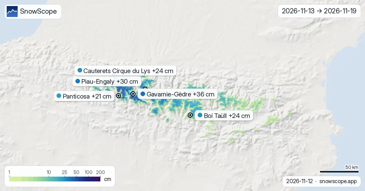
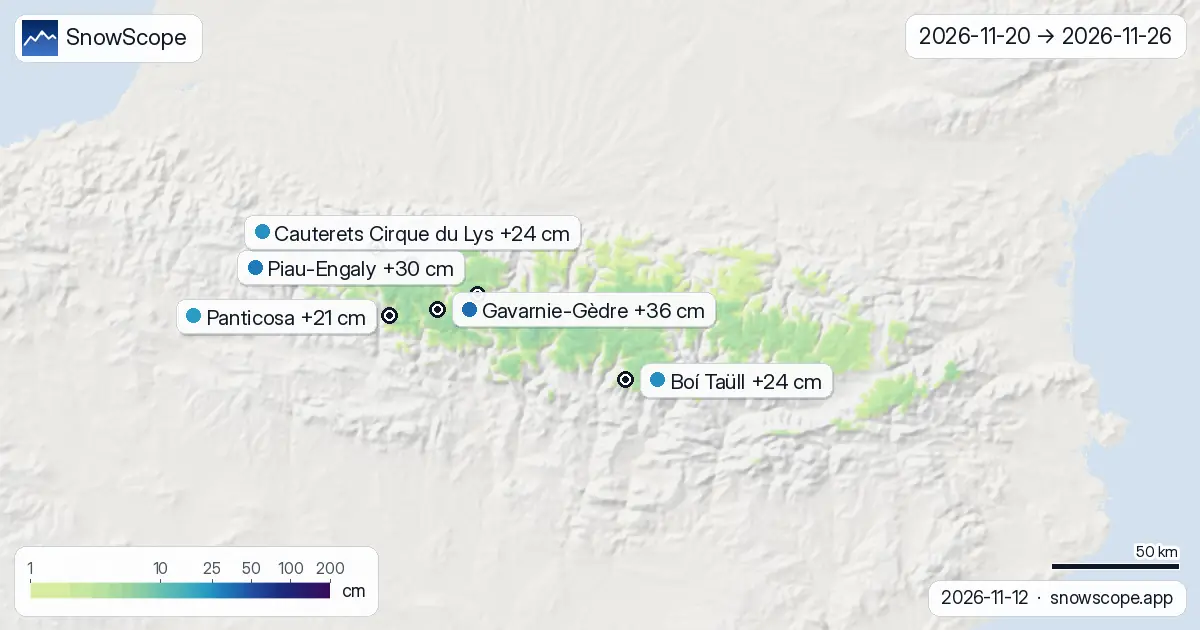
Add the region up and 67 % of the fortnight's snow is already down by 19 November; what the maps show from 20 November to 26 November is the rest.
Front-loaded: Gavarnie-Gèdre, Piau-Engaly, Boí Taüll, Cauterets Cirque du Lys, Panticosa and Gourette get most of their snow in the first week.
On the map, about 1,369 km² of mountain terrain get 20 cm or more over the two weeks, and 121 km² get 50 cm or more.
New snow by height
Band by band, counting every mountain pixel of the region and not only the ski areas, the fortnight gives: between 1,000 m and 1,500 m: next to nothing; between 1,500 m and 2,000 m: typically 1 cm, the snowiest quarter of that band 3 cm or more; between 2,000 m and 2,500 m: typically 12 cm, the snowiest quarter of that band 20 cm or more; between 2,500 m and 3,000 m: typically 26 cm, the snowiest quarter of that band 38 cm or more.
How to read the maps
The pictures: one map adds up the whole two weeks, the next two split them into the first and the second week. Light green means a dusting, deep blue and purple a big total; the pins carry the value for each resort's upper slopes.
A two-week forecast is a trend. The first week is usually close to what happens; the second can still change a lot, so we print the range of the two models next to every total and redraw the maps each morning.
Tips for skiers
- Use the week-one map to choose your days, the week-two map only to choose your region.
- The 0 °C level is a forecast and can move by several hundred metres, which changes where rain turns to snow: check the map again the day before you go.
- Before any off-piste or touring day, read the official avalanche bulletin (links below).
- Snow on the map does not mean a resort is open: check lifts and dates on the resort's website.
About these numbers
Resort snow depths are the deepest snow on the resort's upper slopes from the SnowScope snow model (about 1 km, run of 12 November); they are estimates for an area, not a measurement at one point. Station values are measurements on the date shown. Forecasts can change. Always read the official avalanche bulletin before going off-piste.
Official avalanche bulletins: Météo-France / Meteocat / AEMET
Cite this report
For research, teaching or the press: the numbers and charts are free to reuse under CC BY 4.0 with this citation.
SnowScope (2026), Where it snows in the Pyrenees in the next 14 days: Gavarnie-Gèdre leads with 36 cm, https://snowscope.app/blog/en/2026/11/pyrenees-2-week-snow-forecast-maps-12-november-2026.html, accessed 2026-11-12
SnowScope (Atlas Labs). (2026, November 12). Where it snows in the Pyrenees in the next 14 days: Gavarnie-Gèdre leads with 36 cm. SnowScope snow reports. https://snowscope.app/blog/en/2026/11/pyrenees-2-week-snow-forecast-maps-12-november-2026.html
BibTeX
@misc{snowscope2026pyrenees2weeksnowforecas,
  author       = {{SnowScope (Atlas Labs)}},
  title        = {Where it snows in the Pyrenees in the next 14 days: Gavarnie-Gèdre leads with 36 cm},
  year         = {2026},
  month        = nov,
  howpublished = {\url{https://snowscope.app/blog/en/2026/11/pyrenees-2-week-snow-forecast-maps-12-november-2026.html}},
  note         = {Published 2026-11-12 18:27 UTC; accessed 2026-11-12}
}· CC BY 4.0 · Methods, data and tools →
Gavarnie-Gèdre: snow and temperature by height, this winter vs last (tools) →
Follow Gavarnie-Gèdre
Free: a message when fresh snow is coming, and the forecast every morning.

More snow reports

Cauterets offers 25 km of runs for 46 EUR, but our snow history shows that the best chance for cover is the last week of December.
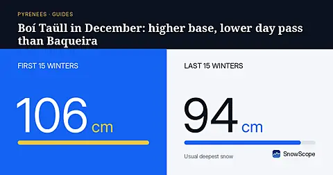
Boí Taüll starts at 2039 m and beats Baqueira Beret on day-pass price, though early December snow still takes some patience.
Pyrenees day passes from 46 EUR: six resorts in France, Spain and Andorra compared by price, then by the snow they usually have in December and January.