 SnowScope
Is Swiss snow already deeper than it should be? Yes, at most resorts
Swiss mountains are holding snow that is rare for mid-November. At Glacier 3000, the measured depth of 60 cm is double what we usually see at this point in the season, and four of the five main resorts measured are running above their long-term average.
See the live snow forecast for Glacier 3000 in the SnowScope appSnow depth, powder alerts and the 3D map, free.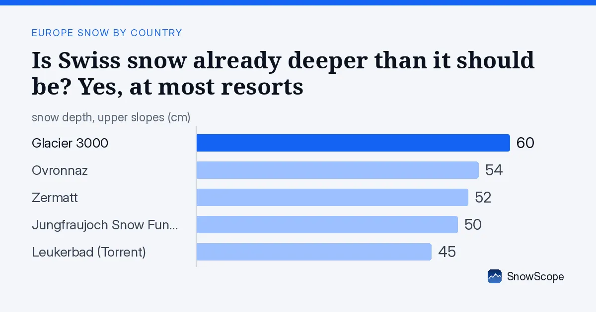
Snow already running high for the season
November snow is thin across most Alps, but Switzerland is an exception right now. The snow water stored in the mountains above 2000 metres is equivalent to what we see in the best three weeks of January. At Glacier 3000 (measured at 2238 m), the 60 cm of snow on the ground is 246 percent of what we normally measure on this date. Ovronnaz, at 1898 m, holds 54 cm, also more than double the average. Even at lower elevations, snow is building faster than the climate record suggests it should.
This early depth matters for water supply. Autumn and early winter snow feeds rivers and fills reservoirs through spring melt. When November snow is this deep, it signals that the snowpack is starting the season with more water stored than usual. The 18210 square kilometres of snow cover across the Swiss model domain is 59 percent of the mapped area, an unusual proportion for mid-November.
| Resort | Today | Normal for the date | Share of normal |
|---|---|---|---|
| Glacier 3000 | 59 cm | 24 cm | 246 % |
| Ovronnaz | 41 cm | 20 cm | 205 % |
| Zermatt | 221 cm | 31 cm | 713 % |
| Jungfraujoch Snow Fun Park | 67 cm | 74 cm | 91 % |
| Leukerbad (Torrent) | 24 cm | 17 cm | 141 % |
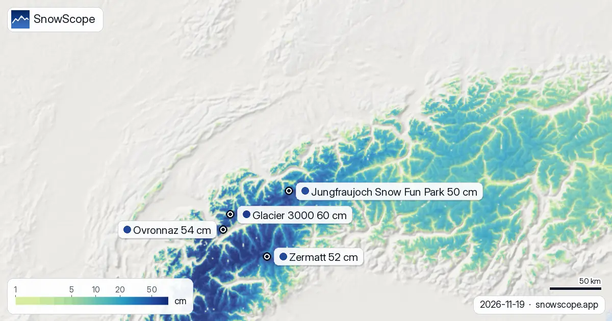
Where the snow water is concentrated
The thickest snow sits high. Above 2500 metres, the model shows a mean depth of 27 cm across the entire Swiss area, and all slopes are snow-covered. Between 2000 and 2500 metres, the average is 14 cm. Below 2000 metres, snow thins fast: at 1500 to 2000 metres, only 7 cm lies on average. The snow line sits at 1300 metres; below that, the ground is mostly bare.
The Valais Alps hold the most snow relative to what has fallen. In the past 72 hours, that region accumulated 151 cm of new snow on the high peaks. The Bernese Oberland recorded 99 cm in the same period. These zones are where most of the water is being stored right now.
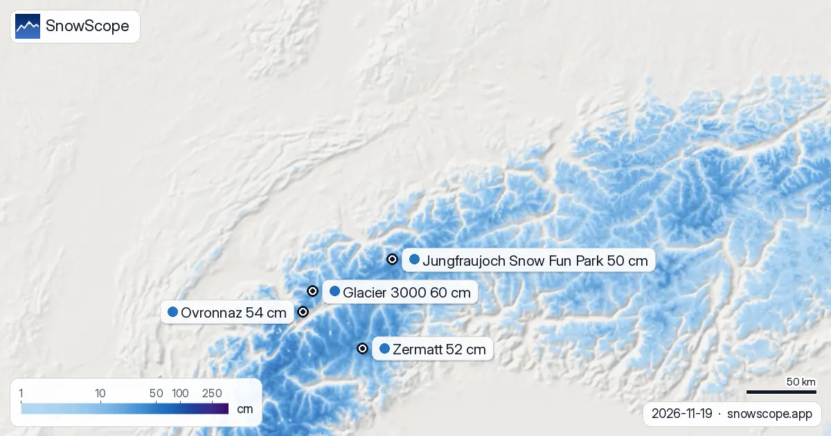
The five highest measured depths
Glacier 3000 leads with 60 cm, followed by Ovronnaz at 54 cm and Zermatt at 52 cm. Jungfraujoch Snow Fun Park holds 50 cm, and Leukerbad (Torrent) has 45 cm. All five of these sites received substantial new snow in the past three days: Glacier 3000 gained 94 cm, Ovronnaz 79 cm, and Zermatt 76 cm. These are not freak measurements; they reflect a region-wide pulse of wet snow that began several days ago and is still moving across the Alps.
Snow depths by elevation band
At 500 to 1000 metres, there is no snow on the ground. Between 1000 and 1500 metres, only 40 percent of the area is snow-covered and the mean depth is just 1 cm. The critical boundary is at 1500 metres: above that, 100 percent snow cover begins, and depths grow steadily with altitude. This sharp transition is typical for November, when the troposphere is still warm at low elevations but already cold enough to hold snow on the summits.
What comes next
The model forecasts up to 125 cm of new snow over the next seven days, with the heaviest single day likely on 22 November (38 cm). Over the next three days, resorts can expect 55 to 87 cm of new accumulation depending on location. This will push total snow storage well above the nine-in-ten-winters benchmark. The water equivalent of that fresh snow will be significant for spring runoff and reservoir levels.
By early December, the forecast signal weakens. The model shows only 27 cm of new snow expected between 27 November and 3 December, suggesting that the main snow event is front-loaded into the coming week.
Trend over four days
Snow cover across Switzerland grew by 1980 square kilometres in the past 24 hours alone and has expanded by 5110 square kilometres in the past week. On 16 November, Ovronnaz led the country with 136 cm. By 19 November, Glacier 3000 had moved to the top with 60 cm at its measurement point. This shift reflects the uneven distribution of the latest snowfall: different regions receive different amounts, and measurement sites at different elevations can show different signals.
Tips for skiers
- Check the official avalanche bulletin before touring above 2000 metres; fresh wet snow on steep slopes carries avalanche risk. The new snow is heavy with water content.
- Early-season snow below 1500 metres is thin and may hide rocks. Stick to marked runs and known terrain if you venture below the snow line at 1300 metres.
- On the high glaciers (above 2500 metres), 27 cm average depth gives good base, but crevasse hazard remains; rope-team travel and training are essential.
- Reservoir operators should note that this week's snow will add significant melt water in spring. The water stored now is above the nine-in-ten-winters normal.
- Use SnowScope's map to find the deepest snow at your chosen elevation. Above 2500 metres, all slopes are snow-covered and stable. Between 2000 and 2500 metres, choose north-facing slopes for more reliable depth.
About these numbers
Resort snow depths are the deepest snow on the resort's upper slopes from the SnowScope snow model (about 1 km, run of 19 November); they are estimates for an area, not a measurement at one point. Station values are measurements on the date shown. Forecasts can change. Always read the official avalanche bulletin before going off-piste.
Cite this report
For research, teaching or the press: the numbers and charts are free to reuse under CC BY 4.0 with this citation.
SnowScope (2026), Is Swiss snow already deeper than it should be? Yes, at most resorts, https://snowscope.app/blog/en/2026/11/switzerland-rare-early-snow-19-november-2026.html, accessed 2026-11-19
SnowScope (Atlas Labs). (2026, November 19). Is Swiss snow already deeper than it should be? Yes, at most resorts. SnowScope snow reports. https://snowscope.app/blog/en/2026/11/switzerland-rare-early-snow-19-november-2026.html
BibTeX
@misc{snowscope2026switzerlandrareearlysnow,
  author       = {{SnowScope (Atlas Labs)}},
  title        = {Is Swiss snow already deeper than it should be? Yes, at most resorts},
  year         = {2026},
  month        = nov,
  howpublished = {\url{https://snowscope.app/blog/en/2026/11/switzerland-rare-early-snow-19-november-2026.html}},
  note         = {Published 2026-11-19 11:34 UTC; accessed 2026-11-19}
}· CC BY 4.0 · Methods, data and tools →
Glacier 3000: snow and temperature by height, this winter vs last (tools) →
Follow Glacier 3000
Free: a message when fresh snow is coming, and the forecast every morning.

More snow reports
Only Borovets and Bansko have a trace of snow at the top today, 2 cm each. A week ago Borovets had 11 cm. Day by day, and the one snowy day in the forecast.
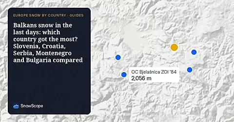
From 13 to 19 November 2026 Slovenia got the most snow and kept it; Serbia and Croatia had a deep but short white weekend; Montenegro only on Durmitor; Bulgaria almost none. The ranking, with links to each country report.
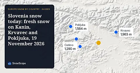
Snow is falling on Slovenia's ski mountains today: about 37 cm on Kanin and 21 cm on Krvavec. Where the snow lies, how it compares with past winters, and the next snowy day.