 SnowScope
Oukaimeden in December 2026: a warm month ahead, snow odds below usual
Oukaimeden is still bare: the 6 cm that fell at the top (3260 m) last week have melted, and the next seven days look dry. For December, the seasonal forecast is clearly warm over the High Atlas, and that is enough to tilt the snow odds below usual.
See the live snow forecast for Oukaimeden in the SnowScope appSnow depth, powder alerts and the 3D map, free.
Snow today
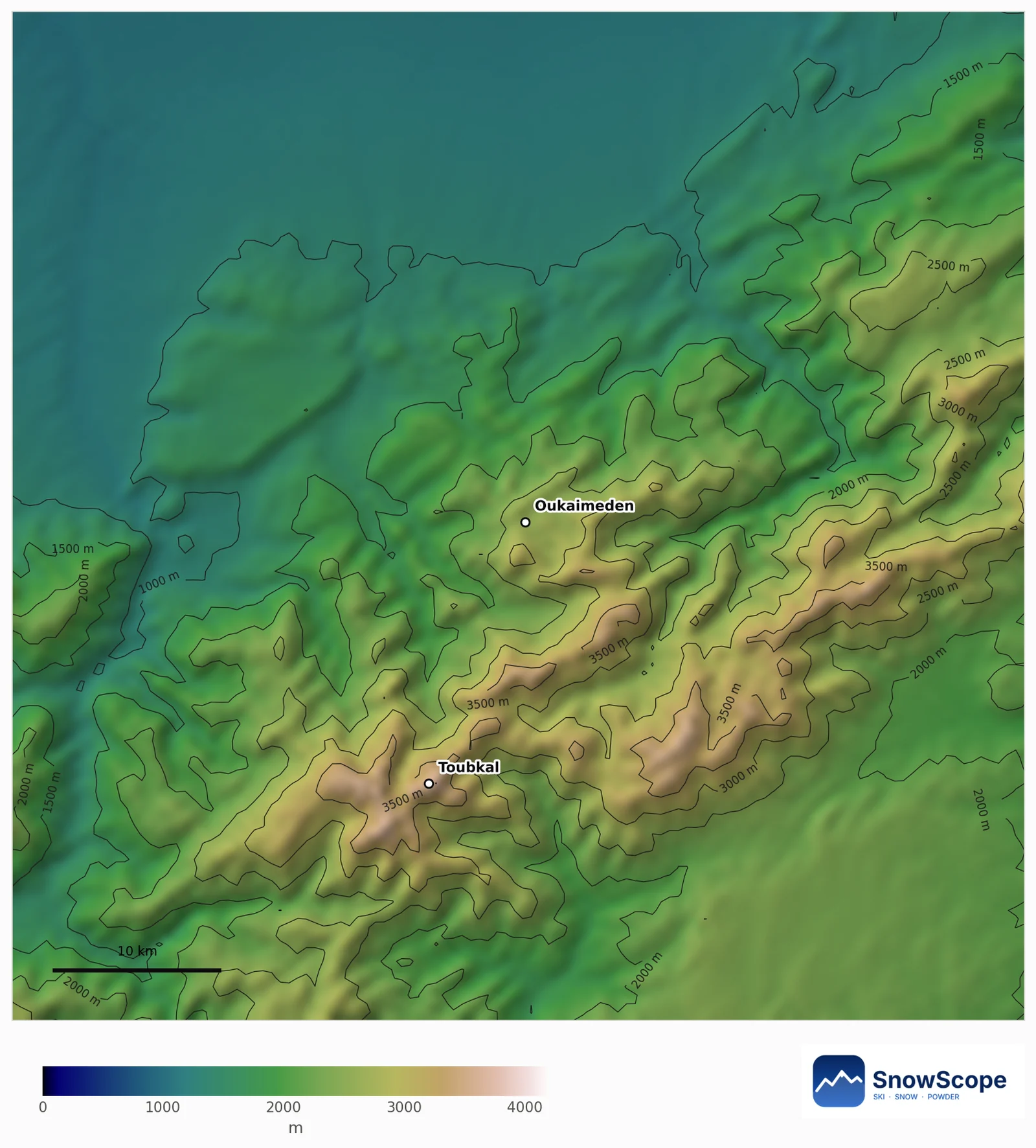
The map shows 0 cm at the base (2600 m), at mid-mountain (2930 m) and at the top. Only 1 % of the 60 km around Oukaimeden is white, so instead of an empty snow map we show the terrain: Toubkal and the high ridges where the first lasting snow usually appears.
Leaner odds almost everywhere
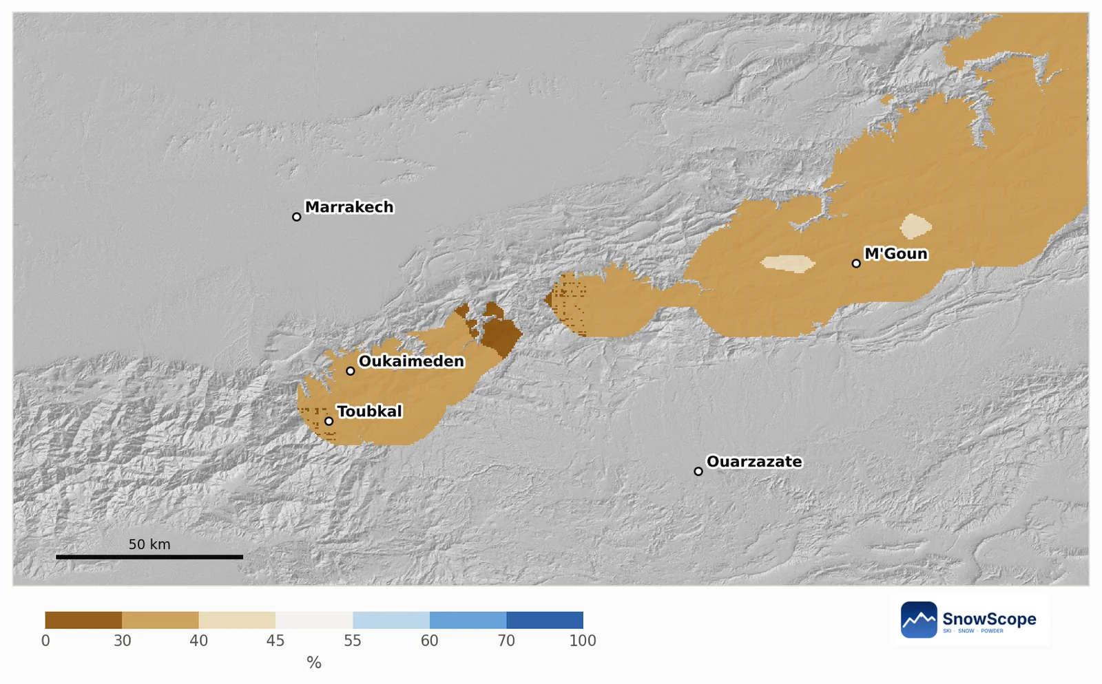
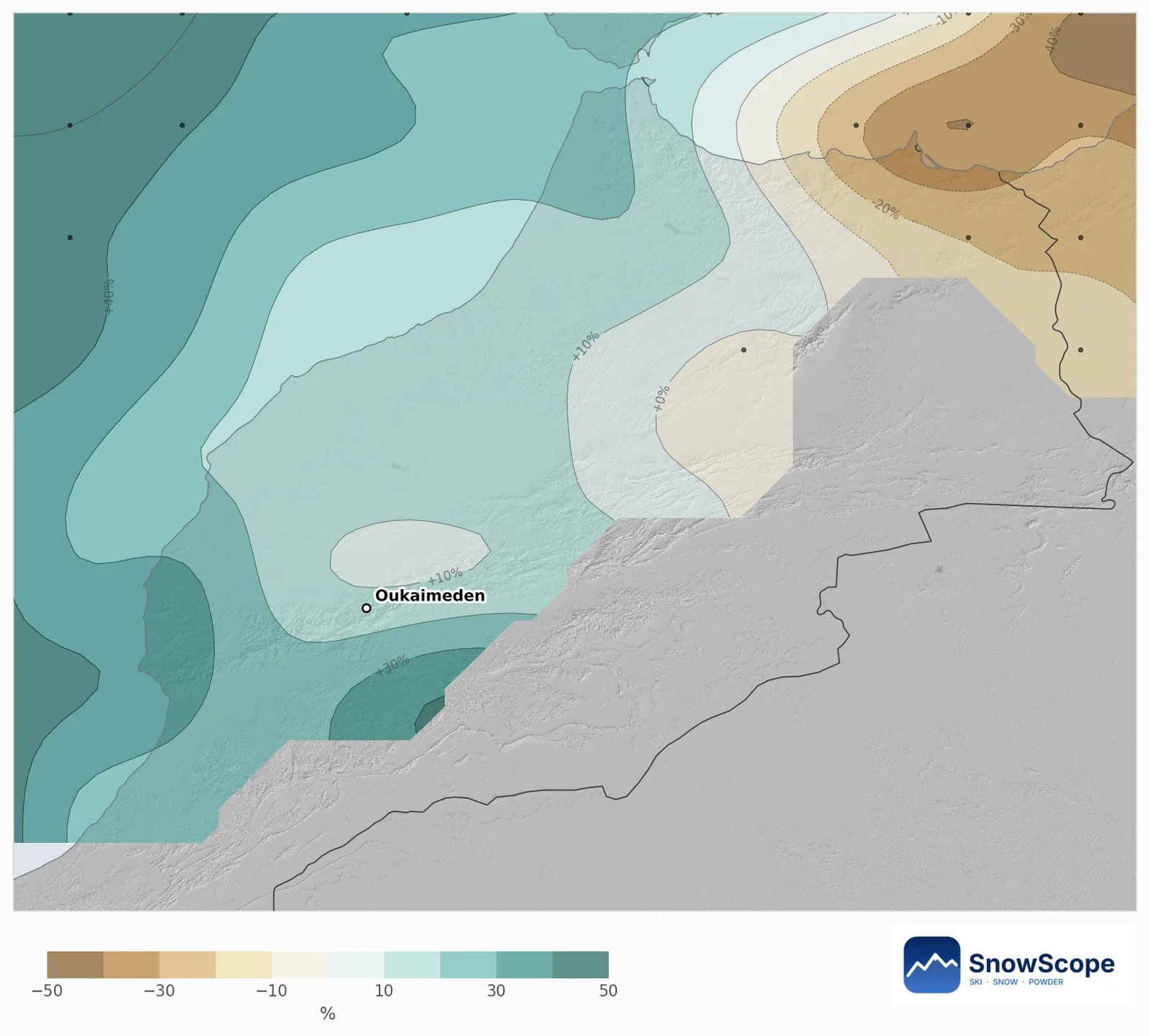
Our outlook map compares every High Atlas mountain area of about 10 km with its own past Decembers. 95 % of the mountain area leans leaner and none leans snowier. The chance of more new snow than in a usual December ranges from 29 % to 43 % across the range.
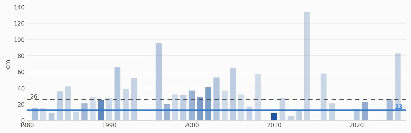
High up at Oukaimeden, around 3200 m, a usual December brings 41 cm of new snow and leaves 26 cm on the ground on 31 December. This year's outlook is 37 cm of new snow and 13 cm on 31 December, most likely between 0 and 29 cm. The chance of more snow than usual on 31 December is only 26 %.
What the European forecast says
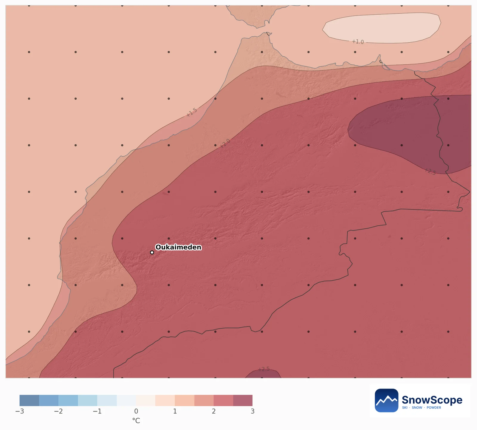
The 51 runs of the European weather centre's seasonal system are almost unanimous: 94 % of them make December warmer than usual, by 2.2 °C on average over the area. For precipitation the runs are split: 51 % are wetter, and the average is 11 % above a usual December of only 33 mm, pushed up by a few very wet runs.
In the Atlas this matters a lot. Storms are few in December, and with warmer air more of each storm falls as rain on the lower slopes and the snow melts faster in the strong sun. Snow here still follows precipitation first (correlation 0.91), but warmth takes away from what falls.
Past Decembers like this one
The past Decembers whose weather looked most like this forecast are 2010, 2023 and 1989. A single big storm can still change the picture in the Atlas, so the outlook is a tilt of the odds, not a dry verdict.
Follow the 7-day forecast: when a storm from the Atlantic is announced, the top of Oukaimeden is the first place to get snow.
Tips for skiers
- Do not plan a ski day in early December without checking the 7-day forecast.
- After a storm, the highest slopes keep snow longest; the lower area melts within days in a warm month.
- For hiking, the high trails may stay mostly clear of snow; check conditions before going above 3000 m.
References and credits
- ECMWF SEAS5 seasonal forecasts, Copernicus Climate Change Service (C3S) cds.climate.copernicus.eu/datasets/seasonal-postprocessed-single-levels
- ERA5 monthly averaged data, Copernicus Climate Change Service (C3S) cds.climate.copernicus.eu/datasets/reanalysis-era5-single-levels-monthly-means
About these numbers
Method. Temperature and precipitation: the seasonal forecast of the European weather centre (ECMWF SEAS5, 51 runs started 1 November 2026, anomalies against its own 1993-2016 reforecasts, about 100 km grid). Snow: for every mountain cell of about 10 km we take our model of the past (46 winters, snow depth corrected for height) and the weather of each December from 1981 to 2025 (ERA5); past Decembers whose temperature and precipitation look like each forecast run count more, and their snow gives the odds. Snow today: the SnowScope snow map (500 m). A monthly outlook only tilts the odds: it cannot forecast a storm or a date.
Cite this report
For research, teaching or the press: the numbers and charts are free to reuse under CC BY 4.0 with this citation.
SnowScope (2026), Oukaimeden in December 2026: a warm month ahead, snow odds below usual, https://snowscope.app/blog/en/2026/11/oukaimeden-december-2026-snow-outlook.html, accessed 2026-11-10
SnowScope (Atlas Labs). (2026, November 10). Oukaimeden in December 2026: a warm month ahead, snow odds below usual. SnowScope snow reports. https://snowscope.app/blog/en/2026/11/oukaimeden-december-2026-snow-outlook.html
BibTeX
@misc{snowscope2026oukaimedendecember2026sn,
  author       = {{SnowScope (Atlas Labs)}},
  title        = {Oukaimeden in December 2026: a warm month ahead, snow odds below usual},
  year         = {2026},
  month        = nov,
  howpublished = {\url{https://snowscope.app/blog/en/2026/11/oukaimeden-december-2026-snow-outlook.html}},
  note         = {Published 2026-11-10 09:30 UTC; accessed 2026-11-10}
}· CC BY 4.0 · Methods, data and tools →
Follow Oukaimeden
Free: a message when fresh snow is coming, and the forecast every morning.

More snow reports
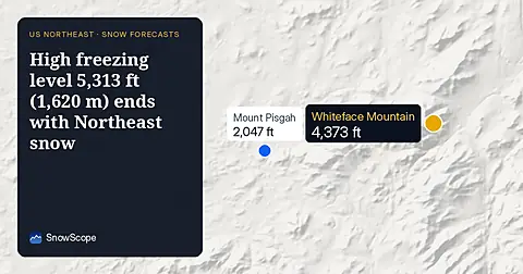
On November 10, the freezing level reaches 5,313 ft (1,620 m) above Northeast summits, bringing rain before 20–25 cm of snow arrives.
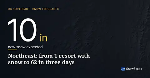
Northeast forecast made 10 November: 10 in (25 cm) of new snow arriving through 13 November will transform snow cover from 1 resort to 62.
Above 1,500 m around Toubkal, the ground was white for 94 days in winter 2025-26, the most in 26 winters of satellite images. How low the snow came, when it left, and how this winter compares with 2008-09 and the dry years.