 SnowScope
Pyrenees powder alert: Cauterets Cirque du Lys +7–19 cm in 72 hours (15 November)
Pyrenees snow report, 15 November. Mixed rain and snow: snow is expected only up high, about 7–19 cm near the top of Cauterets Cirque du Lys (2,420 m), with rain below about 2,160 m. In the last 72 hours, 7–19 cm of new snow fell on Cauterets Cirque du Lys; 9 cm of it came in the last 24 hours. The snowpack on its upper slopes is now about 9 cm, according to our snow model. Every number here is an estimate with some uncertainty; the trend over several days is usually more reliable than one value.
See the live snow forecast for Cauterets Cirque du Lys in the SnowScope appSnow depth, powder alerts and the 3D map, free.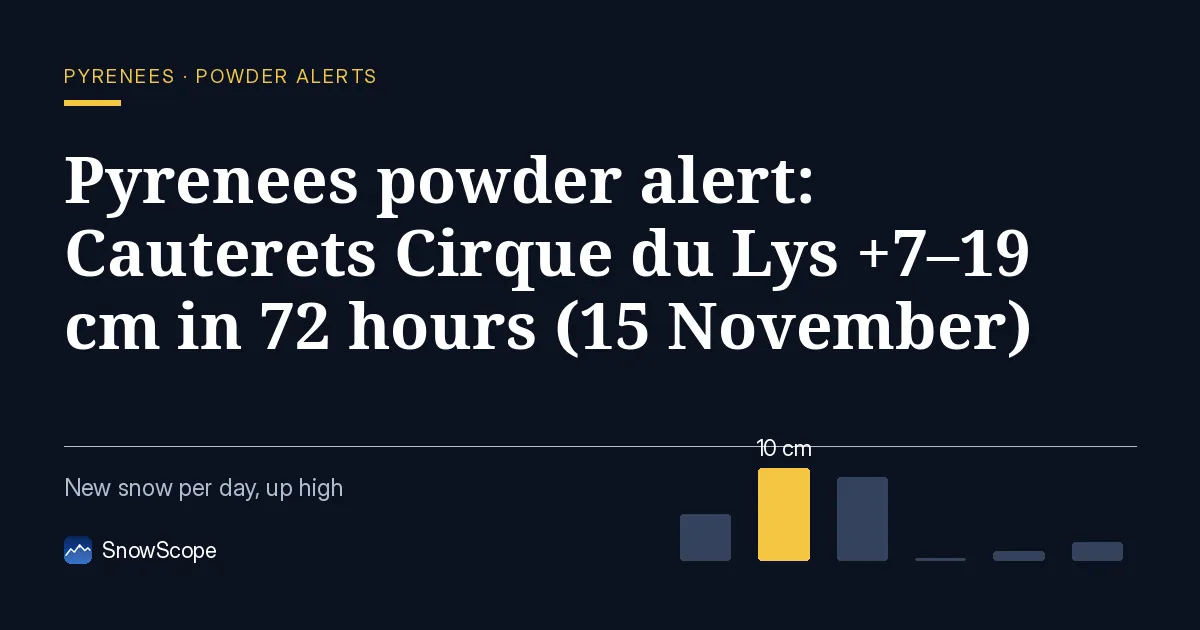
What the storm added
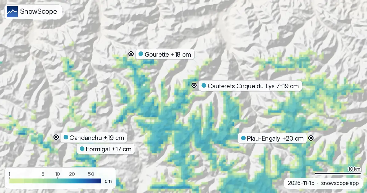
The storm also reached Piau-Engaly, Candanchu and Gourette, with 15 cm, 19 cm and 18 cm in the last 72 hours.
Snow now covers 1,420 km² in the Pyrenees; 25 of 53 resorts have some on their upper slopes.
| Resort | Snow depth | New snow, 72 h | Coming, next days | Top |
|---|---|---|---|---|
| Cauterets Cirque du Lys | 9 cm | 19 cm | 3 cm | 2,420 m |
| Piau-Engaly | 8 cm | 15 cm | 3 cm | 2,527 m |
| Candanchu | 8 cm | 19 cm | 2 cm | 2,238 m |
| Gourette | 11 cm | 18 cm | 2 cm | 2,453 m |
| Formigal | 5 cm | 17 cm | 1 cm | 2,264 m |
The next days in the forecast
More snow, and so more stored water, is on the way: by 18 November our forecast gives 7–19 cm at Cauterets Cirque du Lys, 6–15 cm at Piau-Engaly and 15–19 cm at Candanchu.
Forecasts a few days ahead can change: look at the map again the day before you travel.
Where snow stays, where it melts
Our model splits Cauterets Cirque du Lys into three heights: 4 cm at the top (2,420 m), 0 cm at mid-mountain (2,072 m), 0 cm at the base (1,725 m).
On 17 November the freezing level at Cauterets Cirque du Lys rises to 2,830 m to 3,680 m, above the top of the resort (2,420 m): precipitation can fall as rain or wet snow, and rain on snow speeds up the melt.
Measured snow
Measured, not modelled: the Certascan (2.398 m) station (2,398 m) recorded 8 cm of snow on the ground on 13 November, with 8 cm of new snow in 24 hours. The Boí (2.537 m) station (2,537 m) reported a snow depth of 6 cm on 13 November, 6 cm of it from the last 24 hours. Measured, not modelled: the Núria (1.971 m) station (1,971 m) recorded 5 cm of snow on the ground on 13 November, with 5 cm of new snow in 24 hours.
A note on measurement: resort values are modelled for the upper slopes, station values are measured at one place on the date given, and both carry some uncertainty.
Avalanche danger and safety
The avalanche service (Météo-France – Bulletin d'estimation du risque d'avalanche) rates the Cauterets Cirque du Lys area at 1 on the 5-level scale today.
After fresh snow, wind builds drifts on sheltered slopes. Off-piste, the first days after a snowfall need the most care.
Tips for skiers
- Fresh snow has a short best-before time: the first hours. Early starts win.
- Shade protects the snowpack. High, north-facing slopes get less sun, so their snow lasts longer than on the south side.
- Before you ski off-piste or go touring, read the official avalanche bulletin (links below).
- Snow on the map does not mean a resort is open: check lifts and opening dates on the resort's website.
- Get a powder alert in the SnowScope app to know when Cauterets Cirque du Lys gets fresh snow.
About these numbers
Resort snow depths are the deepest snow on the resort's upper slopes from the SnowScope snow model (about 1 km, run of 15 November); they are estimates for an area, not a measurement at one point. Station values are measurements on the date shown. Forecasts can change. Always read the official avalanche bulletin before going off-piste.
Official avalanche bulletins: Météo-France – Bulletin d'estimation du risque d'avalanche
Cite this report
For research, teaching or the press: the numbers and charts are free to reuse under CC BY 4.0 with this citation.
SnowScope (2026), Pyrenees powder alert: Cauterets Cirque du Lys +7–19 cm in 72 hours (15 November), https://snowscope.app/blog/en/2026/11/pyrenees-cauterets-cirque-du-lys-fresh-snow-powder-alert-15-november-2026.html, accessed 2026-11-15
SnowScope (Atlas Labs). (2026, November 15). Pyrenees powder alert: Cauterets Cirque du Lys +7–19 cm in 72 hours (15 November). SnowScope snow reports. https://snowscope.app/blog/en/2026/11/pyrenees-cauterets-cirque-du-lys-fresh-snow-powder-alert-15-november-2026.html
BibTeX
@misc{snowscope2026pyreneescauteretscirqued,
  author       = {{SnowScope (Atlas Labs)}},
  title        = {Pyrenees powder alert: Cauterets Cirque du Lys +7–19 cm in 72 hours (15 November)},
  year         = {2026},
  month        = nov,
  howpublished = {\url{https://snowscope.app/blog/en/2026/11/pyrenees-cauterets-cirque-du-lys-fresh-snow-powder-alert-15-november-2026.html}},
  note         = {Published 2026-11-15 18:24 UTC; accessed 2026-11-15}
}· CC BY 4.0 · Methods, data and tools →
Cauterets Cirque du Lys: snow and temperature by height, this winter vs last (tools) →
Follow Cauterets Cirque du Lys
Free: a message when fresh snow is coming, and the forecast every morning.

More snow reports
How long the Pyrenees stayed white each winter since 2000-01, seen by satellite, and snow depth at 10 long-running stations. Three thin winters in a row ended in 2025-26; this autumn has started normally.

Pyrenees day passes from 46 EUR: six resorts in France, Spain and Andorra compared by price, then by the snow they usually have in December and January.
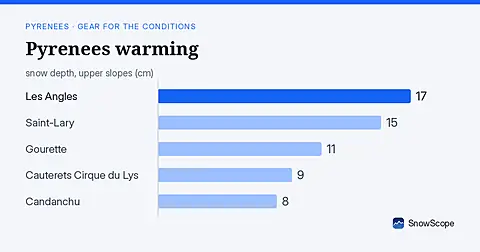
Rain forecast as freezing level climbs to 4080 m; snow measured on 15 November is thin (under 20 cm) at all major Pyrenees resorts.