 SnowScope
Mt. Shasta Ski Park: 20 cm at the top, nothing at the base
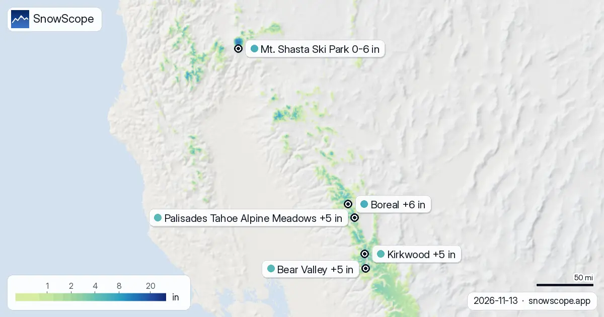
Mt. Shasta Ski Park's upper slopes hold 20 cm of new snow from the last 72 hours, but the base is bare ground. This extreme height gap—where snow accumulates above roughly 2020 m and rain dominates below—is the story of early season snowfall here.
See the live snow forecast for Mt. Shasta Ski Park in the SnowScope appSnow depth, powder alerts and the 3D map, free.What fell and where
On 2026-11-13, the freezing level at Mt. Shasta climbed as high as 2460 m in the afternoon, then dropped to 1620 m at night. This wild swing meant the snowfall was cut by an invisible line. Our snow model estimates 16 cm of fresh snow fell on the upper slopes in 72 hours. Ground truth from nearby stations shows Fish Creek at 2347 m recorded 10 cm, while Hickerson Park at 2780 m recorded 10 cm. Both sit above the rain line. Below roughly 2020 m, only rain reached the ground on 2026-11-13.
| Resort | Snow depth | New snow, 72 h | Coming, next days | Top |
|---|---|---|---|---|
| Mt. Shasta Ski Park | 6 in (14 cm) | 6 in (16 cm) | 13 in (32 cm) | 7,539 ft (2,298 m) |
| Boreal | 5 in (13 cm) | 6 in (14 cm) | 12 in (30 cm) | 7,700 ft (2,347 m) |
| Bear Valley | 8 in (21 cm) | 5 in (13 cm) | 13 in (34 cm) | 8,484 ft (2,586 m) |
| Kirkwood | 9 in (24 cm) | 5 in (13 cm) | 13 in (32 cm) | 9,462 ft (2,884 m) |
| Palisades Tahoe Alpine Meadows | 7 in (17 cm) | 5 in (13 cm) | 12 in (30 cm) | 8,494 ft (2,589 m) |
Breaking it down by elevation
The vertical breakdown is stark. At the base (1666 m), there is zero snow and no hope until the snowline drops several hundred metres. At mid elevations around 1982 m, the model shows 7 cm—patchy, thin, and risky for rocks. The top (2298 m) has 20 cm, the best on the mountain but still early-season fragile. Within the next seven days, the model forecasts 29 cm at the base (if it falls as snow), 54 cm at mid, and 67 cm at the top. This tells you where to focus if you plan to ski in the coming week.
The next few days
The forecast calls for 32 cm of new snow over the next few days, split across three days: 6 cm on 2026-11-14, 22 cm on 2026-11-15, and 4 cm on 2026-11-16. Most falls on 2026-11-15. Because the freezing level is expected to drop (reaching 1520 m at night on 2026-11-15), more snow should stick higher up the mountain, and the base might finally catch some powder by 2026-11-16. By 2026-11-16, the forecast expects 136 of the region's 195 resorts to have snow cover, up from 122 today.
How Mt. Shasta compares
Mt. Shasta is in the middle of the pack for the region. The upper slopes hold 14 cm now, edging out Boreal (13 cm) but well behind Kirkwood (24 cm) and Bear Valley (21 cm). The difference is altitude. Kirkwood tops out at 2884 m, well above Mt. Shasta's 2298 m, so it catches more snow in early season. The storm that swept the Mt. Shasta area in 72 hours packed about 41 cm (measured 8 km from the resort), more than the 33 cm that fell 21 km away near Brian Head Resort. Early-season snow is uneven by geography.
When and where to ski
If you are planning a visit, stick to the upper slopes (above 2020 m) through 2026-11-16. The next two days will bring mixed conditions with heavy snow on 2026-11-15; expect low visibility and variable coverage. The base lifts will likely remain closed or risky through the storm. After 2026-11-16, conditions should improve, and the base may finally start to accumulate snow. If you venture off-piste or into the backcountry, consult the official avalanche forecast for the region first.
Tips for skiers
- Focus on elevations above 2020 m; the base (1666 m) remains bare ground through the forecast period.
- Plan for 22 cm on 2026-11-15, the peak snowfall day; expect low visibility and mixed conditions.
- The snowline is forecast to drop to around 1520 m by 2026-11-15, so snow should reach lower elevations; variable coverage is likely.
- Early-season snow is thin: stations measured only 10 cm even at the highest ridges (Hickerson Park at 2780 m), so expect rocks to show.
- Before skiing off-piste or backcountry terrain, check the official avalanche forecast for the region first, particularly after the upcoming snowfall.
About these numbers
Resort snow depths are the deepest snow on the resort's upper slopes from the SnowScope snow model (about 1 km, run of 13 November); they are estimates for an area, not a measurement at one point. Station values are measurements on the date shown. Forecasts can change. Always read the official avalanche bulletin before going off-piste.
Official avalanche bulletins: avalanche.org
Cite this report
For research, teaching or the press: the numbers and charts are free to reuse under CC BY 4.0 with this citation.
SnowScope (2026), Mt. Shasta Ski Park: 20 cm at the top, nothing at the base, https://snowscope.app/blog/en/2026/11/us-west-mt-shasta-ski-park-fresh-snow-powder-alert-13-november-2026.html, accessed 2026-11-13
SnowScope (Atlas Labs). (2026, November 13). Mt. Shasta Ski Park: 20 cm at the top, nothing at the base. SnowScope snow reports. https://snowscope.app/blog/en/2026/11/us-west-mt-shasta-ski-park-fresh-snow-powder-alert-13-november-2026.html
BibTeX
@misc{snowscope2026uswestmtshastaskiparkfre,
  author       = {{SnowScope (Atlas Labs)}},
  title        = {Mt. Shasta Ski Park: 20 cm at the top, nothing at the base},
  year         = {2026},
  month        = nov,
  howpublished = {\url{https://snowscope.app/blog/en/2026/11/us-west-mt-shasta-ski-park-fresh-snow-powder-alert-13-november-2026.html}},
  note         = {Published 2026-11-13 21:01 UTC; accessed 2026-11-13}
}· CC BY 4.0 · Methods, data and tools →
Mt. Shasta Ski Park: snow and temperature by height, this winter vs last (tools) →
Follow Mt. Shasta Ski Park
Free: a message when fresh snow is coming, and the forecast every morning.

More snow reports
Alpental snow forecast for 13 November 2026: about 1 in on the upper mountain, rain almost to the summit this weekend with a snow level near 5,400 to 5,600 ft, then 4 to 5 in of mixed rain and snow up top next week.
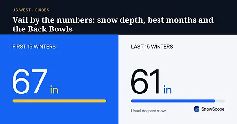
Vail in numbers: a usual peak of about 64 in (162 cm) at mid-mountain over 46 past winters, March the deepest month, plus terrain, access and safety.
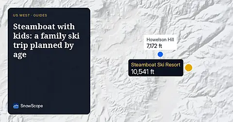
Steamboat, Colorado, for families: what works for toddlers, school-age kids, teens and parents, with the snow of 46 past winters at three heights.