 SnowScope
Wolf Creek 115 percent of normal for mid-November
Wolf Creek's station measured 20 in (51 cm) on November 11, putting this season at 115 percent of normal for the date. Last year this same location recorded just 1 in (3 cm), so the region is making up for a late, weak start that hampered the previous winter.
See the live snow forecast for Wolf Creek in the SnowScope appSnow depth, powder alerts and the 3D map, free.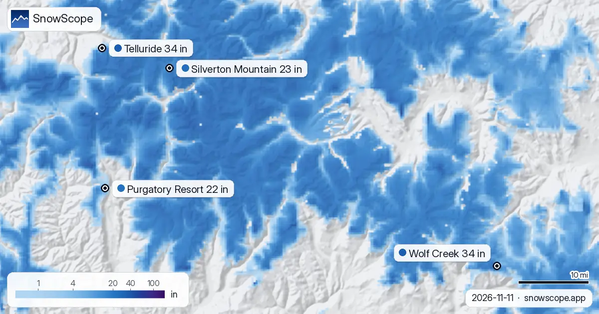
Tracking normal
Tracking normal is not headline material, but it matters early. November is when mountains build from bare ground, and each snowfall event counts. Wolf Creek sits where November should put it.
The model estimates 26 in (66 cm) across the resort's reference height, while the measured station shows 20 in (51 cm). Both values point the same direction: this season is on schedule.
| Resort | Snow depth | New snow, 72 h | Coming, next days | Top |
|---|---|---|---|---|
| Wolf Creek | 34 in (87 cm) | 0 in (0 cm) | 3 in (8 cm) | 11,762 ft (3,585 m) |
| Telluride | 34 in (86 cm) | 0 in (0 cm) | 4 in (9 cm) | 12,507 ft (3,812 m) |
| Silverton Mountain | 23 in (58 cm) | 0 in (0 cm) | 3 in (7 cm) | 10,974 ft (3,345 m) |
| Purgatory Resort | 22 in (57 cm) | 0 in (0 cm) | 5 in (12 cm) | 10,797 ft (3,291 m) |
Last winter's thin beginning
The contrast that matters is not with normal snow but with last November. On November 11, 2025, Wolf Creek Summit recorded 1 in (3 cm). The entire region was running late.
Storms that should have arrived in October did not come reliably until December. That compressed timeline meant scrambling for adequate base depth and rushed lift openings. This year's single storm has nearly matched the entire monthly depth from last year.
Wider pattern across the US West
Wolf Creek is not alone. At Telluride, the Alta Lakes station measured 19 in (48 cm) on November 11. Silverton Mountain's Red Mountain Pass station recorded 23 in (58 cm).
Our model puts Purgatory at 4 in (10 cm), though a nearby station still shows no measurable snow there, suggesting the southern resorts lag behind their northern neighbors. Across the region, 123 of 195 resorts report some snow, and the snow-covered area has grown to 134,530 km² by November 11.
Why the early kick
Significant precipitation arrived at high elevations in October across Colorado and Utah. Wolf Creek triggered its first 5 cm gain by October 22, while Telluride and Silverton Mountain started even earlier on October 17.
The long-range pattern has shifted, bringing early-season troughs southward more often than in the drought years. One major storm per week through October was enough to establish a foundation that did not exist last year.
What the forecast suggests
Forecasts shift, but the model shows snow-covered area expanding to 213,380 km² by November 14 as storms continue to move through. The region is building the kind of base that lets resorts plan with confidence for opening terrain in coming weeks.
Wolf Creek is not in surplus, but it is established. For the second week of November, it is tracking where it needs to be when the season peaks.
Tips for skiers
- Wolf Creek's measured 20 in (51 cm) is enough for groomed mid-mountain runs, but check the resort about rock exposure on steeper slopes, which remains a hazard under thin early-season snow.
- The forecast calls for more snow through November 14. Before skiing off-piste terrain, check the local avalanche bulletin to assess how new snow is loading the existing thin base.
- Purgatory is weak at 4 in (10 cm) on the model with no measured snow nearby; expect delayed opening or base-only terrain until more accumulation arrives.
- Elevation shifts the game: Wolf Creek's high elevations are snow-reliable, but Purgatory and lower resorts can see rain-on-snow events if temperatures rise, so watch the forecast high.
- This 115 percent of normal may not persist if the jet stream pattern flattens by mid-December. Early-season skiers should use this window while the foundation is firm.
About these numbers
Resort snow depths are the deepest snow on the resort's upper slopes from the SnowScope snow model (about 1 km, run of 11 November); they are estimates for an area, not a measurement at one point. Station values are measurements on the date shown. Forecasts can change. Always read the official avalanche bulletin before going off-piste.
Official avalanche bulletins: avalanche.org
Cite this report
For research, teaching or the press: the numbers and charts are free to reuse under CC BY 4.0 with this citation.
SnowScope (2026), Wolf Creek 115 percent of normal for mid-November, https://snowscope.app/blog/en/2026/11/us-west-snow-this-season-vs-last-season-11-november-2026.html, accessed 2026-11-11
SnowScope (Atlas Labs). (2026, November 11). Wolf Creek 115 percent of normal for mid-November. SnowScope snow reports. https://snowscope.app/blog/en/2026/11/us-west-snow-this-season-vs-last-season-11-november-2026.html
BibTeX
@misc{snowscope2026uswestsnowthisseasonvsla,
  author       = {{SnowScope (Atlas Labs)}},
  title        = {Wolf Creek 115 percent of normal for mid-November},
  year         = {2026},
  month        = nov,
  howpublished = {\url{https://snowscope.app/blog/en/2026/11/us-west-snow-this-season-vs-last-season-11-november-2026.html}},
  note         = {Published 2026-11-11 18:44 UTC; accessed 2026-11-11}
}· CC BY 4.0 · Methods, data and tools →
Wolf Creek: snow and temperature by height, this winter vs last (tools) →
Follow Wolf Creek
Free: a message when fresh snow is coming, and the forecast every morning.

More snow reports
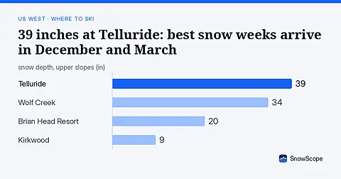
Telluride has 39 inches today. Peak snow weeks historically arrive in late December and March, not November.

Mt Baker, Washington: about 133 in (337 cm) at the usual peak at mid-mountain in 46 past winters, a world snowfall record, no lodging on the hill, and what that means.
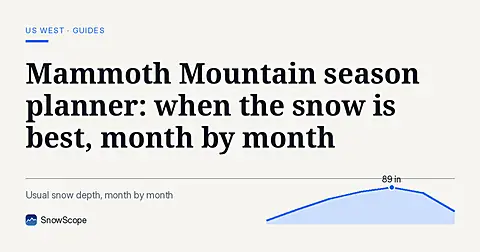
Plan Mammoth Mountain by season: about 93 in (235 cm) at the usual peak at mid-mountain over 46 past winters, March deepest, long springs, and winters that swing.