 SnowScope
Wolf Creek base: why 8 inches when the top has 47 cm?
Wolf Creek's base holds only 3 in (8 cm) of snow while its summit reaches 19 in (47 cm). This 15 in (39 cm) gap between top and bottom reveals how freezing level divides the resort into wet and dry zones in early November.
See the live snow forecast for Wolf Creek in the SnowScope appSnow depth, powder alerts and the 3D map, free.Height and freezing level create the gap
The gap appears because Wolf Creek straddles the freezing-level zone this week. The base sits at 10,260 ft (3,128 m) where the air is still warm enough to bring rain, with the freezing level around 11,000 ft (3,360 m). The summit at 11,760 ft (3,585 m) sits solidly above that threshold. When a resort spans from rain zone to snow zone, the lower half loses accumulation while the upper half keeps it.
Mid-elevation, at 11,000 ft (3,356 m), currently holds 15 in (37 cm)—deeper than 32 of the past 46 winters at this date. That shows the upper mountain is working well. But the base, at only 3 in (8 cm), is where the system breaks down. Rocks lie close beneath such thin cover.
| Resort | Snow depth | New snow, 72 h | Coming, next days | Top |
|---|---|---|---|---|
| Wolf Creek | 34 in (87 cm) | 0 in (0 cm) | 3 in (8 cm) | 11,762 ft (3,585 m) |
| Telluride | 34 in (86 cm) | 0 in (0 cm) | 4 in (9 cm) | 12,507 ft (3,812 m) |
| Silverton Mountain | 23 in (58 cm) | 0 in (0 cm) | 3 in (7 cm) | 10,974 ft (3,345 m) |
| Purgatory Resort | 22 in (57 cm) | 0 in (0 cm) | 5 in (12 cm) | 10,797 ft (3,291 m) |
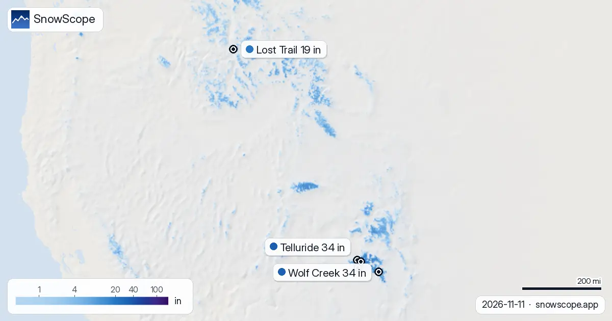
| Lost Trail | 19 in (49 cm) | 0 in (0 cm) | 0 in (1 cm) | 8,186 ft (2,495 m) |
What satellite and stations tell us
Our model estimates the depth gap at Wolf Creek. Satellite imagery from 3 November confirmed snow cover across the area. A weather station at Idarado, 8.7 mi (14 km) away at 9,780 ft (2,981 m), measured 2 in (5 cm) on 10 November, suggesting precipitation came as rain at lower elevations rather than snow. The model fits this pattern.
We cannot say the base depth is exact (early snow is fragile; rocks lie close beneath thin cover), but the model is consistent with station data. Forecasts are more certain at higher elevations, where snow is deeper and more stable.
What is coming: freezing level drops
By Friday 13 November, the freezing level will have dropped well below the base elevation. It falls from about 11,000 ft (3,360 m) on Wednesday to around 8,760 ft (2,670 m) by Friday. When the freezing level sinks below 10,260 ft (3,128 m), rain becomes snow.
The forecast calls for 3 in (8 cm) of new snow by Saturday 14 November. Even so, the base will gain only about 1 in (3 cm), while mid-elevations will gain up to 5 in (13 cm). The gap will narrow, but slowly. More storms and sustained cold are needed to close it fully.
Early-season reality on a steep mountain
A 15 in (39 cm) gap from base to top is not unusual for mountains in autumn when freezing level splits them into wet and dry halves. The real issue is the absolute depth at the base: 3 in (8 cm) means exposed rock is a real hazard. At mid-elevation, 15 in is skiable but thin. On the upper slopes, coverage averages 34 in (87 cm), which is better for turns.
For now, the mid and upper slopes are the smart play. The base is risky until snow arrives and builds depth. By next week, if storms continue and freezing level stays down, the base may become safer. Until then, stay at elevation.
Tips for skiers
- Avoid the base runs until 15 November. Rocks are exposed in 3 in of cover.
- Stick to elevations above 10,800 ft (3,300 m), where snow depth reaches 15 in and is more stable.
- Watch the forecast for 13–14 November. If freezing level drops as modelled, the base will improve quickly.
- Check the Colorado Avalanche Information Center bulletin before skiing off-piste; danger is currently level 1 (low).
About these numbers
Resort snow depths are the deepest snow on the resort's upper slopes from the SnowScope snow model (about 1 km, run of 11 November); they are estimates for an area, not a measurement at one point. Station values are measurements on the date shown. Forecasts can change. Always read the official avalanche bulletin before going off-piste.
Official avalanche bulletins: Colorado Avalanche Information Center
Cite this report
For research, teaching or the press: the numbers and charts are free to reuse under CC BY 4.0 with this citation.
SnowScope (2026), Wolf Creek base: why 8 inches when the top has 47 cm?, https://snowscope.app/blog/en/2026/11/us-west-snow-vs-past-winters-11-november-2026.html, accessed 2026-11-11
SnowScope (Atlas Labs). (2026, November 11). Wolf Creek base: why 8 inches when the top has 47 cm?. SnowScope snow reports. https://snowscope.app/blog/en/2026/11/us-west-snow-vs-past-winters-11-november-2026.html
BibTeX
@misc{snowscope2026uswestsnowvspastwinters1,
  author       = {{SnowScope (Atlas Labs)}},
  title        = {Wolf Creek base: why 8 inches when the top has 47 cm?},
  year         = {2026},
  month        = nov,
  howpublished = {\url{https://snowscope.app/blog/en/2026/11/us-west-snow-vs-past-winters-11-november-2026.html}},
  note         = {Published 2026-11-11 18:44 UTC; accessed 2026-11-11}
}· CC BY 4.0 · Methods, data and tools →
Wolf Creek: snow and temperature by height, this winter vs last (tools) →
Follow Wolf Creek
Free: a message when fresh snow is coming, and the forecast every morning.

More snow reports
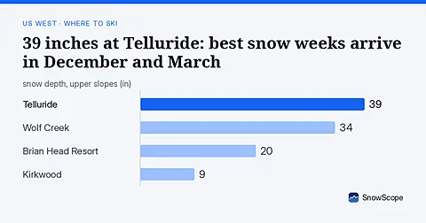
Telluride has 39 inches today. Peak snow weeks historically arrive in late December and March, not November.
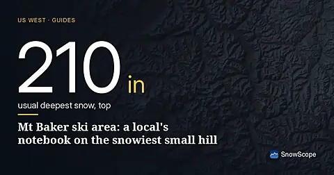
Mt Baker, Washington: about 133 in (337 cm) at the usual peak at mid-mountain in 46 past winters, a world snowfall record, no lodging on the hill, and what that means.
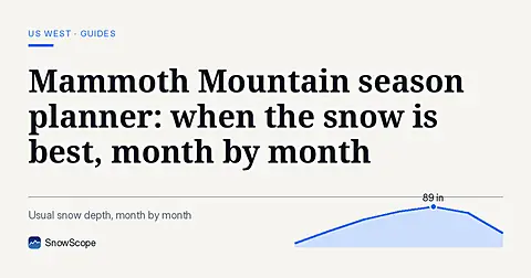
Plan Mammoth Mountain by season: about 93 in (235 cm) at the usual peak at mid-mountain over 46 past winters, March deepest, long springs, and winters that swing.