 SnowScope
52 cm at La Grave; season peaks in weeks 15, 16, 17
La Grave will receive about 52 cm of new snow in the next 24 hours, the most of any Alpine resort. This timing is early in the season, but historical data shows that the deepest snow at La Grave usually falls in weeks 15, 16 and 17, months ahead.
See the live snow forecast for La Grave in the SnowScope appSnow depth, powder alerts and the 3D map, free.
Where the Alpine snow concentrates
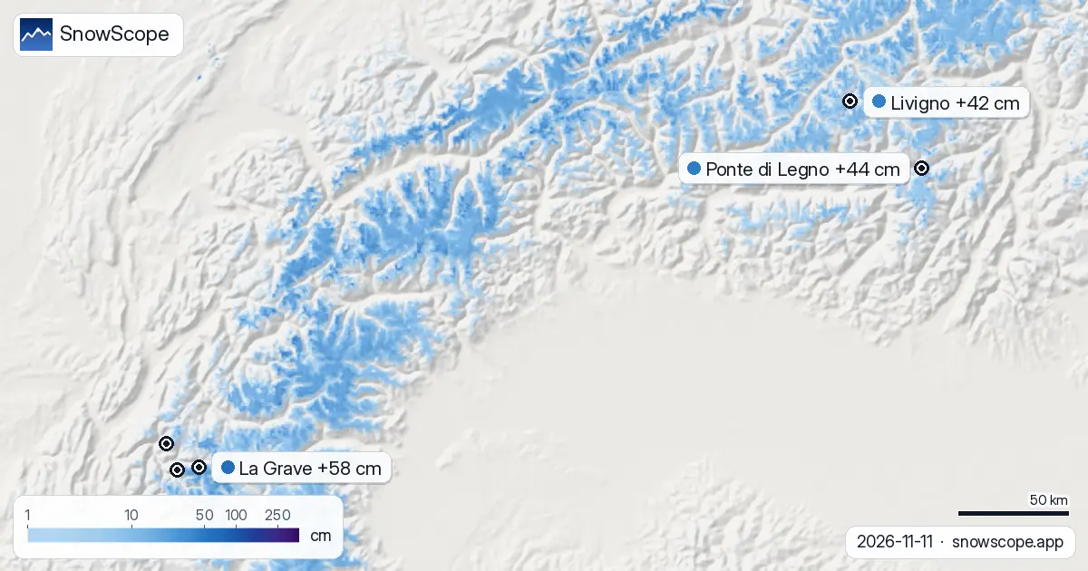
Across the Alps, the heaviest accumulation in the next 24 hours will stay at the highest elevations. La Grave, at 3543 m, tops the forecast with 52 cm. Les Deux Alpes follows with 45 cm, while Livigno and Ponte di Legno will see 40 cm and 38 cm respectively. Diavolezza-Lagalb records 37 cm. These high-altitude sites act as first capture points for water vapour carried by the system pushing from the west.
By Friday, the snow line at La Grave will drop to about 2900 m, meaning most of this new accumulation arrives as frozen precipitation to the summit and upper slopes. Below 2900 m, mixed precipitation becomes more likely.
| # | Resort | Region | +24 h | +72 h | Snow line |
|---|---|---|---|---|---|
| 1 | La Grave | Alps · France | 52 cm | 58 cm | 2,900 m |
| 2 | Les Deux Alpes | Alps · France | 45 cm | 51 cm | 2,600 m |
| 3 | Ponte di Legno | Alps · Italy | 38 cm | 44 cm | 2,300 m |
| 4 | Livigno | Alps · Italy | 40 cm | 42 cm | 2,200 m |
| 5 | Alpe d'Huez Grand Domaine | Alps · France | 34 cm | 42 cm | 2,500 m |
| 6 | Diavolezza-Lagalb | Alps · Switzerland | 37 cm | 40 cm | 2,300 m |
| 7 | Lagazuoi | Alps · Italy | 26 cm | 35 cm | 2,200 m |
| 8 | Mölltaler Gletscher | Alps · Austria | 17 cm | 35 cm | 2,300 m |
| # | Resort | Region | +24 h | +72 h | Snow line |
|---|---|---|---|---|---|
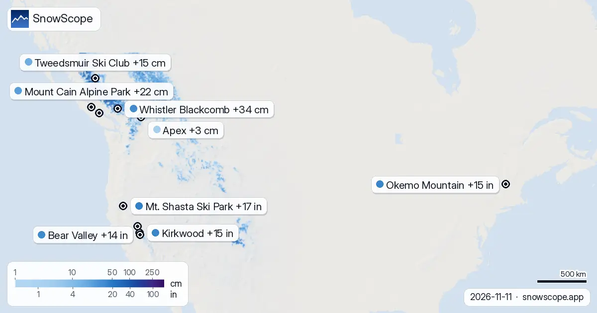
| 1 | Mt. Shasta Ski Park | US West · United States | 0 in (0 cm) | 17 in (43 cm) | 7,200 ft (2,200 m) |
| 2 | Kirkwood | US West · United States | 0 in (0 cm) | 15 in (39 cm) | 9,200 ft (2,800 m) |
| 3 | Okemo Mountain | US Northeast · United States | 3 in (8 cm) | 15 in (38 cm) | 1,000 ft (300 m) |
| 4 | Bear Valley | US West · United States | 0 in (0 cm) | 14 in (36 cm) | 8,900 ft (2,700 m) |
| 5 | Boreal | US West · United States | 0 in (0 cm) | 14 in (36 cm) | 9,500 ft (2,900 m) |
| 6 | Palisades Tahoe Olympic Valley | US West · United States | 0 in (0 cm) | 14 in (35 cm) | 9,800 ft (3,000 m) |
| 7 | Sierra-at-Tahoe | US West · United States | 0 in (0 cm) | 13 in (33 cm) | 9,800 ft (3,000 m) |
| 8 | Homewood | US West · United States | 0 in (0 cm) | 13 in (32 cm) | – |
| # | Resort | Region | +24 h | +72 h | Snow line |
|---|---|---|---|---|---|
| 1 | Whistler Blackcomb | Western Canada · Canada | 16 cm | 34 cm | 2,400 m |
| 2 | Mount Cain Alpine Park | Western Canada · Canada | 16 cm | 22 cm | 2,000 m |
| 3 | Tweedsmuir Ski Club | Western Canada · Canada | 12 cm | 15 cm | 1,100 m |
| 4 | Mount Washington Alpine Resort | Western Canada · Canada | 5 cm | 5 cm | 2,000 m |
| 5 | Apex | Western Canada · Canada | 0 cm | 3 cm | 2,900 m |
| 6 | Manning Park Resort | Western Canada · Canada | 0 cm | 3 cm | 2,700 m |
| 7 | Mt. Baldy Family | Western Canada · Canada | 0 cm | 3 cm | 2,800 m |
How early snow builds the water budget
From the hydrologist's perspective, every November snowfall adds to the mountain's water storage, even if it is months before peak season. Right now La Grave holds 28 cm of snow on the ground—about 60 percent of the long-term average of 47 cm at this date. The 52 cm forecast represents a sharp pulse: it will roughly double the current water depth stored high in the range.
However, this pulse is still far from reliable. Early snow is fragile. Wind can scour it, sun can soften the surface, and many centimetres may not survive to spring. The question for water managers is how much of this November addition merges into the deeper April snowpack, when conditions typically favour sustained accumulation.
When water storage peaks in the Alps
Historical analysis of La Grave shows that the season's most reliable and deepest snow arrives in weeks 15, 16 and 17 of the calendar year—mid-April, mid-April and late April. That is when the seasonal pattern typically favours snow over rain at these elevations, and when fresh layers bond to a stable base below. For ski areas and hydroelectric operators, this long-term view is essential: a November fall is valuable; the spring falls are the foundation.
The current forecast demonstrates that snow can arrive any month. But the hydrological year—and the skier's season—is built on the storms that stack layer by layer from March into May. Today's 52 cm is a building block toward those weeks.
The 72-hour window
Extending the forecast to Friday 14 November, La Grave shows 58 cm of new snow across the full 72-hour period. Les Deux Alpes reaches 51 cm. This represents a substantial addition to the Alpine summits over three days. For comparison, the same system brings 43 cm to Mt. Shasta in California, and 38 cm to Okemo Mountain in Vermont.
Early-season snow at this volume is significant, but it can also be deceptive. Thin layers may hide rocks, bonding to older snow is uncertain, and wind can redistribute material within hours. If you plan to ski above the prepared slopes after this event, the official avalanche forecast for your region should be your first resource.
Safety on fresh snow
Fresh snow on steep terrain in November has not yet hardened into stable layers. North-facing slopes are especially prone to sliding if the new snow lands on a thin base or on ice. Check the official regional avalanche bulletin before entering any steep off-piste terrain.
The snow line of 2900 m at La Grave means that most runs below that point will see rain or mixed precipitation, while runs above will hold dry snow. Early-season conditions reward caution and careful line choice.
Looking ahead to peak season
Weeks 15, 16 and 17 are still five months away. How this November event integrates into the spring snowpack will depend on weather systems yet to arrive. For now, the 52 cm in 24 hours is a reminder that the high Alps begin their water storage early, and that every storm builds the foundation for the season that typically peaks in spring.
Use the SnowScope app to track daily updates as the system evolves and as the forecast refines over the coming days.
Tips for skiers
- Highest elevations hold the most snow: aim for slopes above 2900 m at La Grave to find the 52 cm accumulation; lower runs will see mixed precipitation.
- Off-piste: check the official regional avalanche bulletin before entering steep terrain; fresh November snow has not yet bonded to deeper layers.
- Early snow is fragile: expect wind transport, isolated bare ground, and rocks near the surface; plan your line carefully.
- Mark the calendar: weeks 15, 16 and 17 (April dates) are when La Grave typically holds its deepest snow; this November event is a building block toward that peak.
- Watch forecasts daily: 52 cm is the current estimate for 24 hours; model updates may revise it as the system evolves.
About these numbers
Resort snow depths are the deepest snow on the resort's upper slopes from the SnowScope snow model (about 1 km, run of 11 November); they are estimates for an area, not a measurement at one point. Station values are measurements on the date shown. Forecasts can change. Always read the official avalanche bulletin before going off-piste.
Official avalanche bulletins: EAWS (Europe) · avalanche.org (US) · Avalanche Canada
Cite this report
For research, teaching or the press: the numbers and charts are free to reuse under CC BY 4.0 with this citation.
SnowScope (2026), 52 cm at La Grave; season peaks in weeks 15, 16, 17, https://snowscope.app/blog/en/2026/11/where-most-snow-falls-next-72-hours-11-november-2026.html, accessed 2026-11-11
SnowScope (Atlas Labs). (2026, November 11). 52 cm at La Grave; season peaks in weeks 15, 16, 17. SnowScope snow reports. https://snowscope.app/blog/en/2026/11/where-most-snow-falls-next-72-hours-11-november-2026.html
BibTeX
@misc{snowscope2026wheremostsnowfallsnext72,
  author       = {{SnowScope (Atlas Labs)}},
  title        = {52 cm at La Grave; season peaks in weeks 15, 16, 17},
  year         = {2026},
  month        = nov,
  howpublished = {\url{https://snowscope.app/blog/en/2026/11/where-most-snow-falls-next-72-hours-11-november-2026.html}},
  note         = {Published 2026-11-11 18:44 UTC; accessed 2026-11-11}
}· CC BY 4.0 · Methods, data and tools →
La Grave: snow and temperature by height, this winter vs last (tools) →
Follow La Grave
Free: a message when fresh snow is coming, and the forecast every morning.

More snow reports

Western Canada forecast: 90 cm new snow at Mount Washington in the next two weeks, with 70 cm expected in late November and early December. Model run 2026-11-18.
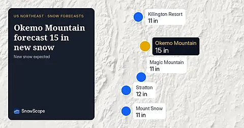
Okemo Mountain will get 15 in (38 cm) of new snow by November 14, with 11 in (29 cm) on November 13, our snow model from November 11 shows.
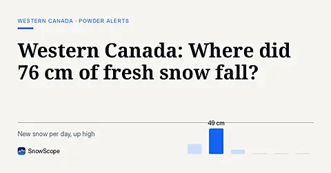
Whistler Blackcomb saw 76 cm of new snow in the last 72 hours, with Mount Cain Alpine Park also receiving 64 cm, as of November 16, 2026.