 SnowScope
Western Canada: Where did 76 cm of fresh snow fall?
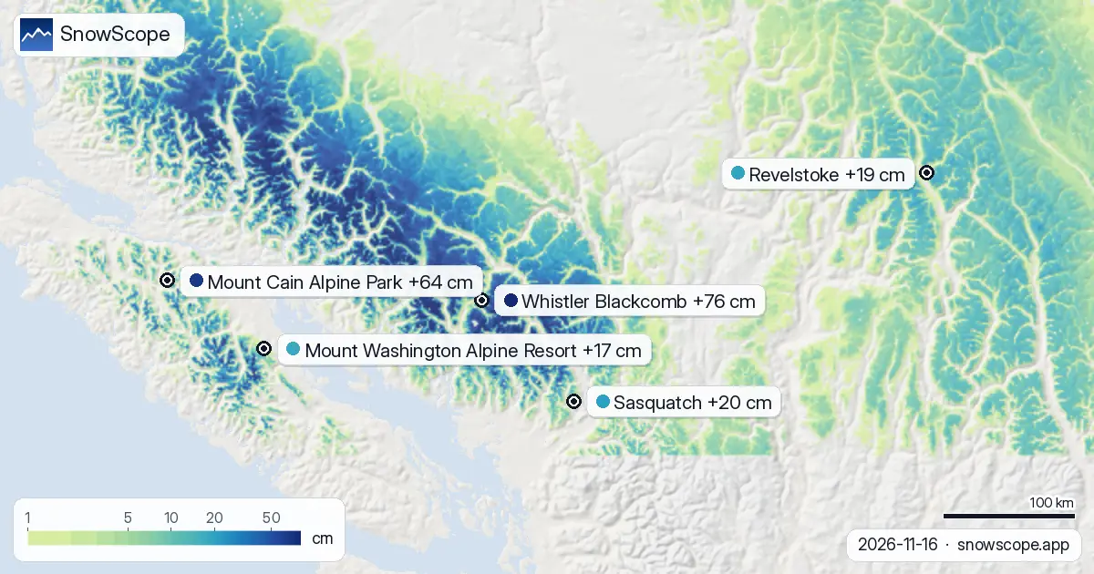
Where did fresh snow fall in Western Canada in the last 72 hours, and is more coming? Whistler Blackcomb received a significant 76 cm of new snow in the past three days, with Mount Cain Alpine Park also seeing 64 cm. However, our models show little new snow expected in the coming days for these areas.
See the live snow forecast for Whistler Blackcomb in the SnowScope appSnow depth, powder alerts and the 3D map, free.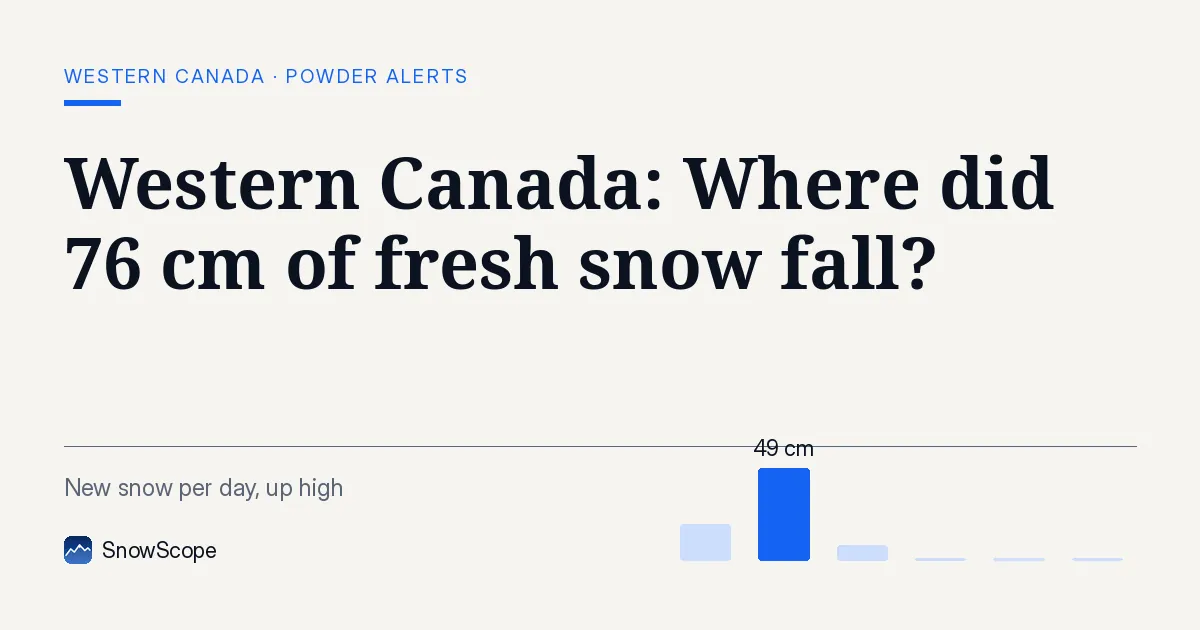
Recent Snowfall Highlights
Over the past 72 hours, Whistler Blackcomb recorded 76 cm of fresh snow on its upper slopes. Mount Cain Alpine Park also had a good refresh with 64 cm of new snow. Mount Washington Alpine Resort and Revelstoke saw 17 cm and 19 cm respectively during the same period.
Our snow model, updated on November 16, 2026, shows that the snow-covered area across Western Canada has increased. The region now has 270,420 square kilometres covered in snow, up from 260,410 square kilometres two days ago. This means 43 out of 57 resorts in the region currently have snow.
| Resort | Snow depth | New snow, 72 h | Coming, next days | Top |
|---|---|---|---|---|
| Whistler Blackcomb | 139 cm | 76 cm | 0 cm | 2,259 m |
| Mount Cain Alpine Park | 91 cm | 64 cm | 0 cm | 1,616 m |
| Revelstoke | 45 cm | 19 cm | 1 cm | 2,224 m |
| Mount Washington Alpine Resort | 111 cm | 17 cm | 1 cm | 1,569 m |
Current Snow Depths and Freezing Levels
At Whistler Blackcomb, the upper slopes have a measured depth of 139 cm. The snow depth modelled at mid-mountain (1456 m) is 49 cm, while the base (653 m) shows 0 cm. The freezing level at Whistler Blackcomb is expected to range between 660 m and 1360 m today, November 16, 2026, dropping to 150 m by November 18.
Mount Cain Alpine Park reports 91 cm on its upper slopes. The modelled depth at mid-mountain (1403 m) is 27 cm, and 8 cm at the base (1190 m). The freezing level there will be between 880 m and 1090 m today, rising to 1880 m by November 18.
Looking Ahead: Forecast for the Next Days
Unfortunately, the forecast for the next few days indicates very little new snow for Whistler Blackcomb and Mount Cain Alpine Park. Both resorts are expected to receive 0 cm of new snow by November 19, 2026. Revelstoke and Mount Washington Alpine Resort might see a small amount, around 1 cm, in the coming days.
The overall snow-covered area in Western Canada is forecast to increase to 310,150 square kilometres by November 19, with 45 resorts expected to have snow. This suggests that while the recent storm was significant, the immediate future looks drier for the main resorts.
Comparison to Past Winters
At Whistler Blackcomb, the modelled snow depth at 1456 m is 36 cm. This is deeper than only 1 of the past 46 winters on this date, and below the usual 103 cm for mid-November. This suggests that while recent snowfall was good, the overall snow base is still developing compared to historical averages.
In contrast, Mount Cain Alpine Park shows a modelled snow depth of 37 cm at 1403 m. This is deeper than 27 of the past 46 winters on this date, and above the usual 30 cm for this time of year. This indicates a stronger start to the season for Mount Cain Alpine Park compared to its historical record.
Tips for skiers
- For the best snow conditions, focus on the upper slopes at Whistler Blackcomb where 139 cm is measured, or Mount Cain Alpine Park with 91 cm, given the recent snowfall.
- Be aware of the varying freezing levels. At Whistler Blackcomb, the freezing level will be between 660 m and 1360 m today, meaning lower elevations might experience rain or wet snow.
- Early season snow can be thin, especially at lower elevations. Be cautious of unmarked obstacles or rocks under the snow.
- Always check the official avalanche bulletin if you plan to go off-piste, as conditions can change rapidly with new snow.
- While resorts are gaining snow, always check the resort's official website for opening status and specific lift information before you go.
About these numbers
Resort snow depths are the deepest snow on the resort's upper slopes from the SnowScope snow model (about 1 km, run of 16 November); they are estimates for an area, not a measurement at one point. Station values are measurements on the date shown. Forecasts can change. Always read the official avalanche bulletin before going off-piste.
Official avalanche bulletins: Avalanche Canada
Cite this report
For research, teaching or the press: the numbers and charts are free to reuse under CC BY 4.0 with this citation.
SnowScope (2026), Western Canada: Where did 76 cm of fresh snow fall?, https://snowscope.app/blog/en/2026/11/western-canada-whistler-blackcomb-fresh-snow-powder-alert-16-november-2026.html, accessed 2026-11-16
SnowScope (Atlas Labs). (2026, November 16). Western Canada: Where did 76 cm of fresh snow fall?. SnowScope snow reports. https://snowscope.app/blog/en/2026/11/western-canada-whistler-blackcomb-fresh-snow-powder-alert-16-november-2026.html
BibTeX
@misc{snowscope2026westerncanadawhistlerbla,
  author       = {{SnowScope (Atlas Labs)}},
  title        = {Western Canada: Where did 76 cm of fresh snow fall?},
  year         = {2026},
  month        = nov,
  howpublished = {\url{https://snowscope.app/blog/en/2026/11/western-canada-whistler-blackcomb-fresh-snow-powder-alert-16-november-2026.html}},
  note         = {Published 2026-11-17 06:57 UTC; accessed 2026-11-16}
}· CC BY 4.0 · Methods, data and tools →
Whistler Blackcomb: snow and temperature by height, this winter vs last (tools) →
Follow Whistler Blackcomb
Free: a message when fresh snow is coming, and the forecast every morning.

More snow reports

Whistler Blackcomb for every level, with our snow history: about 370 cm at the usual peak at mid-mountain over 46 past winters, March and April the deepest months.
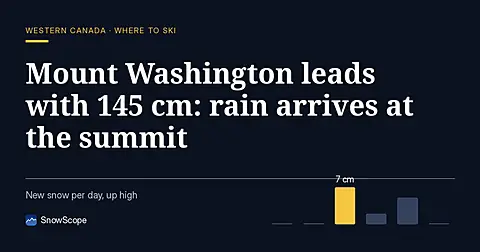
Mount Washington holds 145 cm on 8 November, the deepest in Western Canada, but the freezing level will climb above the summit by 11 November.

Western Canada mountains carry 42% of their normal snow for mid-November as of 12 November, but 142 cm is forecast over the next two weeks.