 SnowScope
Whistler Blackcomb tops the 72-hour snow forecast: +130 cm (9 November)
Our daily table follows the coming snow: the resorts with the most forecast for the next 24 hours and until 12 November, in Europe, Morocco and North America, and where the snow line sits. Snow that falls high up is stored; what falls as rain lower down reaches the rivers within days.
See the live snow forecast for Whistler Blackcomb in the SnowScope appSnow depth, powder alerts and the 3D map, free.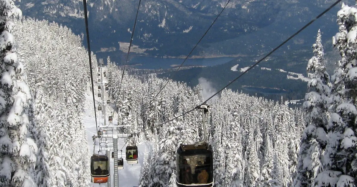
Europe and Morocco
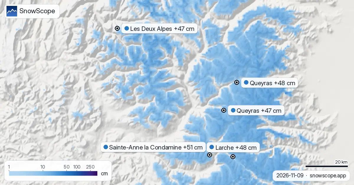
For Sainte-Anne la Condamine (France) the forecast gives 10 cm in the next 24 hours and 51 cm in 72 hours, with a snow line close to 2,800 m. Larche (France) should get 8 cm in the next 24 hours and 48 cm within 72 hours; the snow line sits near 2,900 m. For Queyras (France) the forecast gives 6 cm in the next 24 hours and 48 cm in 72 hours, with a snow line close to 2,800 m.
| # | Resort | Region | +24 h | +72 h | Snow line |
|---|---|---|---|---|---|
| 1 | Sainte-Anne la Condamine | Alps · France | 10 cm | 51 cm | 2,800 m |
| 2 | Larche | Alps · France | 8 cm | 48 cm | 2,900 m |
| 3 | Queyras | Alps · France | 6 cm | 48 cm | 2,800 m |
| 4 | Les Deux Alpes | Alps · France | 9 cm | 47 cm | 2,800 m |
| 5 | Queyras | Alps · France | 9 cm | 47 cm | 2,800 m |
| 6 | Isola 2000 | Alps · France | 7 cm | 47 cm | 3,000 m |
| 7 | La Grave | Alps · France | 8 cm | 45 cm | 2,900 m |
| 8 | Argentera | Alps · Italy | 7 cm | 45 cm | 3,000 m |
| # | Resort | Region | +24 h | +72 h | Snow line |
|---|---|---|---|---|---|
| 1 | Mt Baker | US West · United States | 8 in (20 cm) | 9 in (24 cm) | 9,200 ft (2,800 m) |
| 2 | Crystal Mountain | US West · United States | 4 in (10 cm) | 4 in (10 cm) | 10,500 ft (3,200 m) |
| 3 | Mt. Hood Meadows | US West · United States | 4 in (10 cm) | 4 in (10 cm) | 11,200 ft (3,400 m) |
| 4 | Stevens Pass | US West · United States | 4 in (10 cm) | 4 in (10 cm) | 9,800 ft (3,000 m) |
| 5 | Sahalie Ski Club | US West · United States | 3 in (8 cm) | 3 in (8 cm) | 9,500 ft (2,900 m) |
| 6 | Hurricane Ridge | US West · United States | 3 in (7 cm) | 3 in (7 cm) | 10,200 ft (3,100 m) |
| 7 | White Pass | US West · United States | 2 in (5 cm) | 2 in (5 cm) | 10,800 ft (3,300 m) |
| 8 | Ski Eldorado | US Northeast · Canada | 1 in (2 cm) | 2 in (5 cm) | 2,000 ft (600 m) |
| # | Resort | Region | +24 h | +72 h | Snow line |
|---|---|---|---|---|---|
| 1 | Whistler Blackcomb | Western Canada · Canada | 17 cm | 130 cm | 2,500 m |
| 2 | Ski Callaghan | Western Canada · Canada | 19 cm | 69 cm | 2,400 m |
| 3 | Tweedsmuir Ski Club | Western Canada · Canada | 4 cm | 39 cm | 2,000 m |
| 4 | Mount Cain Alpine Park | Western Canada · Canada | 11 cm | 28 cm | 2,600 m |
| 5 | Manning Park Resort | Western Canada · Canada | 6 cm | 10 cm | 2,700 m |
| 6 | Whitewater | Western Canada · Canada | 6 cm | 9 cm | 3,300 m |
| 7 | Revelstoke | Western Canada · Canada | 5 cm | 7 cm | 2,900 m |
| 8 | Summit Lake Ski & Snowboard Area | Western Canada · Canada | 5 cm | 7 cm | 3,100 m |
United States
Mt Baker (United States) should get 8 in (20 cm) in the next 24 hours and 9 in (24 cm) within 72 hours; the snow line sits near 9,200 ft (2,800 m). For Crystal Mountain (United States) the forecast gives 4 in (10 cm) in the next 24 hours and 4 in (10 cm) in 72 hours, with a snow line close to 10,500 ft (3,200 m). Mt. Hood Meadows (United States) should get 4 in (10 cm) in the next 24 hours and 4 in (10 cm) within 72 hours; the snow line sits near 11,200 ft (3,400 m).
Canada
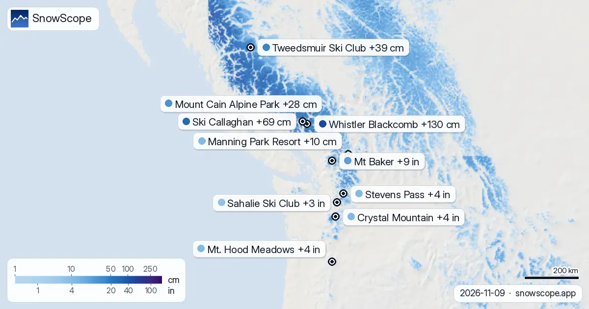
For Whistler Blackcomb (Canada) the forecast gives 17 cm in the next 24 hours and 130 cm in 72 hours, with a snow line close to 2,500 m. Ski Callaghan (Canada) should get 19 cm in the next 24 hours and 69 cm within 72 hours; the snow line sits near 2,400 m. For Tweedsmuir Ski Club (Canada) the forecast gives 4 cm in the next 24 hours and 39 cm in 72 hours, with a snow line close to 2,000 m.
Snow still to come
The snow line is about 300 m below the forecast freezing level: above it the new snow is stored on the mountain, below it falls wet or as rain and runs off.
Our model estimates the snow over an area; a station measures it at one point. The truth on the slope is usually in between.
Forecasts a few days ahead can change: look at the map again the day before you travel.
Tips for skiers
- New snow does not stay new for long. Start early, while it is still soft and untracked.
- When the melting line sits above the resort, the snow turns wet. The highest lifts are the safe bet.
- Before you ski off-piste or go touring, read the official avalanche bulletin (links below).
- Snow on the map does not mean a resort is open: check lifts and opening dates on the resort's website.
- Get a powder alert in the SnowScope app to know when Whistler Blackcomb gets fresh snow.
About these numbers
Resort snow depths are the deepest snow on the resort's upper slopes from the SnowScope snow model (about 1 km, run of 9 November); they are estimates for an area, not a measurement at one point. Station values are measurements on the date shown. Forecasts can change. Always read the official avalanche bulletin before going off-piste.
Official avalanche bulletins: EAWS (Europe) · avalanche.org (US) · Avalanche Canada
Cite this report
For research, teaching or the press: the numbers and charts are free to reuse under CC BY 4.0 with this citation.
SnowScope (2026), Whistler Blackcomb tops the 72-hour snow forecast: +130 cm (9 November), https://snowscope.app/blog/en/2026/11/where-most-snow-falls-next-72-hours-9-november-2026.html, accessed 2026-11-09
SnowScope (Atlas Labs). (2026, November 9). Whistler Blackcomb tops the 72-hour snow forecast: +130 cm (9 November). SnowScope snow reports. https://snowscope.app/blog/en/2026/11/where-most-snow-falls-next-72-hours-9-november-2026.html
BibTeX
@misc{snowscope2026wheremostsnowfallsnext72,
  author       = {{SnowScope (Atlas Labs)}},
  title        = {Whistler Blackcomb tops the 72-hour snow forecast: +130 cm (9 November)},
  year         = {2026},
  month        = nov,
  howpublished = {\url{https://snowscope.app/blog/en/2026/11/where-most-snow-falls-next-72-hours-9-november-2026.html}},
  note         = {Published 2026-11-09 11:38 UTC; accessed 2026-11-09}
}· CC BY 4.0 · Methods, data and tools →
Whistler Blackcomb: snow and temperature by height, this winter vs last (tools) →
Follow Whistler Blackcomb
Free: a message when fresh snow is coming, and the forecast every morning.

More snow reports
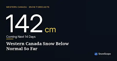
Western Canada mountains carry 42% of their normal snow for mid-November as of 12 November, but 142 cm is forecast over the next two weeks.
Whistler Blackcomb received 100 cm of fresh snow in 72 hours to 8 November, but it fell unevenly: 96 cm at the summit, none at the base.
Western Canada's ski resorts hold snow at 18 percent of early-season norms as of November 3, with Mount Cain leading and lower elevations lagging far behind.