 SnowScope
Whistler leads forecast; snow depth up 24 cm this week
Whistler Blackcomb has gained 24 centimetres of snow in the past week, bringing its depth to 50 centimetres. As the northern hemisphere's forecast leaders prepare for major storms, Whistler tops the global rankings with 62 centimetres of new snow expected over the next 72 hours, while the European Alps follow with La Grave at 32 centimetres and Orcières Merlette at 30 centimetres.
See the live snow forecast for Whistler Blackcomb in the SnowScope appSnow depth, powder alerts and the 3D map, free.
The Whistler basin and rapid water accumulation
A 24-centimetre gain in a single week represents significant new water entering the Whistler basin. Currently at 50 centimetres, the snowpack stores water that will feed rivers, streams, and reservoirs through spring snowmelt. The accumulation rate over the past seven days—roughly 3.5 centimetres daily—is well above typical November pace. The incoming storm, forecast to deliver 62 centimetres by November 11, will nearly triple current depth and create an unusually dense base for December.
For hydrologists tracking water supply in British Columbia, this rapid transition matters: deep snowpack in November means stable spring runoff, which fills reservoirs and powers seasonal generation through the warm months. The rate at which water enters the system now affects reservoir management through summer.
| # | Resort | Region | +24 h | +72 h | Snow line |
|---|---|---|---|---|---|
| 1 | La Grave | Alps · France | 10 cm | 32 cm | 2,900 m |
| 2 | Orcières Merlette | Alps · France | 10 cm | 30 cm | 2,800 m |
| 3 | Les Deux Alpes | Alps · France | 9 cm | 28 cm | 2,800 m |
| 4 | Sainte-Anne la Condamine | Alps · France | 12 cm | 27 cm | 2,800 m |
| 5 | Pelvoux-Vallouise | Alps · France | 10 cm | 27 cm | 2,800 m |
| 6 | Les Orres | Alps · France | 10 cm | 25 cm | 2,800 m |
| 7 | Alpe d'Huez Grand Domaine | Alps · France | 7 cm | 25 cm | 2,700 m |
| 8 | Forêt Blanche : Vars/Risoul | Alps · France | 10 cm | 22 cm | 2,800 m |
| # | Resort | Region | +24 h | +72 h | Snow line |
|---|---|---|---|---|---|
| 1 | Mt Baker | US West · United States | 0 in (1 cm) | 7 in (19 cm) | 7,900 ft (2,400 m) |
| 2 | Mt. Hood Meadows | US West · United States | 1 in (3 cm) | 5 in (12 cm) | 10,500 ft (3,200 m) |
| 3 | Crystal Mountain | US West · United States | 1 in (2 cm) | 4 in (10 cm) | 9,500 ft (2,900 m) |
| 4 | White Pass | US West · United States | 0 in (1 cm) | 3 in (8 cm) | 9,500 ft (2,900 m) |
| 5 | Smugglers' Notch Resort | US Northeast · United States | 1 in (2 cm) | 2 in (4 cm) | 3,300 ft (1,000 m) |
| 6 | Sugarbush Resort | US Northeast · United States | 1 in (2 cm) | 2 in (4 cm) | 3,600 ft (1,100 m) |
| 7 | Tuckerman Ravine | US Northeast · United States | 1 in (2 cm) | 2 in (4 cm) | – |
| 8 | Whiteface Mountain | US Northeast · United States | 1 in (2 cm) | 2 in (4 cm) | 3,600 ft (1,100 m) |
| # | Resort | Region | +24 h | +72 h | Snow line |
|---|---|---|---|---|---|
| 1 | Whistler Blackcomb | Western Canada · Canada | 1 cm | 62 cm | 1,900 m |
| 2 | Ski Callaghan | Western Canada · Canada | 1 cm | 53 cm | 1,600 m |
| 3 | Tweedsmuir Ski Club | Western Canada · Canada | 0 cm | 39 cm | 1,400 m |
| 4 | Mount Cain Alpine Park | Western Canada · Canada | 6 cm | 21 cm | 2,500 m |
| 5 | Mount Washington Alpine Resort | Western Canada · Canada | 2 cm | 7 cm | 2,500 m |
| 6 | Revelstoke | Western Canada · Canada | 2 cm | 7 cm | 1,400 m |
| 7 | Manning Park Resort | Western Canada · Canada | 0 cm | 6 cm | 1,900 m |
| 8 | Grouse Mountain | Western Canada · Canada | 0 cm | 5 cm | 2,200 m |
Alpine dominance across the 72-hour window
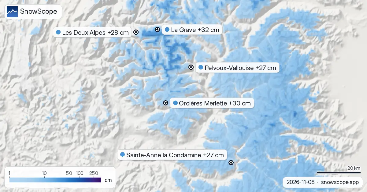
Europe's Alps dominate the three-day forecast. La Grave, France, leads all resorts globally with 32 centimetres forecast, followed by Orcières Merlette with 30 centimetres and Les Deux Alpes with 28 centimetres. The snow line across the region sits around 2,800 to 2,900 metres, so precipitation above that threshold accumulates as snow while rain dominates lower elevations.
For water managers, this distinction matters: snow at altitude stays in place through winter, releasing gradually as temperatures warm. Rain at mid-elevations runs off quickly, often within hours. The high-altitude snow lines tell us that alpine reservoirs will fill steadily rather than flood from rapid melt.
Western Canada's exceptional storm
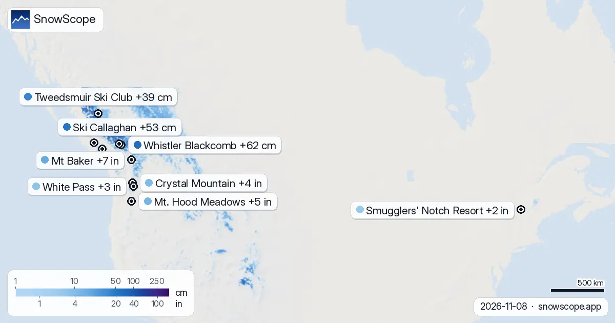
British Columbia is in line for the northern hemisphere's most dramatic 72-hour accumulation. Whistler Blackcomb's 62-centimetre forecast is 30 centimetres above Europe's leader—a genuinely exceptional amount of new mass arriving in short time. Ski Callaghan receives 53 centimetres, Tweedsmuir Ski Club 39 centimetres. The snow line sits around 1,600 to 1,900 metres, so precipitation falls as snow across most ski terrain, not just summits.
With roughly 20 centimetres per day, this rapid arrival will substantially boost reservoir inflows by late November and December as the snowpack settles and begins to consolidate.
Modest Pacific and Northeast accumulation
The US Pacific Northwest sees far less impact. Mt Baker leads the region with 7 in (19 cm) over 72 hours, Mt. Hood Meadows with 5 in (12 cm), Crystal Mountain with 4 in (10 cm). Snow lines range from 7,900 to 9,500 ft (2,400 to 2,900 m), so much of the precipitation falls as rain below that altitude.
Across the Northeast, resorts will see around 1.5 in (4 cm), with snow lines near 3,300 to 3,600 ft (1,000 to 1,100 m). Early-season base building remains slow in both regions despite these falls.
Forecast uncertainty and early-season caution
These numbers represent our snow model's estimates for upper-mountain regions; they predict total new snow likely across an area, not point measurements at a single weather station. Storm evolution can shift, and intensity may vary. Early-season snow arrives on thin base layers and sometimes directly on bedrock—conditions ripe for avalanche hazard once rapid loading stops.
If you plan to ski off-piste after major new snow, consult the official avalanche bulletin for your area first. The water all this snow represents matters to reservoirs and rivers downstream, but it matters immediately to stability on steep terrain.
Tips for skiers
- Whistler and western Canada skiers: heavy snow through Tuesday; expect slopes over 30 degrees to load rapidly; stay clear of off-piste terrain until the official avalanche bulletin indicates stabilization.
- Alps skiers: peak accumulation above 2,800 metres; rain-on-snow risk below that altitude; north-facing slopes near treeline carry avalanche hazard after the storm.
- Pacific Northwest: modest new snow; focus on early-season base consolidation; watch for mixed rain-snow around 2,400–2,900 m elevation where temperatures hover near freezing.
- Northeast US: minimal new snow; thin base remains the primary limitation; prioritize protected terrain and dense tree cover for better conditions.
- Monitor official avalanche bulletins and forecast refinements closely over the next 36 hours; early-season patterns can shift rapidly as storage changes.
About these numbers
Resort snow depths are the deepest snow on the resort's upper slopes from the SnowScope snow model (about 1 km, run of 8 November); they are estimates for an area, not a measurement at one point. Station values are measurements on the date shown. Forecasts can change. Always read the official avalanche bulletin before going off-piste.
Official avalanche bulletins: EAWS (Europe) · avalanche.org (US) · Avalanche Canada
Cite this report
For research, teaching or the press: the numbers and charts are free to reuse under CC BY 4.0 with this citation.
SnowScope (2026), Whistler leads forecast; snow depth up 24 cm this week, https://snowscope.app/blog/en/2026/11/where-most-snow-falls-next-72-hours-8-november-2026.html, accessed 2026-11-08
SnowScope (Atlas Labs). (2026, November 8). Whistler leads forecast; snow depth up 24 cm this week. SnowScope snow reports. https://snowscope.app/blog/en/2026/11/where-most-snow-falls-next-72-hours-8-november-2026.html
BibTeX
@misc{snowscope2026wheremostsnowfallsnext72,
  author       = {{SnowScope (Atlas Labs)}},
  title        = {Whistler leads forecast; snow depth up 24 cm this week},
  year         = {2026},
  month        = nov,
  howpublished = {\url{https://snowscope.app/blog/en/2026/11/where-most-snow-falls-next-72-hours-8-november-2026.html}},
  note         = {Published 2026-11-08 20:08 UTC; accessed 2026-11-08}
}· CC BY 4.0 · Methods, data and tools →
Whistler Blackcomb: snow and temperature by height, this winter vs last (tools) →
Follow Whistler Blackcomb
Free: a message when fresh snow is coming, and the forecast every morning.

More snow reports
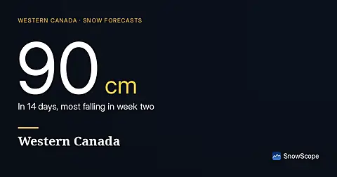
Western Canada forecast: 90 cm new snow at Mount Washington in the next two weeks, with 70 cm expected in late November and early December. Model run 2026-11-18.
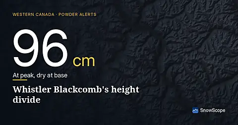
Whistler Blackcomb received 100 cm of fresh snow in 72 hours to 8 November, but it fell unevenly: 96 cm at the summit, none at the base.
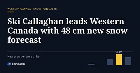
Ski Callaghan leads Western Canada forecast with 48 cm new snow through 7 November, mostly on 6th, with higher elevations capturing deeper accumulation.