 SnowScope
Lech am Arlberg snow report: 6 cm today, 42 to 91 cm possible up high this week (13 November 2026)
Lech has a reputation as one of the snowiest places in the Alps, and our own history agrees with it. Today, though, the snow report is modest: about 6 cm at the top of the ski area (2436 m), about 6 cm at mid-mountain (1933 m) and bare ground in Lech itself at 1430 m. The story is the week ahead, and here the forecasts disagree a lot: we see 42 cm at the top, others go as high as 91 cm.
See the live snow forecast for Lech Zürs am Arlberg in the SnowScope appSnow depth, powder alerts and the 3D map, free.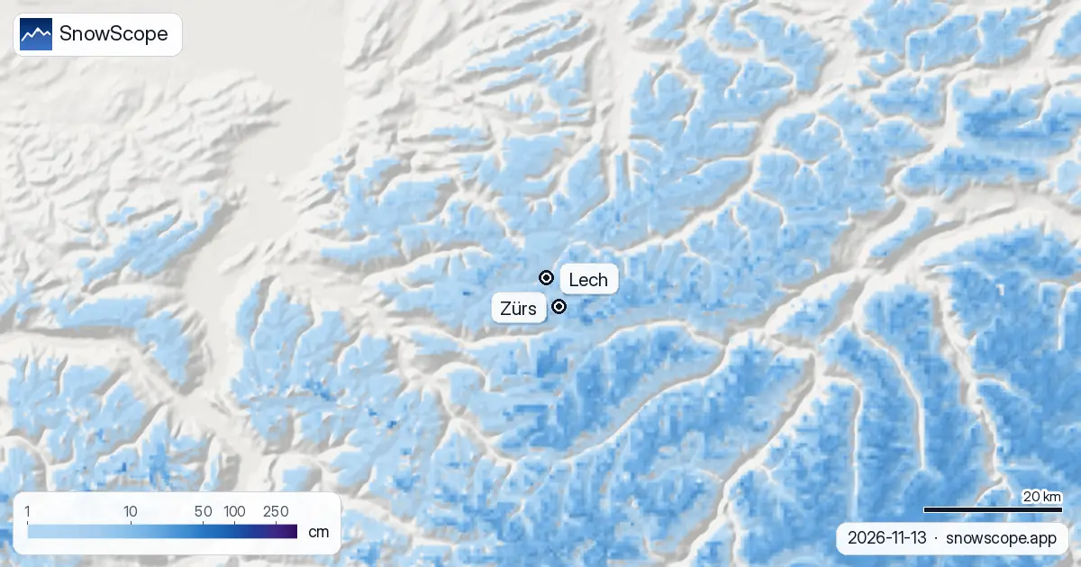
Today: a white skin, no base
The top took 17 cm of new snow over the last seven days, 6 cm of it in the last 24 hours, and about 6 cm of it is still lying. Mid-mountain had only 2 cm in the week but kept a similar thin layer from earlier falls. In the village there is nothing yet. It is enough to make the slopes look wintry from the valley, not enough to ski.
The week: a storm of uncertain size
Over the next seven days our forecast gives 42 cm at the top, 34 cm at mid-mountain and 27 cm at village height, about 5 cm up high in the first 24 hours. The other forecasts we compare with are all higher: 52 to 91 cm at the top, 49 to 132 cm at mid-mountain and 21 to 77 cm at village height. When every other number sits above ours, the honest reading is that a real storm is coming and our figure is the low end.
The snow line is the second thing to watch. It sits around 1400 m, right at the height of Lech, so expect rain and snow mixed in the village, with snow turning reliable a little higher up and in Zürs, which lies above Lech on the pass road.
Lech against St Anton: the snowy side
Lech and St Anton share the Arlberg, yet our 46 past winters (1980-81 to 2025-26) give Lech more snow. The top of Lech's ski area is 2436 m, lower than St Anton's 2642 m, but a middle winter peaks at 338 cm there against 298 cm. At mid-mountain, at almost the same height (1933 m against 1962 m), it is 219 cm against 194 cm. Lech faces the moist air coming from the north-west first, and it shows.
What a usual Lech winter looks like
A usual November holds 7 cm in the village, 23 cm at mid-mountain and 41 cm at the top. December climbs to 28, 70 and 109 cm, January to 49, 111 and 161 cm. At mid-mountain 18 weeks of the winter have 50 cm or more in 9 of 10 winters, at the top 25 weeks, and even the village gets 7 such weeks in half of winters. The deepest snow up high usually comes in March and April (262 and 270 cm).
Peaks have fallen at mid-mountain, from 240 cm in the first 15 of our winters to 199 cm in the last 15, and at the top from 351 to 323 cm. Last winter peaked at 62, 181 and 293 cm. The mapped area of Lech and Zürs counts 120 km of runs and 32 lifts.
Tips for skiers
- Read this week's forecast as a range: plan with our 42 cm at the top, and be ready for much more.
- In Lech expect rain mixed with snow; on the Flexen road up to Zürs, winter tyres and chains are a must when the snow comes.
- A big first storm on a thin base is a classic avalanche setup: read the Vorarlberg avalanche report before any step off the piste.
More maps (external sites)
References and credits
- Lech Zürs am Arlberg, official site (lifts, opening dates, snow report) www.lechzuers.com/
- Lawinenwarndienst Vorarlberg, avalanche report lawinen.report/
About these numbers
Snow numbers: the SnowScope snow model, run of 12 November 2026 for 13 November, at three heights of the ski area (an estimate for the area, not resort measurements), and our snow history, 46 past winters (1980-81 to 2025-26), corrected for height, for Lech Zürs and St Anton. The forecast range and the snow line compare other weather forecasts at the same heights. Run length and lift count: OpenSkiMap mapping. Forecasts change: look at the map before you go.
Official avalanche bulletins: Lawinenwarndienst Vorarlberg
Cite this report
For research, teaching or the press: the numbers and charts are free to reuse under CC BY 4.0 with this citation.
SnowScope (2026), Lech am Arlberg snow report: 6 cm today, 42 to 91 cm possible up high this week (13 November 2026), https://snowscope.app/blog/en/2026/11/lech-am-arlberg-snow-report-13-november-2026.html, accessed 2026-11-13
SnowScope (Atlas Labs). (2026, November 13). Lech am Arlberg snow report: 6 cm today, 42 to 91 cm possible up high this week (13 November 2026). SnowScope snow reports. https://snowscope.app/blog/en/2026/11/lech-am-arlberg-snow-report-13-november-2026.html
BibTeX
@misc{snowscope2026lechamarlbergsnowreport1,
  author       = {{SnowScope (Atlas Labs)}},
  title        = {Lech am Arlberg snow report: 6 cm today, 42 to 91 cm possible up high this week (13 November 2026)},
  year         = {2026},
  month        = nov,
  howpublished = {\url{https://snowscope.app/blog/en/2026/11/lech-am-arlberg-snow-report-13-november-2026.html}},
  note         = {Published 2026-11-13 13:50 UTC; accessed 2026-11-13}
}· CC BY 4.0 · Methods, data and tools →
Lech Zürs am Arlberg: snow and temperature by height, this winter vs last (tools) →
Follow Lech Zürs am Arlberg
Free: a message when fresh snow is coming, and the forecast every morning.

More snow reports
Snowfall in Val Thorens, 13 November 2026: 27 cm fell at the top (3175 m) and 17 cm at 2498 m over seven days; snow depth is 50 cm and 8 cm. Next seven days: 86 cm at the top, 73 cm at 2498 m, snow line well below the village. Usual snowfall season from 46 winters.
Tignes snow conditions on 13 November 2026: 42 cm at the top (3447 m), 12 cm at 2503 m, a bare valley at 1559 m, and 99 cm forecast at the top over seven days, with rain below about 1700 m. How it compares with 46 past winters.
St Anton and Ski Arlberg through the winter: how deep the snow usually is each month at three heights, from 46 past winters.