 SnowScope
Mt Baker depth at 100% normal—5 inches (13 cm)
Mt Baker's depth matches normal for this date, while fresh powder from the past 72 hours is concentrated in the high peaks of the Cascades and Colorado. The forecast shows a sharp switch starting November 8, with the Pacific Northwest set for significant new snow while the Colorado mountains remain dry.
See the live snow forecast for Mt Baker in the SnowScope appSnow depth, powder alerts and the 3D map, free.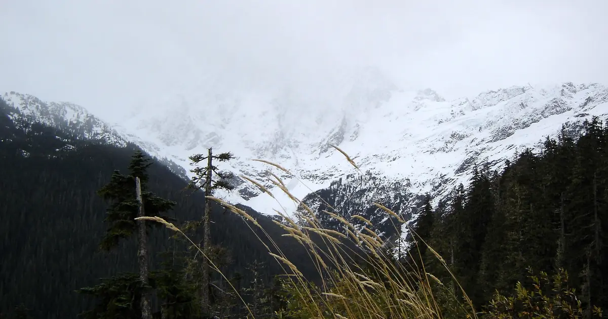
Taking the mountain's pulse
Mt Baker sits at the northern edge of the Pacific Northwest's ski region. At its mid-elevation (1,331 m / 4,370 ft), our snow model estimates 5 in (13 cm) of depth today. That depth matches exactly what we see in past winters on this same date—a perfect alignment with historical patterns.
At the summit (1,556 m / 5,105 ft), the depth reaches 8 in (21 cm). The base is thin at just 1 in (2 cm), which is entirely typical for early November. This even tracking—neither ahead nor behind seasonal patterns—tells us the season is running on schedule despite warm autumn temperatures in earlier months. The mountain has built no early cushion, but it has not fallen behind either.
| Resort | Snow depth | New snow, 72 h | Coming, next days | Top |
|---|---|---|---|---|
| Mt Baker | 17 in (44 cm) | 13 in (32 cm) | 21 in (53 cm) | 5,105 ft (1,556 m) |
| Buttermilk | 19 in (49 cm) | 6 in (15 cm) | 0 in (0 cm) | 9,882 ft (3,012 m) |
| Monarch Mountain | 11 in (28 cm) | 4 in (11 cm) | 0 in (0 cm) | 11,804 ft (3,598 m) |
| Ski Cooper | 18 in (46 cm) | 4 in (11 cm) | 0 in (0 cm) | 11,742 ft (3,579 m) |
| Crested Butte | 43 in (109 cm) | 4 in (10 cm) | 0 in (0 cm) | 11,444 ft (3,488 m) |
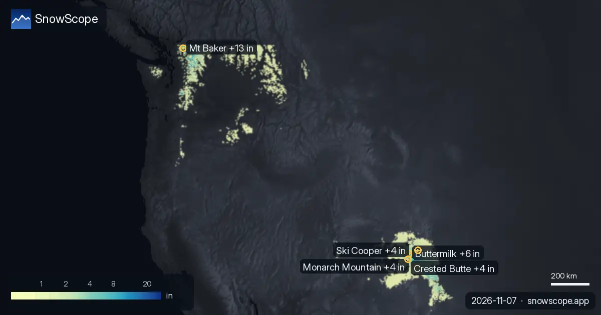
Where fresh snow concentrated
The past 72 hours have brought significant precipitation to the northern Cascades. Our snow model estimates 17 in (43 cm) fell in a storm band that passed 14 km south of Mt Baker. The heaviest local falls at the resort itself arrived on November 5-6, adding about 11 in (29 cm) to the snowpack.
Meanwhile, the Colorado high peaks experienced their main snow event earlier in the month. High-elevation stations near Red Mountain Pass (at 3,371 m / 11,060 ft) recorded 11 in (28 cm) in a single 24-hour period, while similar elevations near Chepeta captured 12 in (30 cm) and Bison Lake measured 10 in (25 cm). The pattern has kept snow concentrated at high elevations across both regions, with lower zones remaining mostly dry.
The forecast split
Beginning November 8, our model shows a dramatic change. Mt Baker will receive 21 in (53 cm) of new snow through November 10. Meanwhile, the Colorado peaks face warm, dry weather with temperatures rising. Buttermilk, Monarch Mountain, and Ski Cooper are forecast to stay dry through November 10. The Pacific Northwest and Colorado will move in completely opposite directions.
Mt Baker's powder timing
The forecast timing matters significantly for Mt Baker. The model predicts 21 in (53 cm) of new snow through November 10, with the heaviest falls on November 8. On that day, the freezing level will plummet to 1,000-1,630 m (3,280-5,350 ft), ensuring powder snow at all elevations. This is genuine early-season powder, not rain-snow mix.
By contrast, November 9 and 10 will bring lighter accumulation as the system weakens. The best window for powder skiing will likely be the morning of November 8, before afternoon sun affects the surface. This marks Mt Baker's first real powder event of the season, though it will be brief.
Early season caveats
Thin snow always carries risk. At Mt Baker's base, only 1 in (2 cm) lies on the ground. Rocks will poke through in many areas, and freeze-thaw cycles at lower elevations may leave lumpy snow under the new powder.
If you explore off-piste terrain, stay alert to this layering. Check the official avalanche bulletin for the Pacific Northwest before leaving marked slopes. The region as a whole is still young: 136 out of 195 resorts have any snow. By November 10, that number will drop further as warmer weather hits lower zones.
Tips for skiers
- Mt Baker will offer its best powder skiing on the morning of November 8 before afternoon warming; plan to be on the upper slopes early.
- If you are skiing Colorado or Utah through November 10, focus on elevations above 3,200 m (10,500 ft) where the past week brought measurable snow.
- The base zone at Mt Baker (around 1,100 m / 3,610 ft) will see rain mixed with wet snow on November 8; stick to mid and upper slopes for best powder conditions.
- Check the official avalanche bulletin for the Pacific Northwest before venturing off-piste with the new snow.
- Early season snow is thin; rocks are still near the surface across both regions, so watch for hard patches and exposed terrain.
About these numbers
Resort snow depths are the deepest snow on the resort's upper slopes from the SnowScope snow model (about 1 km, run of 6 November); they are estimates for an area, not a measurement at one point. Station values are measurements on the date shown. Forecasts can change. Always read the official avalanche bulletin before going off-piste.
Official avalanche bulletins: Colorado Avalanche Information Center
Cite this report
For research, teaching or the press: the numbers and charts are free to reuse under CC BY 4.0 with this citation.
SnowScope (2026), Mt Baker depth at 100% normal—5 inches (13 cm), https://snowscope.app/blog/en/2026/11/us-west-fresh-snow-powder-alert-7-november-2026.html, accessed 2026-11-07
SnowScope (Atlas Labs). (2026, November 7). Mt Baker depth at 100% normal—5 inches (13 cm). SnowScope snow reports. https://snowscope.app/blog/en/2026/11/us-west-fresh-snow-powder-alert-7-november-2026.html
BibTeX
@misc{snowscope2026uswestfreshsnowpowderale,
  author       = {{SnowScope (Atlas Labs)}},
  title        = {Mt Baker depth at 100% normal—5 inches (13 cm)},
  year         = {2026},
  month        = nov,
  howpublished = {\url{https://snowscope.app/blog/en/2026/11/us-west-fresh-snow-powder-alert-7-november-2026.html}},
  note         = {Published 2026-11-07 20:00 UTC; accessed 2026-11-07}
}· CC BY 4.0 · Methods, data and tools →
Mt Baker: snow and temperature by height, this winter vs last (tools) →
Follow Mt Baker
Free: a message when fresh snow is coming, and the forecast every morning.

More snow reports
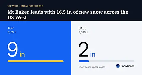
Mt Baker will receive 16.5 in (42 cm) of new snow through November 8, leading the US West, based on our model run on November 5.
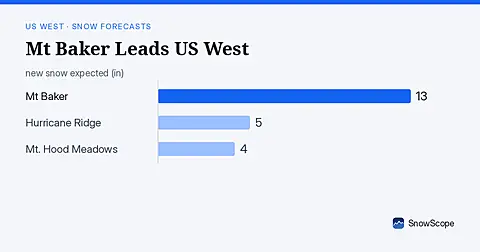
Mt Baker leads the US West with 19 in (47 cm) of upper snow, expecting 13 in (33 cm) through November 9. Model forecast from November 6.
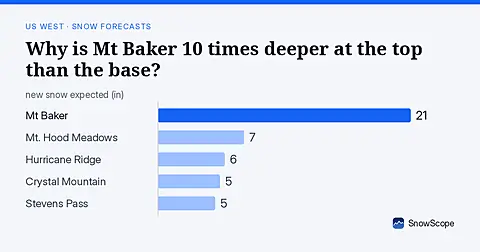
Mt Baker: 8 in (21 cm) at the summit versus less than 1 in (2 cm) at the base. November forecast shows how this height gap will shift.