 SnowScope
How much new snow makes a powder day? Five Colorado snow stations show how fast it shrinks
Ask ten skiers how much new snow makes a powder day and you get ten answers. Field work teaches a more useful question: how much new snow is still soft when you get there? On November 4, five snow stations high in Colorado's mountains, most of them a short drive from Aspen, measured a fresh storm. They kept measuring every day after it. Their numbers show how quickly a powder day changes.
See the live snow forecast for Aspen Snowmass in the SnowScope appSnow depth, powder alerts and the 3D map, free.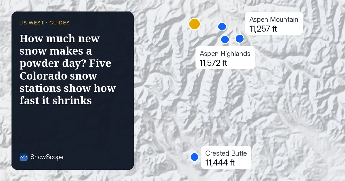
A simple starting point: 6 inches and 12 inches
Most skiers start to call it powder at about 6 in (15 cm) of new snow on a firm base. At that depth your skis float a little and the turns feel soft. At about 12 in (30 cm) the snow reaches your boots and the day feels deep. These are not laws of nature, only a useful scale, and the rest of this article is about why the same number can feel very different.
What the five stations measured
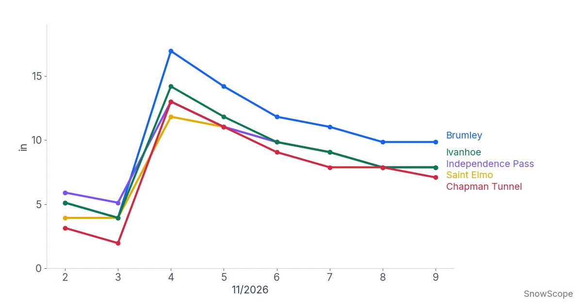
Brumley, at 10,571 ft (3,222 m), had 4 in (10 cm) of old snow on November 3. The next morning it measured 17 in (43 cm): 13 in (33 cm) of new snow overnight. Ivanhoe, at 10,541 ft (3,213 m), went from 4 in to 14 in (10 to 36 cm), Chapman Tunnel at 10,089 ft (3,075 m) from 2 in to 13 in (5 to 33 cm), and Independence Pass and Saint Elmo each gained 8 in (20 cm).
Then the snow started to shrink. By November 9, Brumley showed 10 in (25 cm). It had lost 7 in (18 cm) in five days, more than half of the new snow. The other stations tell the same story: Chapman Tunnel lost 6 in (15 cm), Ivanhoe 6 in (16 cm), Independence Pass 5 in (13 cm) and Saint Elmo 4 in (10 cm). The middle station lost 55 % of the height of its new snow in five days.
None of that snow disappeared from the mountain all at once. Most of it settled. New snow is mostly air, and under its own weight the crystals break, round off and pack closer together. Some of it also melted on sunny afternoons or turned straight into vapor in the dry Colorado air.
Why the same 12 inches can feel so different
Temperature during the storm. Snow that falls in cold air is made of light, branched crystals with a lot of air between them. It feels bottomless and sprays over your shoulders. Snow that falls near freezing is wetter and heavier. The same 12 in can be a dream in cold air and hard work in a warm storm.
Wind. Wind breaks the crystals into small pieces and packs them into firm layers. After a windy storm, the snow is often thin on ridges and deep and dense in sheltered gullies. Windy new snow is also where wind slabs form, the firm layers that can break off as avalanches.
The base below. 6 in of new snow on a firm, smooth base is a good day. The same 6 in on an early-season base of grass and rocks is a day for old skis. At Aspen Snowmass, the usual snow depth at mid-mountain (10,315 ft, 3,144 m) is only 10 in (25 cm) on November 10, so most early storms land on a thin base.
Time. As the stations show, the top layer changes every day. Sun, warm afternoons and skier traffic all work on it. The first hours after a storm are the softest.
A field method for your own powder forecast
In the Atlas mountains of Morocco, snow often comes in single storms with long dry, sunny days in between. You learn to judge fresh snow by its age and by the weather it fell in, not only by its depth. The same method works anywhere.
First, look at the amount: is it over 6 in, or over 12 in, at the height where you ski? Second, check the temperature at that height during the storm. Colder is lighter. Third, check the wind. Strong wind means hunt for sheltered slopes and be careful on loaded ones. Fourth, count the hours since the snow stopped. Every sunny afternoon takes something away.
And look at the base. By mid-December, the usual depth at Aspen Snowmass mid-mountain is 32 in (82 cm). Even in a poor winter, one of the thinnest in ten, it is 14 in (35 cm). That is when a fresh 12 in starts to ski the way you imagine it.
How sure can we be?
Each station measures one spot of ground. A gust can blow snow away from a sensor or pile it up beside it, and a sunny clearing behaves differently from a shady forest. That is why we looked at five stations together. They all show the same shape: a jump on November 4, then a steady drop over five days.
The new snow did not all fall in one hour, and the stations record once a day. The exact numbers of a single station are less important than the pattern. Fresh snow is at its deepest the morning after the storm, and it starts to lose height almost at once.
Tips for skiers
- Use 6 in and 12 in as a rough scale, then adjust for temperature, wind and base.
- Go early: new snow loses height and softness from the first day.
- On a thin early-season base, keep away from rocks hidden under new snow.
- Fresh snow and wind build slabs: always read the avalanche forecast before leaving the groomed runs.
References and credits
- Colorado Avalanche Information Center: daily avalanche forecasts for Colorado. avalanche.state.co.us/
- SnowScope: A powder day at Whitewater, hour by hour. snowscope.app/blog/en/2026/11/whitewater-powder-day-hour-by-hour-nelson.html
About these numbers
Measured snow: daily snow depth at five automatic snow stations in Colorado (Brumley, Ivanhoe, Chapman Tunnel, Independence Pass, Saint Elmo), November 2-9, 2026, as shown on the SnowScope station map. Usual depth at Aspen Snowmass: SnowScope snow history, 46 past winters (1980-81 to 2025-26) at mid-mountain, a model of the past corrected for height.
Cite this report
For research, teaching or the press: the numbers and charts are free to reuse under CC BY 4.0 with this citation.
SnowScope (2026), How much new snow makes a powder day? Five Colorado snow stations show how fast it shrinks, https://snowscope.app/blog/en/2026/11/how-much-new-snow-makes-a-powder-day.html, accessed 2026-11-10
SnowScope (Atlas Labs). (2026, November 10). How much new snow makes a powder day? Five Colorado snow stations show how fast it shrinks. SnowScope snow reports. https://snowscope.app/blog/en/2026/11/how-much-new-snow-makes-a-powder-day.html
BibTeX
@misc{snowscope2026howmuchnewsnowmakesapowd,
  author       = {{SnowScope (Atlas Labs)}},
  title        = {How much new snow makes a powder day? Five Colorado snow stations show how fast it shrinks},
  year         = {2026},
  month        = nov,
  howpublished = {\url{https://snowscope.app/blog/en/2026/11/how-much-new-snow-makes-a-powder-day.html}},
  note         = {Published 2026-11-10 20:38 UTC; accessed 2026-11-10}
}· CC BY 4.0 · Methods, data and tools →
Aspen Snowmass: snow and temperature by height, this winter vs last (tools) →
Follow Aspen Snowmass
Free: a message when fresh snow is coming, and the forecast every morning.

More snow reports
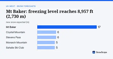
Rain will replace snow at Mt Baker on November 6, as the freezing level climbs to 8,957 ft (2,730 m), far above the ski area.
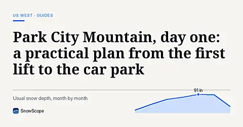
How to spend a first day at Park City Mountain, Utah, and when to go: our snow history gives about 71 in (180 cm) at the usual mid-mountain peak over 46 past winters.
Mt Baker, Washington: about 133 in (337 cm) at the usual peak at mid-mountain in 46 past winters, a world snowfall record, no lodging on the hill, and what that means.