 SnowScope
Snow depth on 100 mountain ranges: who has snow on 9 November 2026?
We cut 100 mountain ranges out of the SnowScope snow depth map of 9 November 2026 and put them side by side, from Mont Blanc to the Coast Mountains, from Toubkal to the White Mountains. Same scale, same colours, one picture.
See the live snow forecast for Alps in the SnowScope appSnow depth, powder alerts and the 3D map, free.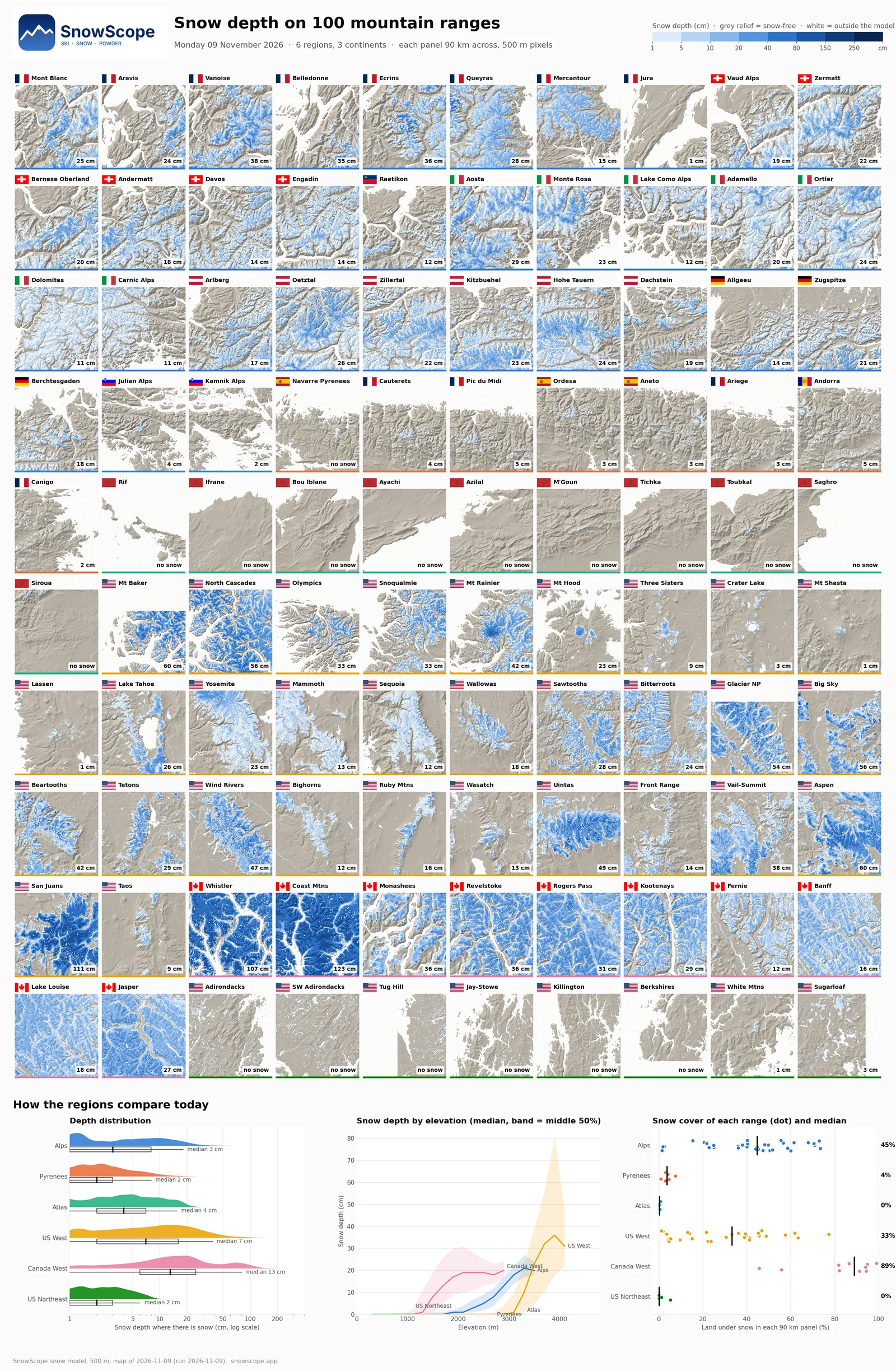
Western Canada is far ahead
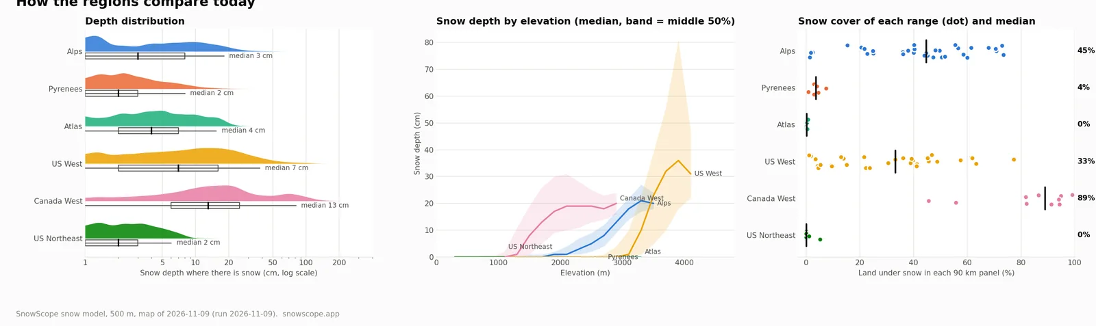
The deepest snow of the day is in British Columbia: 123 cm in the Coast Mountains and 107 cm around Whistler. In the median Canadian range, 89% of the land is already white, and snow of 5 cm or more starts at about 1400 m.
In the US West the snow sits higher: it starts at about 3200 m. The San Juans in Colorado have 111 cm (44 in) on the highest slopes, Aspen and Mt Baker 60 cm (24 in). A typical US West range is 33% white.
The Alps: a white top, green valleys
The Alps have a thin but wide start: 45% of the land is white in the median range, but where there is snow the typical depth is only 3 cm. The French Alps lead today: 38 cm in the Vanoise and 36 cm in the Ecrins, 29 cm above Aosta. Below about 2400 m most slopes are still bare.
Still waiting: the Pyrenees, the Atlas and the US Northeast
The Pyrenees have only 4% snow cover, a few centimetres on the highest crests. None of the 10 Atlas ranges, from the Rif to Siroua, has a real snow cover yet, and the US Northeast, from the Adirondacks to Killington, is bare too. In total 17 of the 100 ranges have no snow at all on this day.
How to read the picture
Each panel is 90 km across with 500 m pixels. Blue shows how deep the snow is, grey shaded relief means no snow, and the number in the corner is the deepest snow in that panel. The coloured line under a panel tells its region, the same colours as in the charts below the grid.
Tips for skiers
- Early in the season, look high: in the Alps the snow starts above about 2400 m.
- Canada is the safe bet for skiing right now.
- Open the SnowScope map to zoom into any of these ranges and follow the snow day by day.
About these numbers
Method: SnowScope snow model, 500 m, map of 9 November 2026 (the day of the run). Each panel is a 90 km window of the map; the number is the deepest snow in it, leaving out the top 1% of pixels. Region charts use every land pixel of each region. A model estimate, not resort reports.
Cite this report
For research, teaching or the press: the numbers and charts are free to reuse under CC BY 4.0 with this citation.
SnowScope (2026), Snow depth on 100 mountain ranges: who has snow on 9 November 2026?, https://snowscope.app/blog/en/2026/11/snow-depth-100-mountain-ranges-9-november-2026.html, accessed 2026-11-09
SnowScope (Atlas Labs). (2026, November 9). Snow depth on 100 mountain ranges: who has snow on 9 November 2026?. SnowScope snow reports. https://snowscope.app/blog/en/2026/11/snow-depth-100-mountain-ranges-9-november-2026.html
BibTeX
@misc{snowscope2026snowdepth100mountainrang,
  author       = {{SnowScope (Atlas Labs)}},
  title        = {Snow depth on 100 mountain ranges: who has snow on 9 November 2026?},
  year         = {2026},
  month        = nov,
  howpublished = {\url{https://snowscope.app/blog/en/2026/11/snow-depth-100-mountain-ranges-9-november-2026.html}},
  note         = {Published 2026-11-09 21:24 UTC; accessed 2026-11-09}
}· CC BY 4.0 · Methods, data and tools →
Follow Alps
Free: a message when fresh snow is coming, and the forecast every morning.

More snow reports
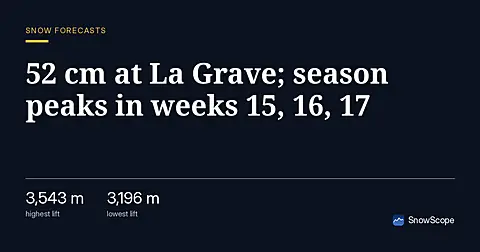
La Grave leads the Alps with 52 cm forecast in 24 hours as of 11 November; early snow arrives weeks before peak accumulation.
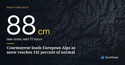
Courmayeur leads forecast with 88 cm in 72 hours; snow depth is at 142 percent of normal for mid-November as of November 15 data.
Orelle holds 42 cm, close to the typical 53 cm for mid-November. Fresh snow forecast across the Alps over the next three days.