 SnowScope
Snow forecast in the US West: up to 13 in at Bear Valley by 16 November
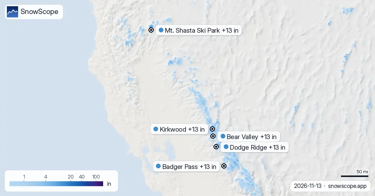
The snow is not done yet: we expect 13 in (34 cm) at Bear Valley, 13 in (34 cm) at Dodge Ridge and 13 in (33 cm) at Badger Pass by 16 November. A word on the numbers: resort values are our model's estimate for the upper slopes, while each station measures a single spot on the date given. Field work in dry mountains teaches one thing: the map is a start, the slope itself has the last word.
See the live snow forecast for Bear Valley in the SnowScope appSnow depth, powder alerts and the 3D map, free.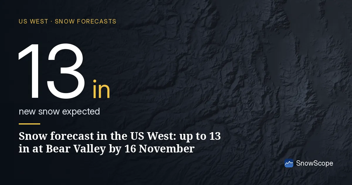
Snow on the slopes today
Of the places named here, Kirkwood leads with about 9 in (24 cm) on its upper slopes; Bear Valley 8 in (21 cm) and Dodge Ridge 6 in (14 cm) come next.
There is snow at 122 of 195 resorts in the US West today, over 49,050 sq mi (127,040 km²) of ground in total.
| Resort | Snow depth | New snow, 72 h | Coming, next days | Top |
|---|---|---|---|---|
| Bear Valley | 8 in (21 cm) | 5 in (13 cm) | 13 in (34 cm) | 8,484 ft (2,586 m) |
| Dodge Ridge | 6 in (14 cm) | 3 in (7 cm) | 13 in (34 cm) | 8,143 ft (2,482 m) |
| Badger Pass | 0 in (0 cm) | 1 in (2 cm) | 13 in (33 cm) | 7,795 ft (2,376 m) |
| Kirkwood | 9 in (24 cm) | 5 in (13 cm) | 13 in (32 cm) | 9,462 ft (2,884 m) |
| Mt. Shasta Ski Park | 6 in (14 cm) | 6 in (16 cm) | 13 in (32 cm) | 7,539 ft (2,298 m) |
The snow still to come
Up to 13 in (34 cm) of new snow is forecast at Bear Valley over the next days.
Forecasts move: the timing is usually more reliable than the totals, so check again two days before you go.
At about 7,562 ft (2,305 m), Bear Valley has 6 in (15 cm) today; a normal 13 November has 2 in (4 cm) there.
That is more than in 33 of the 46 past winters on this date.
In past winters the best snow at Bear Valley usually came early March / mid-March.
Day by day at Bear Valley: Friday 13 November 5 in (13 cm); Saturday 14 November 6 in (16 cm); Monday 16 November 7 in (18 cm).
Height by height at Bear Valley: 6,640 ft (2,024 m) 1 in (3 cm) on the ground, 14 in (35 cm) more in the next 7 days; 7,562 ft (2,305 m) 3 in (8 cm) on the ground, 21 in (54 cm) more in the next 7 days; 8,484 ft (2,586 m) 9 in (22 cm) on the ground, 22 in (57 cm) more in the next 7 days.
Which height to ski today
On 15 November the freezing level at Bear Valley climbs to 4,003 ft (1,220 m) to 10,302 ft (3,140 m), higher than the top of the lifts (8,484 ft / 2,586 m): expect rain or wet snow on every slope.
Warm air at Dodge Ridge on 15 November: the freezing level goes from 4,921 ft (1,500 m) to 10,564 ft (3,220 m), above the resort's top (8,143 ft / 2,482 m), so rain or wet snow can reach every slope.
On 15 November the freezing level at Badger Pass climbs to 6,857 ft (2,090 m) to 11,220 ft (3,420 m), higher than the top of the lifts (7,795 ft / 2,376 m): expect rain or wet snow on every slope.
From the base to the top of Bear Valley: 1 in (3 cm) at the base (6,640 ft / 2,024 m), 3 in (8 cm) at mid-mountain (7,562 ft / 2,305 m) and 9 in (22 cm) at the top (8,484 ft / 2,586 m).
The days ahead
And more is coming: by 16 November, the forecast brings 13 in (32 cm) at Kirkwood and 13 in (32 cm) at Mt. Shasta Ski Park.
Less ground is white now: 49,467 sq mi (128,120 km²) on 11 November, only 49,050 sq mi (127,040 km²) today, and 64,429 sq mi (166,870 km²) expected on 16 November.
Safety and avalanche level
Forecasts a few days ahead can change: look at the map again the day before you travel.
Tips for skiers
- Forecasts a few days ahead can change: look at the map again the day before you travel.
- Air above freezing over the slopes turns snow into slush and water. The highest lifts keep the driest snow.
- New snow does not stay new for long. Start early, while it is still soft and untracked.
- Before you ski off-piste or go touring, read the official avalanche bulletin (links below).
- Get a powder alert in the SnowScope app to know when Bear Valley gets fresh snow.
About these numbers
Resort snow depths are the deepest snow on the resort's upper slopes from the SnowScope snow model (about 1 km, run of 13 November); they are estimates for an area, not a measurement at one point. Station values are measurements on the date shown. Forecasts can change. Always read the official avalanche bulletin before going off-piste.
Official avalanche bulletins: avalanche.org
Cite this report
For research, teaching or the press: the numbers and charts are free to reuse under CC BY 4.0 with this citation.
SnowScope (2026), Snow forecast in the US West: up to 13 in at Bear Valley by 16 November, https://snowscope.app/blog/en/2026/11/us-west-bear-valley-snow-forecast-13-november-2026.html, accessed 2026-11-13
SnowScope (Atlas Labs). (2026, November 13). Snow forecast in the US West: up to 13 in at Bear Valley by 16 November. SnowScope snow reports. https://snowscope.app/blog/en/2026/11/us-west-bear-valley-snow-forecast-13-november-2026.html
BibTeX
@misc{snowscope2026uswestbearvalleysnowfore,
  author       = {{SnowScope (Atlas Labs)}},
  title        = {Snow forecast in the US West: up to 13 in at Bear Valley by 16 November},
  year         = {2026},
  month        = nov,
  howpublished = {\url{https://snowscope.app/blog/en/2026/11/us-west-bear-valley-snow-forecast-13-november-2026.html}},
  note         = {Published 2026-11-13 17:36 UTC; accessed 2026-11-13}
}· CC BY 4.0 · Methods, data and tools →
Bear Valley: snow and temperature by height, this winter vs last (tools) →
Follow Bear Valley
Free: a message when fresh snow is coming, and the forecast every morning.

More snow reports
Big Sky, Montana, made easy to picture: 5,850 acres under Lone Peak, and snow that is about five times deeper near the top than at the base in 46 past winters.
Aspen Snowmass compared: Snowmass has about 75 in (190 cm) at the usual peak at mid-mountain over 46 past winters, Aspen Mountain about 69 in (174 cm). Terrain, access, safety.
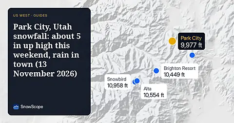
Park City, Utah snowfall forecast for 13 November 2026: almost no snow on the ground right now, about 5 in near the summit from the weekend storm with a snow level of 7,400 to 7,700 ft, rain at the base, and about 12 in up top over the week.