 SnowScope
Southern Alps, December 2026: a mild, wet month and a snow store near normal
Think of December snow as water put into storage for spring. For the Southern Alps, the seasonal forecast points to a milder and wetter month; our map finds no clear signal on 80 % of the area, and a leaner tilt only on the French western edge.
See the live snow forecast for Southern Alps in the SnowScope appSnow depth, powder alerts and the 3D map, free.
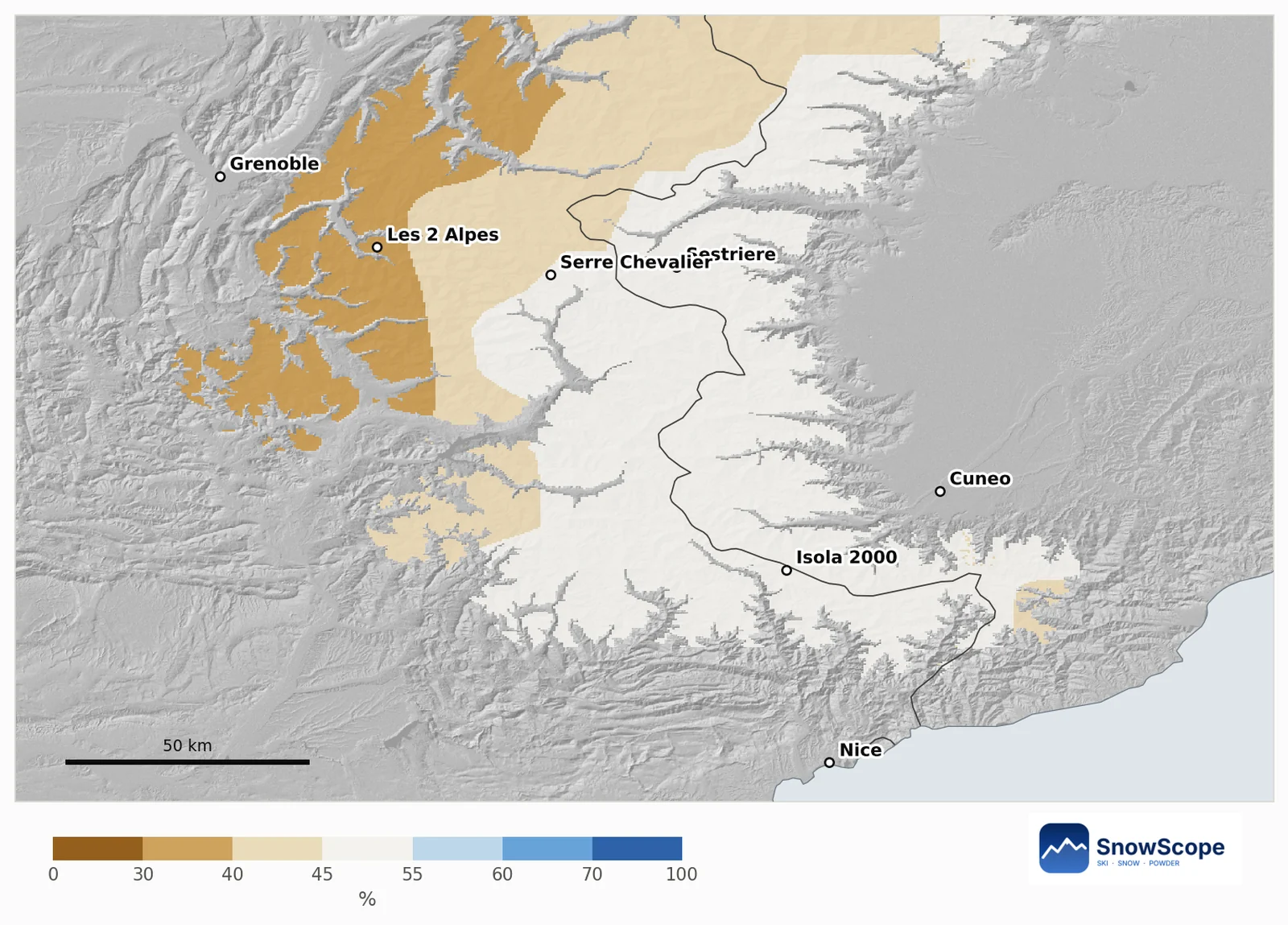
Leaner in the west, undecided almost everywhere else
Each patch of mountain, about 10 km wide, is set against its own past Decembers. On 80 % of the mountain area, from Briançon to Isola 2000 and across the border to Sestriere and Cuneo, the outlook cannot tell more snow from less. The remaining 20 % tilts leaner, mainly on the western side near Les 2 Alpes and towards Grenoble. Not a single area tilts snowier.
The chance of more new snow than in a usual December ranges from 31 % to 55 % over the area; the middle value is 45 %.
Warmth and water in the European forecast
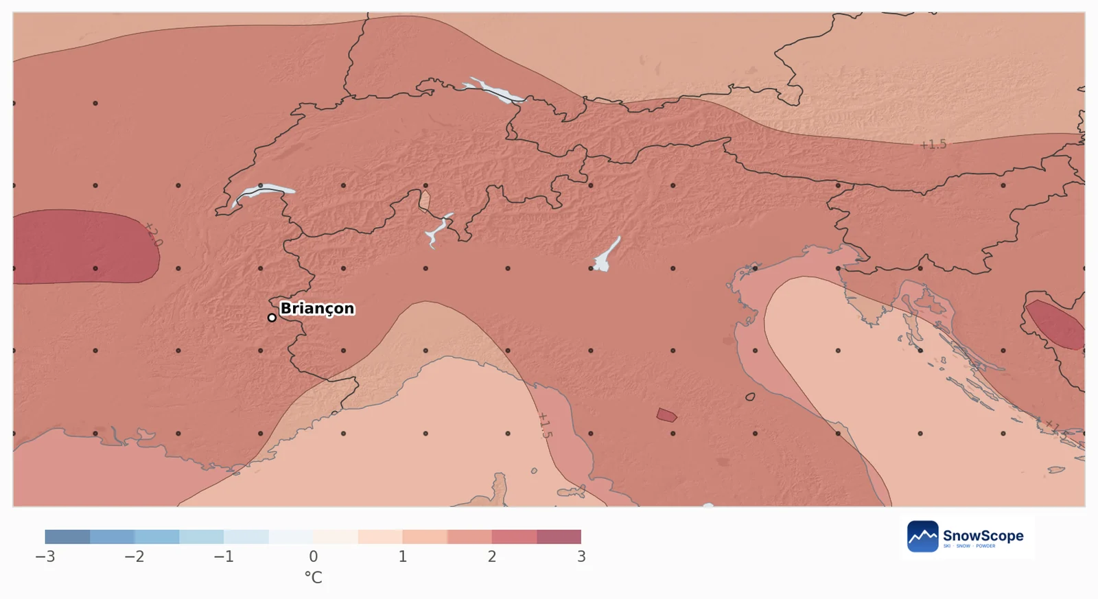
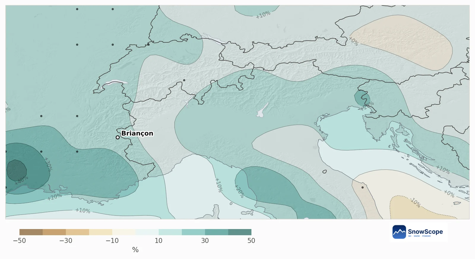
The seasonal system of the European weather centre runs 51 forecasts. 88 % of them make December warmer than usual, by 1.7 °C on average over the Southern Alps. They also add water: precipitation comes out 14 % above a usual December of 101 mm, and 61 % of the runs are wetter.
For a hydrologist this is the familiar trade-off of the southern Alps. Damp Mediterranean air delivers the water; high up it is stored as snow, lower down the extra warmth lets more of it run off as rain. The gain and the loss almost balance, so the odds end up close to a usual December.
France and Italy, side by side
French Southern Alps (Serre Chevalier, Vars and Risoul, Orcières, Valberg, Dévoluy): at mid-mountain a usual December adds 48 cm of new snow, and the outlook gives 44 cm, with a 44 % chance of beating the usual. For 31 December the usual depth is 62 cm; the outlook says 61 cm.
Aosta Valley and Piedmont (Courmayeur, Sestriere, Monterosa, Pila): 43 cm in a usual December, 43 cm in the outlook too, and a 45 % chance of more. The depth on 31 December is usually 64 cm, and the outlook also gives 64 cm. On both sides, the past Decembers closest to this forecast are 2023, 2022 and 2018.
How to use an outlook like this
An outlook near normal still tells you something: no need to cancel a December trip, and no reason to hope for a record month either. The warm signal is the part we trust most, so in early December the higher resorts are the safer bet.
Keep the uncertainty in mind: a monthly outlook cannot see single storms. When the 7-day forecast shows a Mediterranean low, the Southern Alps can store a lot of snow in one or two days.
Tips for skiers
- In early December, choose resorts with high lifts and slopes that face north.
- Follow the 7-day forecast for Mediterranean lows: they deliver the big snowfalls in this area.
- Before booking, compare resorts on the SnowScope map: the snow line can change a lot from one valley to the next.
References and credits
- ECMWF SEAS5 seasonal forecasts, Copernicus Climate Change Service (C3S) cds.climate.copernicus.eu/datasets/seasonal-postprocessed-single-levels
- ERA5 monthly averaged data, Copernicus Climate Change Service (C3S) cds.climate.copernicus.eu/datasets/reanalysis-era5-single-levels-monthly-means
About these numbers
Method. Temperature and precipitation: the seasonal forecast of the European weather centre (ECMWF SEAS5, 51 runs started 1 November 2026, anomalies against its own 1993-2016 reforecasts, about 100 km grid). Snow: for every mountain cell of about 10 km we take our model of the past (46 winters, snow depth corrected for height) and the weather of each December from 1981 to 2025 (ERA5); past Decembers whose temperature and precipitation look like each forecast run count more, and their snow gives the odds. Snow today: the SnowScope snow map (500 m). A monthly outlook only tilts the odds: it cannot forecast a storm or a date.
Cite this report
For research, teaching or the press: the numbers and charts are free to reuse under CC BY 4.0 with this citation.
SnowScope (2026), Southern Alps, December 2026: a mild, wet month and a snow store near normal, https://snowscope.app/blog/en/2026/11/southern-alps-december-2026-snow-outlook.html, accessed 2026-11-10
SnowScope (Atlas Labs). (2026, November 10). Southern Alps, December 2026: a mild, wet month and a snow store near normal. SnowScope snow reports. https://snowscope.app/blog/en/2026/11/southern-alps-december-2026-snow-outlook.html
BibTeX
@misc{snowscope2026southernalpsdecember2026,
  author       = {{SnowScope (Atlas Labs)}},
  title        = {Southern Alps, December 2026: a mild, wet month and a snow store near normal},
  year         = {2026},
  month        = nov,
  howpublished = {\url{https://snowscope.app/blog/en/2026/11/southern-alps-december-2026-snow-outlook.html}},
  note         = {Published 2026-11-10 09:31 UTC; accessed 2026-11-10}
}· CC BY 4.0 · Methods, data and tools →
Follow Southern Alps
Free: a message when fresh snow is coming, and the forecast every morning.

More snow reports
Chantarella, Marguns, Piz Nair, White Turf: the words you hear in St. Moritz, explained, and what 46 past winters of our snow history say about each height of Corviglia.
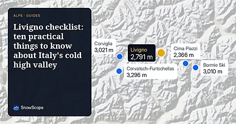
Ten practical points for a ski trip to Livigno: the roads in, the cold, the duty-free shops, the two ski sides and when the snow is best, from 46 past winters of our snow history.
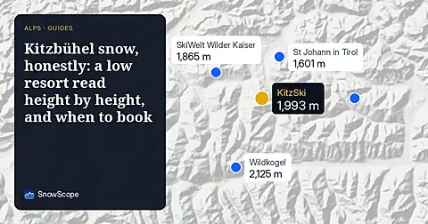
Kitzbühel is famous and low. What 46 past winters say about snow at 762 m, 1,377 m and 1,993 m, how it has changed, and which weeks are the safer bet.