 SnowScope
Chamonix in December 2026: warm signal, wet signal, no clear snow verdict
Winter has started high up in Chamonix: 27 cm lie at the top of the Grands Montets (2768 m) after 15 cm in the last week. For December, the seasonal forecast points to a warmer and somewhat wetter month, and around Mont Blanc the two effects roughly cancel out.
See the live snow forecast for Chamonix in the SnowScope appSnow depth, powder alerts and the 3D map, free.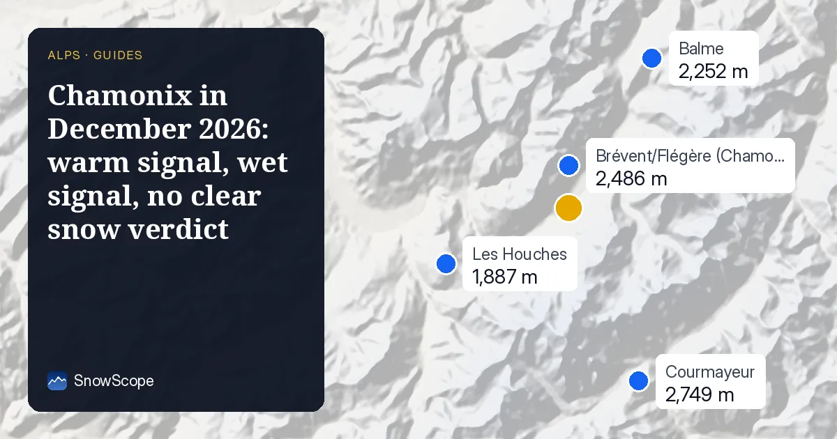
Snow today
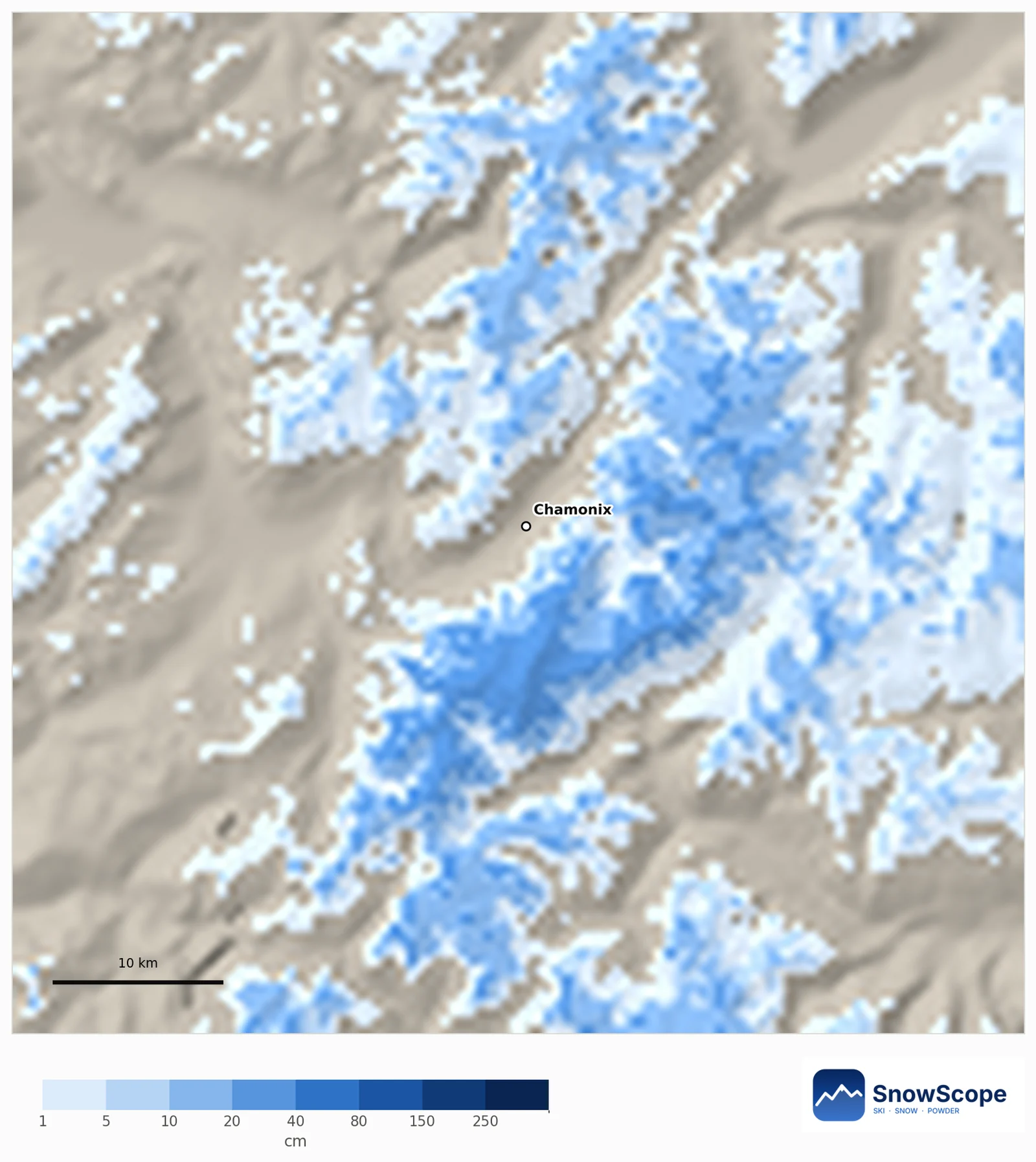
The snow line is still high. At 2001 m the map shows just 1 cm, and the base at 1234 m is bare, although 10 cm fell at mid-mountain during the last seven days. The top has 27 cm, and the next seven days could add about 26 cm up there and 5 cm at mid-mountain.
On the map, 47 % of the 60 km around Chamonix is white: the Mont Blanc massif and the high Valais side, not the valleys.
Snowier or leaner? Mostly no clear signal
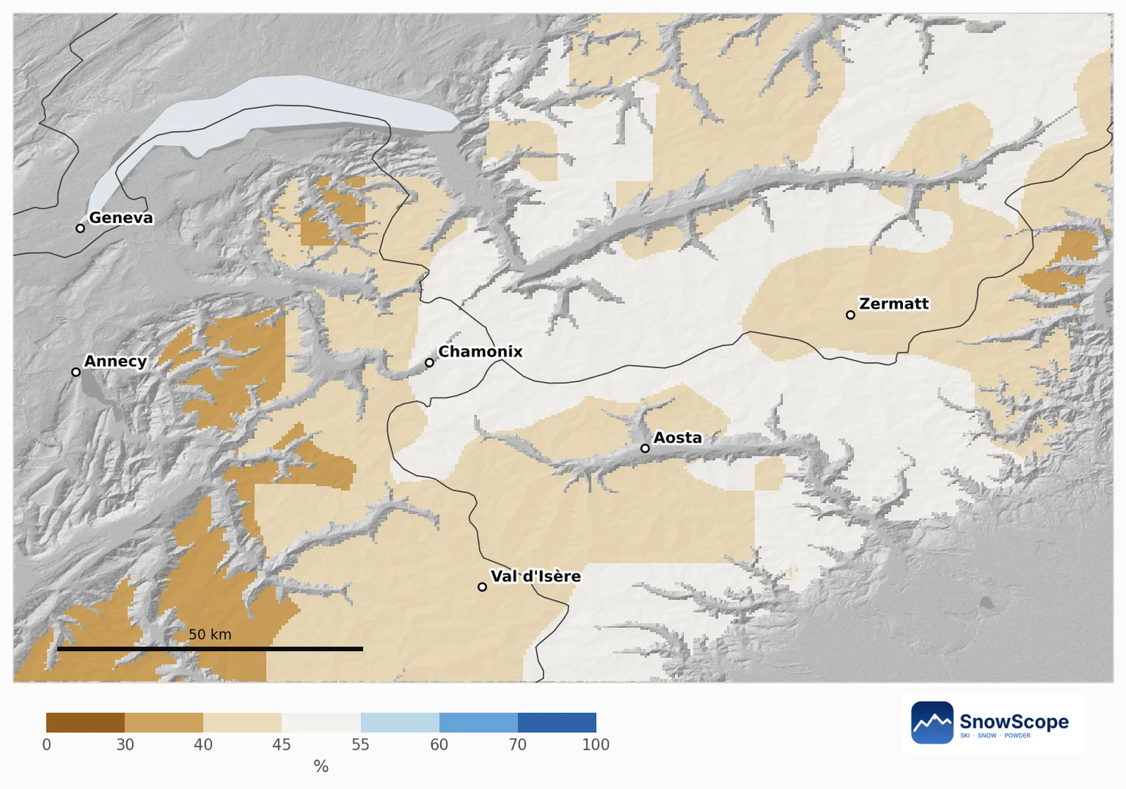
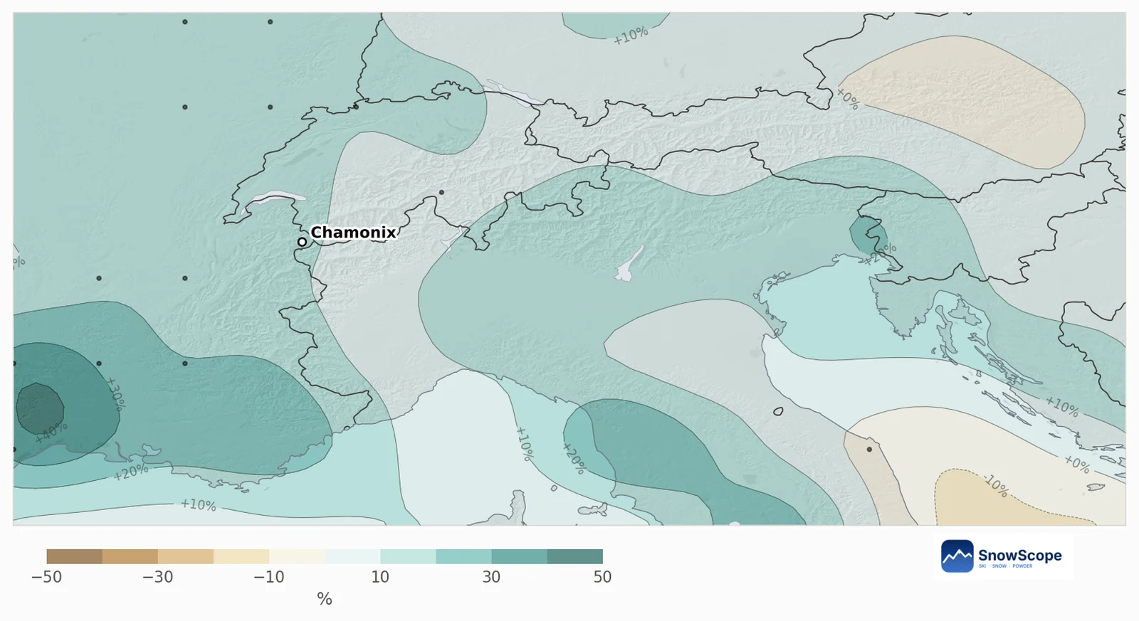
Our outlook map compares every mountain area of about 10 km with its own past Decembers. Around Mont Blanc 86 % of the mountain area shows no clear signal, 14 % leans leaner (mostly the lower Pre-Alps towards Annecy) and none leans snowier.
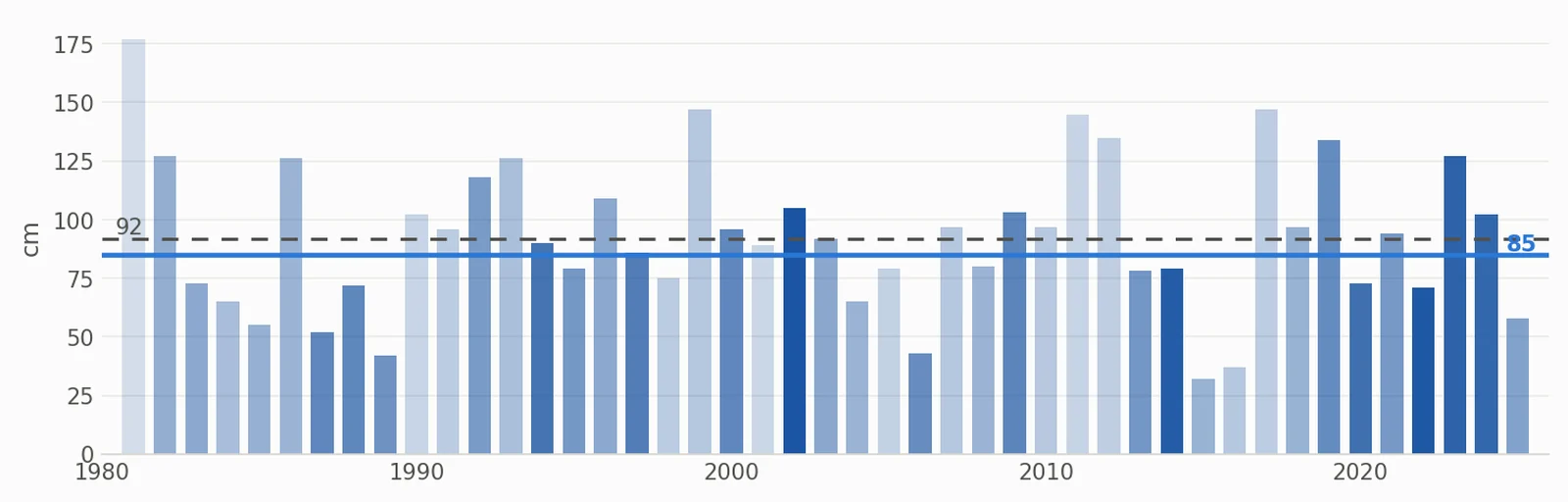
At mid-mountain in Chamonix the chance of more new snow than in a usual December is 45 %. A usual December brings 68 cm of new snow there; this year's outlook is 66 cm. For the snow on 31 December the usual value is 92 cm and the outlook 85 cm, most likely between 71 and 103 cm.
What the European forecast says
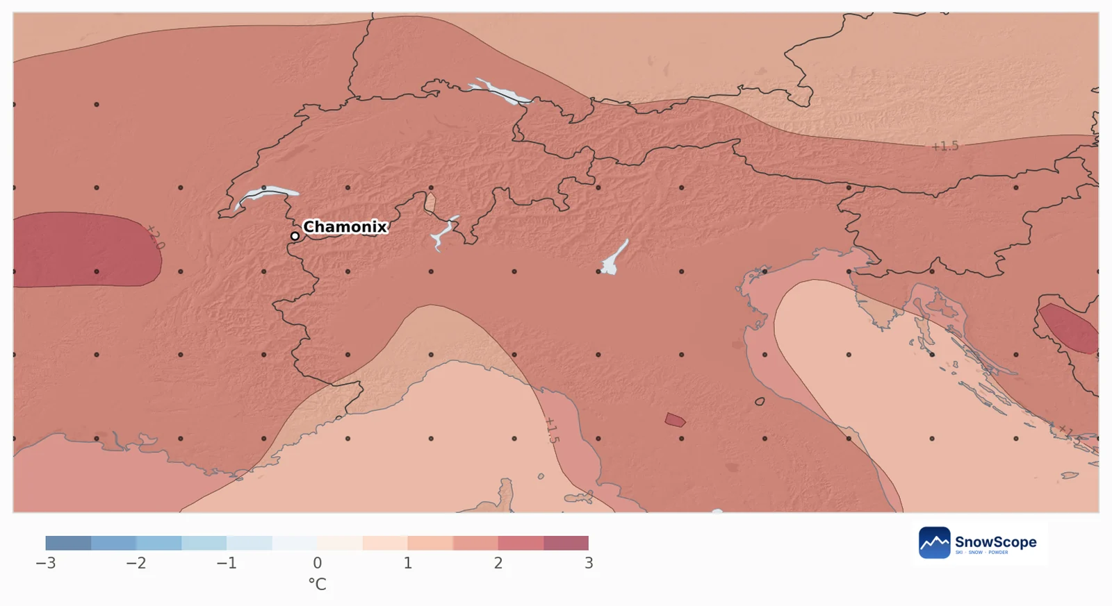
The 51 runs of the European weather centre's seasonal system agree on warmth: on average December is 1.6 °C warmer than usual over the area, and 84 % of the runs are warmer. Precipitation is 11 % above a usual December (128 mm), with 65 % of the runs wetter.
Warm and wet pull in opposite directions. Up high, extra precipitation still falls as snow; lower down, a warmer December means more rain and a higher snow line. In our 45 past Decembers, snow at this height followed precipitation (correlation 0.94) far more than temperature, which is why the result lands close to usual.
Past Decembers like this one
The past Decembers whose weather looked most like this forecast are 2002, 2022 and 2014. They were not alike for snow, which is the honest message: the forecast tilts the odds a little but does not decide the month.
Plan on high terrain first, keep the lower runs as a bonus, and follow the 7-day forecast before you book.
Tips for skiers
- Early December: count on the Grands Montets top and the glacier side, not the valley runs.
- A warm December means a high rain line: watch it in the 7-day forecast.
- Turn on the snow layer in the SnowScope map to follow the snow line week by week.
References and credits
- ECMWF SEAS5 seasonal forecasts, Copernicus Climate Change Service (C3S) cds.climate.copernicus.eu/datasets/seasonal-postprocessed-single-levels
- ERA5 monthly averaged data, Copernicus Climate Change Service (C3S) cds.climate.copernicus.eu/datasets/reanalysis-era5-single-levels-monthly-means
About these numbers
Method. Temperature and precipitation: the seasonal forecast of the European weather centre (ECMWF SEAS5, 51 runs started 1 November 2026, anomalies against its own 1993-2016 reforecasts, about 100 km grid). Snow: for every mountain cell of about 10 km we take our model of the past (46 winters, snow depth corrected for height) and the weather of each December from 1981 to 2025 (ERA5); past Decembers whose temperature and precipitation look like each forecast run count more, and their snow gives the odds. Snow today: the SnowScope snow map (500 m). A monthly outlook only tilts the odds: it cannot forecast a storm or a date.
Cite this report
For research, teaching or the press: the numbers and charts are free to reuse under CC BY 4.0 with this citation.
SnowScope (2026), Chamonix in December 2026: warm signal, wet signal, no clear snow verdict, https://snowscope.app/blog/en/2026/11/chamonix-december-2026-snow-outlook.html, accessed 2026-11-10
SnowScope (Atlas Labs). (2026, November 10). Chamonix in December 2026: warm signal, wet signal, no clear snow verdict. SnowScope snow reports. https://snowscope.app/blog/en/2026/11/chamonix-december-2026-snow-outlook.html
BibTeX
@misc{snowscope2026chamonixdecember2026snow,
  author       = {{SnowScope (Atlas Labs)}},
  title        = {Chamonix in December 2026: warm signal, wet signal, no clear snow verdict},
  year         = {2026},
  month        = nov,
  howpublished = {\url{https://snowscope.app/blog/en/2026/11/chamonix-december-2026-snow-outlook.html}},
  note         = {Published 2026-11-10 09:29 UTC; accessed 2026-11-10}
}· CC BY 4.0 · Methods, data and tools →
Follow Chamonix
Free: a message when fresh snow is coming, and the forecast every morning.

More snow reports
St Anton and Ski Arlberg through the winter: how deep the snow usually is each month at three heights, from 46 past winters.
A year of snow in Sölden, phase by phase: when the glaciers whiten, the World Cup weekend, the long middle of winter and the spring weeks, from 46 past winters at three heights.
Is Verbier good for beginners? When is the snow best? How do you get there? Answers from the 4 Vallées and 46 past winters of snow data.