 SnowScope
Cortina d'Ampezzo in December 2026: thin snow now, Christmas still very likely white
Cortina has only a dusting so far: 2 cm at the top (2739 m) and nothing at mid-mountain. December looks warmer and slightly wetter than usual, but a white Christmas at mid-mountain stays very likely: 96 % this year.
See the live snow forecast for Cortina d'Ampezzo in the SnowScope appSnow depth, powder alerts and the 3D map, free.
Snow today
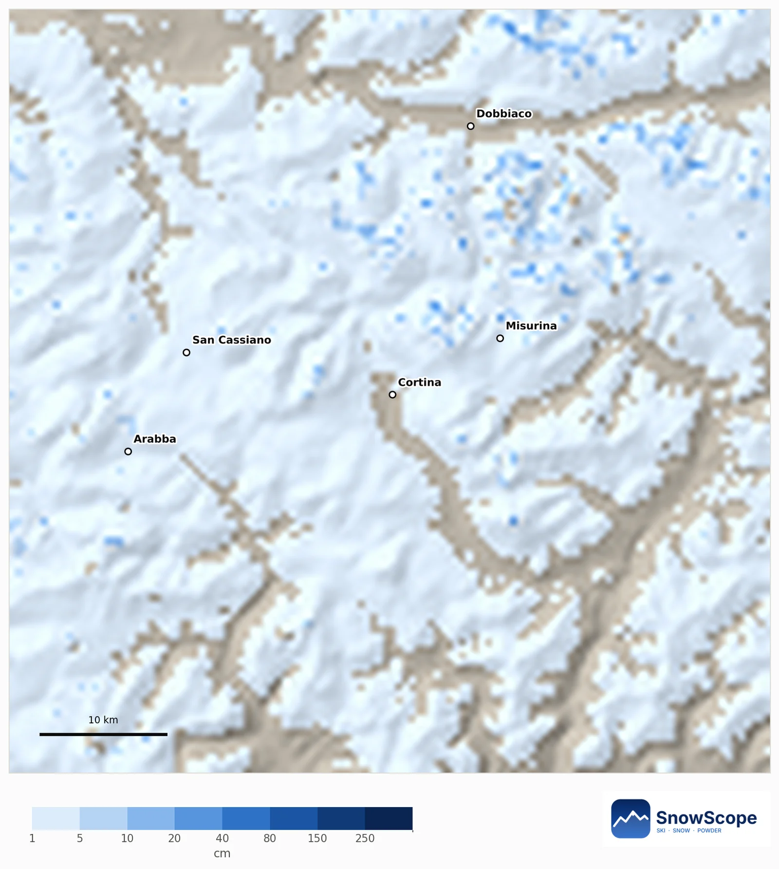
The latest map shows 0 cm at mid-mountain (1799 m) and 2 cm at the top after 5 cm last week. 80 % of the 60 km around Cortina is white, but mostly a thin layer of 1 to 5 cm. The next seven days could add about 17 cm at the top and 3 cm at mid-mountain.
Snowier or leaner?
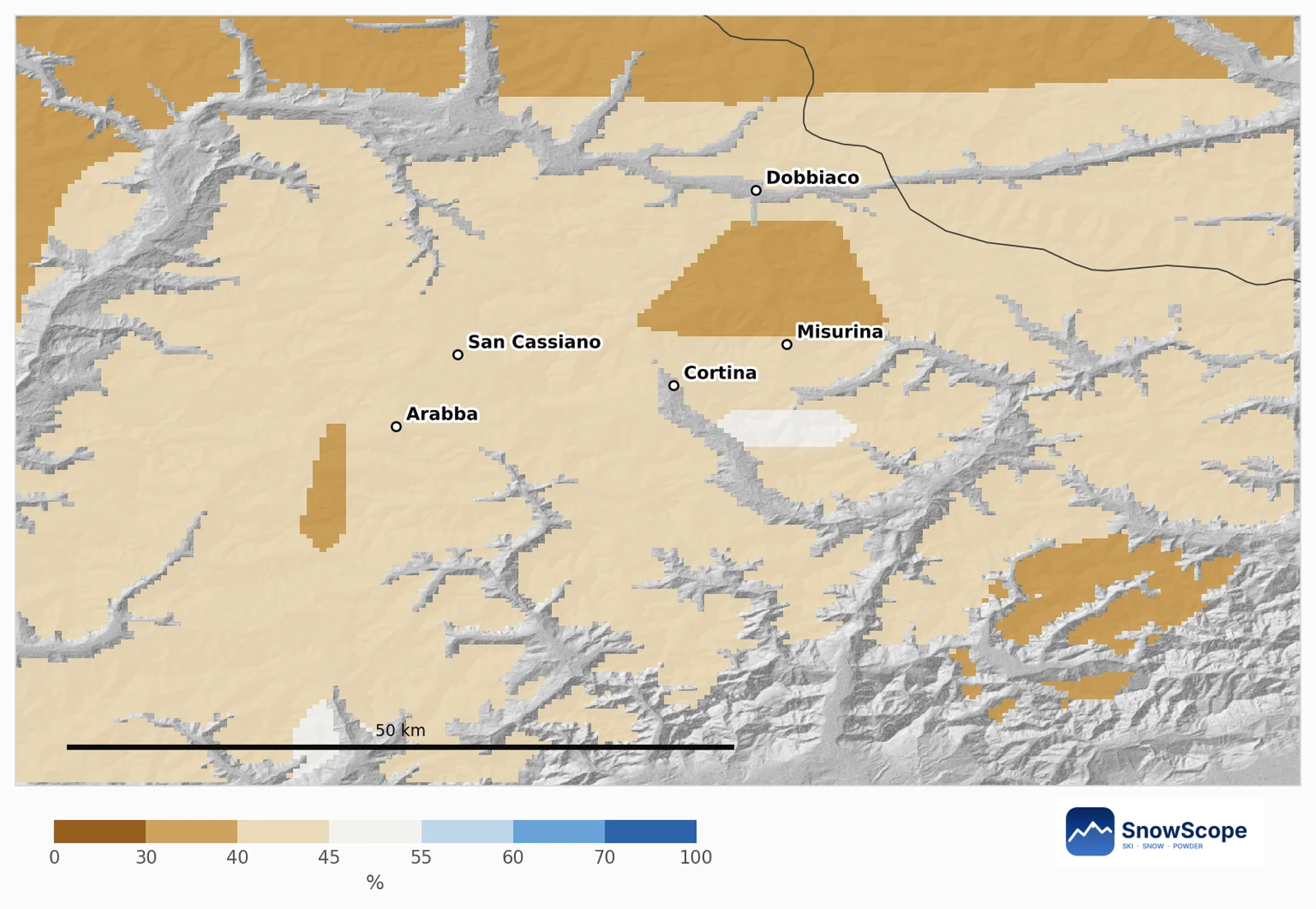
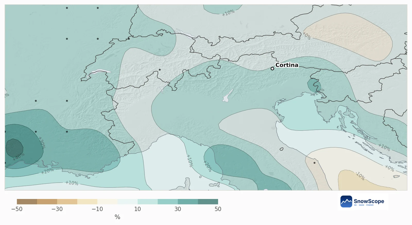
On 61 % of the mountain area around Cortina there is no clear signal; the other 39 % leans leaner, mostly around Misurina, Dobbiaco and the south-east. No area leans snowier.
At mid-mountain, the chance of more new snow than in a usual December is 42 %. A usual December brings 25 cm there, the outlook is 23 cm; snow on 31 December is usually 39 cm, the outlook 35 cm, most likely between 17 and 48 cm.
What the European forecast says
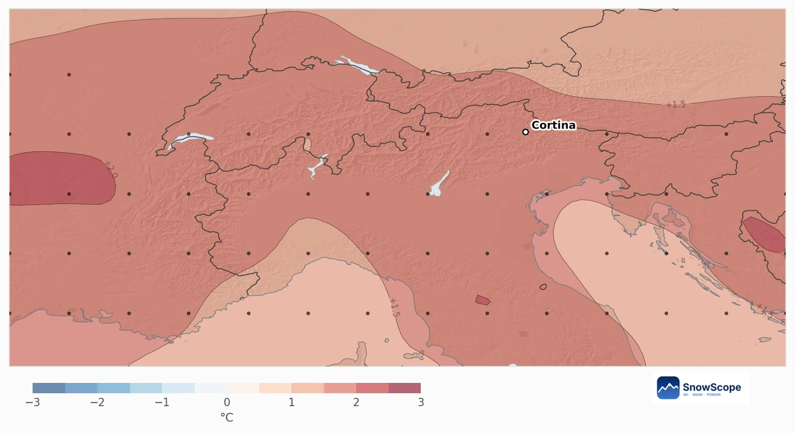
The 51 runs make December 1.7 °C warmer than usual over the area, with 80 % of the runs warmer, and precipitation 12 % above a usual December of 70 mm, with the runs split (53 % wetter).
Snow here follows precipitation much more than temperature (correlation 0.96), which is why a warmer but wetter month lands close to usual.
A white Christmas?
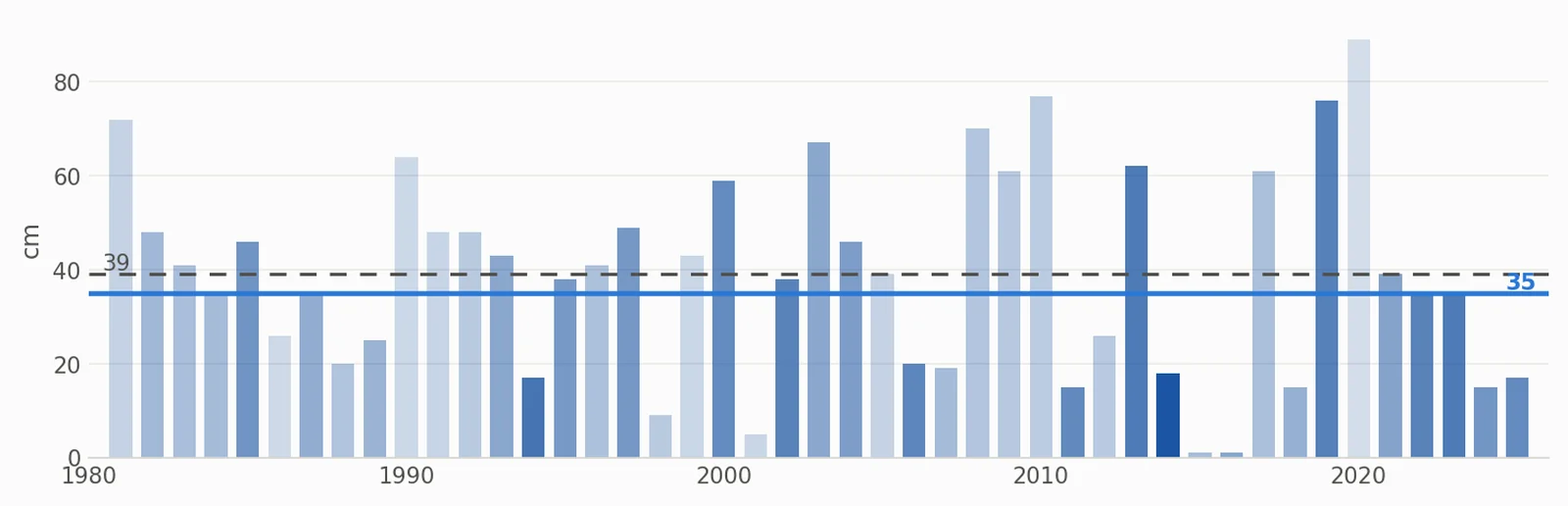
In 42 of the last 45 winters there were at least 5 cm of snow at mid-mountain on 25 December, 93 %. Weighted by this year's forecast the chance is 96 %, with a usual 34 cm and an outlook of 29 cm that day: a little less snow, but still white. The past Decembers most like this one are 2014, 1994 and 2023.
Tips for skiers
- Book Christmas with confidence for mid and high slopes; the valley runs may need machine snow.
- Watch the 7-day forecast for southern storms: they bring the big snowfalls to the Dolomites.
- Follow the snow line on the SnowScope map before you travel.
References and credits
- ECMWF SEAS5 seasonal forecasts, Copernicus Climate Change Service (C3S) cds.climate.copernicus.eu/datasets/seasonal-postprocessed-single-levels
- ERA5 monthly averaged data, Copernicus Climate Change Service (C3S) cds.climate.copernicus.eu/datasets/reanalysis-era5-single-levels-monthly-means
About these numbers
Method. Temperature and precipitation: the seasonal forecast of the European weather centre (ECMWF SEAS5, 51 runs started 1 November 2026, anomalies against its own 1993-2016 reforecasts, about 100 km grid). Snow: for every mountain cell of about 10 km we take our model of the past (46 winters, snow depth corrected for height) and the weather of each December from 1981 to 2025 (ERA5); past Decembers whose temperature and precipitation look like each forecast run count more, and their snow gives the odds. Snow today: the SnowScope snow map (500 m). A monthly outlook only tilts the odds: it cannot forecast a storm or a date.
Cite this report
For research, teaching or the press: the numbers and charts are free to reuse under CC BY 4.0 with this citation.
SnowScope (2026), Cortina d'Ampezzo in December 2026: thin snow now, Christmas still very likely white, https://snowscope.app/blog/en/2026/11/cortina-december-2026-snow-outlook.html, accessed 2026-11-10
SnowScope (Atlas Labs). (2026, November 10). Cortina d'Ampezzo in December 2026: thin snow now, Christmas still very likely white. SnowScope snow reports. https://snowscope.app/blog/en/2026/11/cortina-december-2026-snow-outlook.html
BibTeX
@misc{snowscope2026cortinadecember2026snowo,
  author       = {{SnowScope (Atlas Labs)}},
  title        = {Cortina d'Ampezzo in December 2026: thin snow now, Christmas still very likely white},
  year         = {2026},
  month        = nov,
  howpublished = {\url{https://snowscope.app/blog/en/2026/11/cortina-december-2026-snow-outlook.html}},
  note         = {Published 2026-11-10 12:18 UTC; accessed 2026-11-10}
}· CC BY 4.0 · Methods, data and tools →
Follow Cortina d'Ampezzo
Free: a message when fresh snow is coming, and the forecast every morning.

More snow reports
Val d'Isère and the Espace Killy for beginners, improvers and experts, with the snow of 46 past winters at three heights.
Chantarella, Marguns, Piz Nair, White Turf: the words you hear in St. Moritz, explained, and what 46 past winters of our snow history say about each height of Corviglia.
Kitzbühel is famous and low. What 46 past winters say about snow at 762 m, 1,377 m and 1,993 m, how it has changed, and which weeks are the safer bet.